
| Memorials | : | 1 |
| Location | : | Woodstock, West Oxfordshire District, England |
| Coordinate | : | 51.8472890, -1.3569480 |
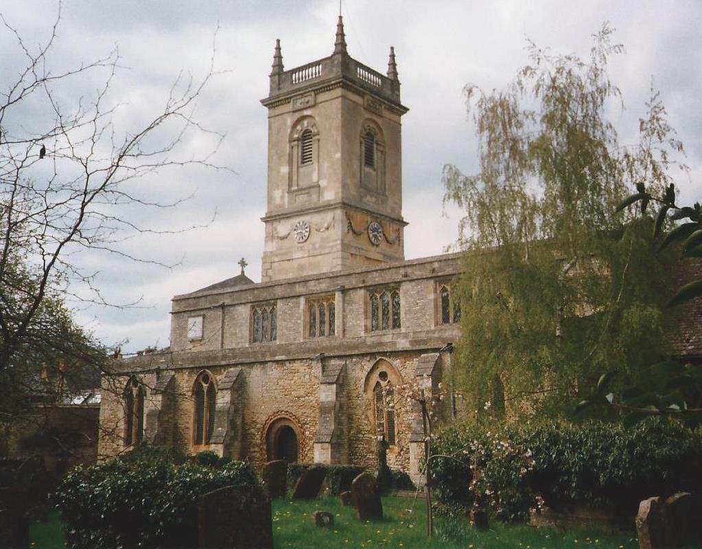
| Description | : | The Church was built in the 12th century, in the reign of King Henry II, as a Chapel-of-Ease to the Parish Church of St. Martin, Bladon, for the convenience of the Court since the King was often in residence at his Royal Manor of Woodstock. In 1200 King John provided an endowment to provide for a priest and to build the chantry chapel. The chancel was built in the 14th century but rebuilt at a later period. In 1453 Henry IV licensed the rectors and churchwardens to acquire land to provide an income for the repair of the building and... Read More |
frequently asked questions (FAQ):
-
Where is St Mary Magdalene Churchyard?
St Mary Magdalene Churchyard is located at Park Street Woodstock, West Oxfordshire District ,Oxfordshire , OX20 1SJEngland.
-
St Mary Magdalene Churchyard cemetery's updated grave count on graveviews.com?
1 memorials
-
Where are the coordinates of the St Mary Magdalene Churchyard?
Latitude: 51.8472890
Longitude: -1.3569480

Nearby Cemetories:
1. Hensington Road Cemetery
Woodstock, West Oxfordshire District, England
Coordinate: 51.8488700, -1.3495500
2. Blenheim Palace
Woodstock, West Oxfordshire District, England
Coordinate: 51.8414993, -1.3611000
3. Lawn Cemetery
Woodstock, West Oxfordshire District, England
Coordinate: 51.8534220, -1.3512110
4. St. Martin's Churchyard
Bladon, West Oxfordshire District, England
Coordinate: 51.8304596, -1.3495430
5. North Oxfordshire Memorial Park and Crematorium
Tackley, West Oxfordshire District, England
Coordinate: 51.8647410, -1.3312160
6. St Mary the Virgin Churchyard
Wootton, West Oxfordshire District, England
Coordinate: 51.8756430, -1.3636990
7. Holy Cross Churchyard
Shipton-on-Cherwell, Cherwell District, England
Coordinate: 51.8452170, -1.3043260
8. Christ Churchyard
Long Hanborough, West Oxfordshire District, England
Coordinate: 51.8247400, -1.3955000
9. St. Michael's Churchyard
Begbroke, Cherwell District, England
Coordinate: 51.8221520, -1.3218069
10. St Giles Churchyard
Shipton-on-Cherwell, Cherwell District, England
Coordinate: 51.8444550, -1.2981890
11. Ss. Peter & Paul Churchyard
Church Hanborough, West Oxfordshire District, England
Coordinate: 51.8125750, -1.3838000
12. St. Nicholas Churchyard
Tackley, West Oxfordshire District, England
Coordinate: 51.8782400, -1.3102910
13. St Mary the Virgin Churchyard
Freeland, West Oxfordshire District, England
Coordinate: 51.8116300, -1.4004700
14. Stonesfield Cemetery
Stonesfield, West Oxfordshire District, England
Coordinate: 51.8497110, -1.4301480
15. Kidlington Burial Ground
Kidlington, Cherwell District, England
Coordinate: 51.8266010, -1.2916660
16. Saint James the Great Churchyard
Stonesfield, West Oxfordshire District, England
Coordinate: 51.8510437, -1.4303250
17. Glympton Churchyard
Glympton, West Oxfordshire District, England
Coordinate: 51.8937150, -1.3852970
18. St Mary the Virgin Churchyard
Hampton Poyle, Cherwell District, England
Coordinate: 51.8359630, -1.2780620
19. St Mary the Virgin Churchyard
Kidlington, Cherwell District, England
Coordinate: 51.8296680, -1.2797360
20. St. Bartholomew's Churchyard
Yarnton, Cherwell District, England
Coordinate: 51.8016610, -1.3087620
21. Yarnton Cemetery
Yarnton, Cherwell District, England
Coordinate: 51.8004080, -1.3103260
22. St Peter's Churchyard
Cassington, West Oxfordshire District, England
Coordinate: 51.7923610, -1.3423160
23. St Mary the Virgin Churchyard
Kirtlington, Cherwell District, England
Coordinate: 51.8718610, -1.2742740
24. St Giles Churchyard and Extension
Bletchingdon, Cherwell District, England
Coordinate: 51.8582500, -1.2655500