
| Memorials | : | 0 |
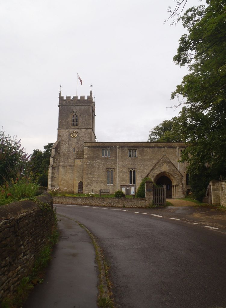
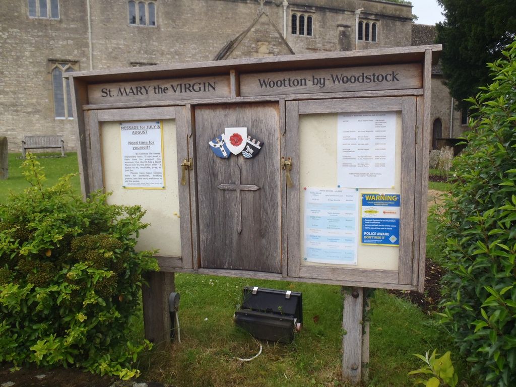
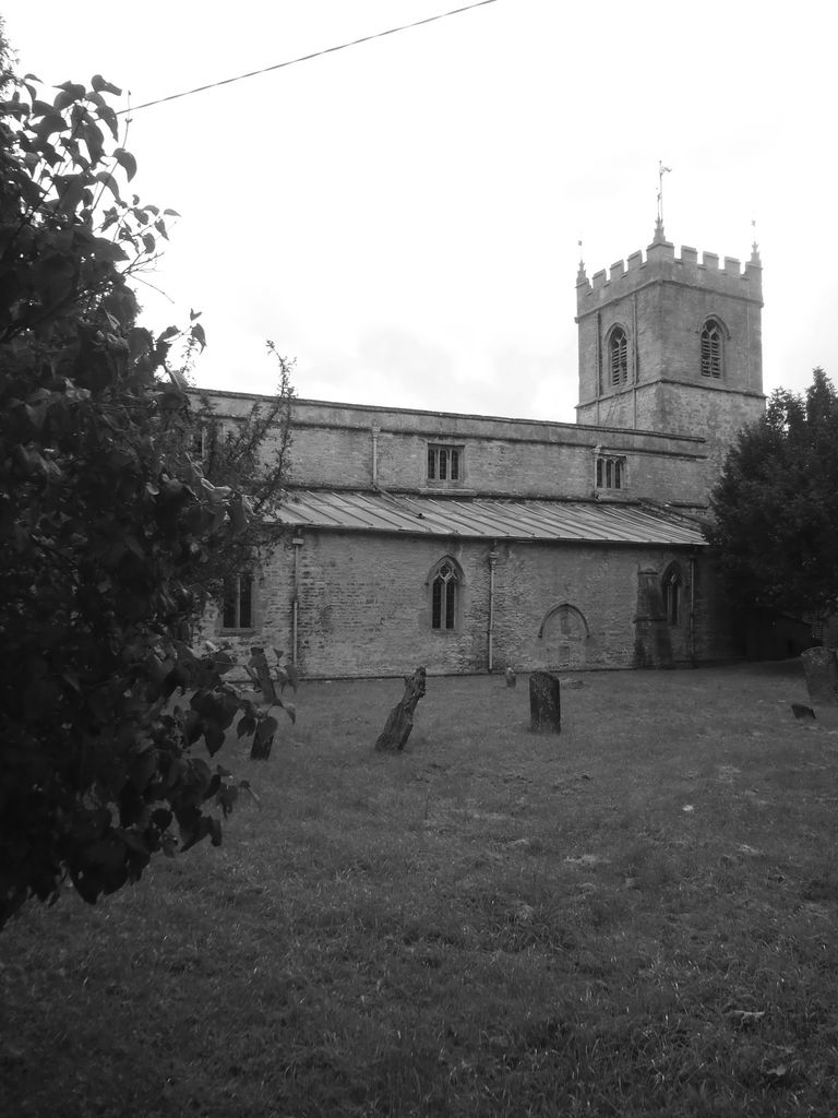
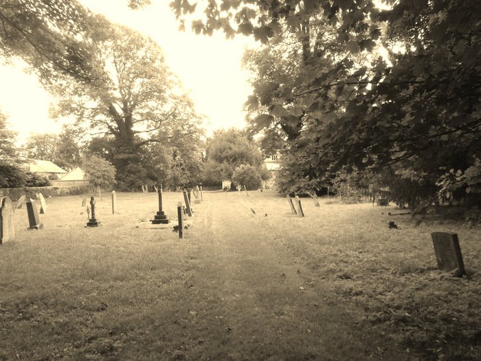
| Location | : | Wootton, West Oxfordshire District, England |
| Coordinate | : | 51.8756430, -1.3636990 |
| Description | : | Wootton is a village and civil parish on the River Glyme three miles north of Woodstock off the A44, Oxfordshire. The village is sometimes referred to as Wootton-by-Woodstock to distinguish it from Wootton, Vale of White Horse, which was in Berkshire but was transferred to Oxfordshire in the 1974 local authority boundary changes. At the time of the Hundred Rolls in 1279 Hordley was recorded as having 19 households and 150 acres (61 ha) of land. By the early part of the 16th century this had declined to only five (adult) residents. The Gregory family had converted most of... Read More |
frequently asked questions (FAQ):
-
Where is St Mary the Virgin Churchyard?
St Mary the Virgin Churchyard is located at Church Street Wootton, West Oxfordshire District ,Oxfordshire , OX20 1DZEngland.
-
St Mary the Virgin Churchyard cemetery's updated grave count on graveviews.com?
0 memorials
-
Where are the coordinates of the St Mary the Virgin Churchyard?
Latitude: 51.8756430
Longitude: -1.3636990
Nearby Cemetories:
1. Glympton Churchyard
Glympton, West Oxfordshire District, England
Coordinate: 51.8937150, -1.3852970
2. North Oxfordshire Memorial Park and Crematorium
Tackley, West Oxfordshire District, England
Coordinate: 51.8647410, -1.3312160
3. Lawn Cemetery
Woodstock, West Oxfordshire District, England
Coordinate: 51.8534220, -1.3512110
4. Hensington Road Cemetery
Woodstock, West Oxfordshire District, England
Coordinate: 51.8488700, -1.3495500
5. St Mary Magdalene Churchyard
Woodstock, West Oxfordshire District, England
Coordinate: 51.8472890, -1.3569480
6. St. Nicholas Churchyard
Tackley, West Oxfordshire District, England
Coordinate: 51.8782400, -1.3102910
7. Blenheim Palace
Woodstock, West Oxfordshire District, England
Coordinate: 51.8414993, -1.3611000
8. St Nicholas Churchyard
Kiddington, West Oxfordshire District, England
Coordinate: 51.9032900, -1.4031790
9. Steeple Barton Churchyard
Steeple Barton, West Oxfordshire District, England
Coordinate: 51.9207670, -1.3498060
10. St. Martin's Churchyard
Bladon, West Oxfordshire District, England
Coordinate: 51.8304596, -1.3495430
11. Holy Cross Churchyard
Shipton-on-Cherwell, Cherwell District, England
Coordinate: 51.8452170, -1.3043260
12. Saint James the Great Churchyard
Stonesfield, West Oxfordshire District, England
Coordinate: 51.8510437, -1.4303250
13. Stonesfield Cemetery
Stonesfield, West Oxfordshire District, England
Coordinate: 51.8497110, -1.4301480
14. St Giles Churchyard
Shipton-on-Cherwell, Cherwell District, England
Coordinate: 51.8444550, -1.2981890
15. St. Edward the Confessor Churchyard
Westcot Barton, West Oxfordshire District, England
Coordinate: 51.9280100, -1.3747200
16. St Leonard and St James Churchyard
Rousham, West Oxfordshire District, England
Coordinate: 51.9139780, -1.3037790
17. Christ Churchyard
Long Hanborough, West Oxfordshire District, England
Coordinate: 51.8247400, -1.3955000
18. St Mary the Virgin Churchyard
Kirtlington, Cherwell District, England
Coordinate: 51.8718610, -1.2742740
19. St. Michael's Churchyard
Begbroke, Cherwell District, England
Coordinate: 51.8221520, -1.3218069
20. St Mary Churchyard
Lower Heyford, Cherwell District, England
Coordinate: 51.9202580, -1.2960220
21. St Giles Churchyard and Extension
Bletchingdon, Cherwell District, England
Coordinate: 51.8582500, -1.2655500
22. St Martins Churchyard
Sandford St Martin, West Oxfordshire District, England
Coordinate: 51.9371500, -1.3901400
23. Ss. Peter & Paul Churchyard
Church Hanborough, West Oxfordshire District, England
Coordinate: 51.8125750, -1.3838000
24. SS Peter and Paul Churchyard
Steeple Aston, Cherwell District, England
Coordinate: 51.9311350, -1.3091000