
| Memorials | : | 0 |
| Location | : | Shipton-on-Cherwell, Cherwell District, England |
| Coordinate | : | 51.8444550, -1.2981890 |
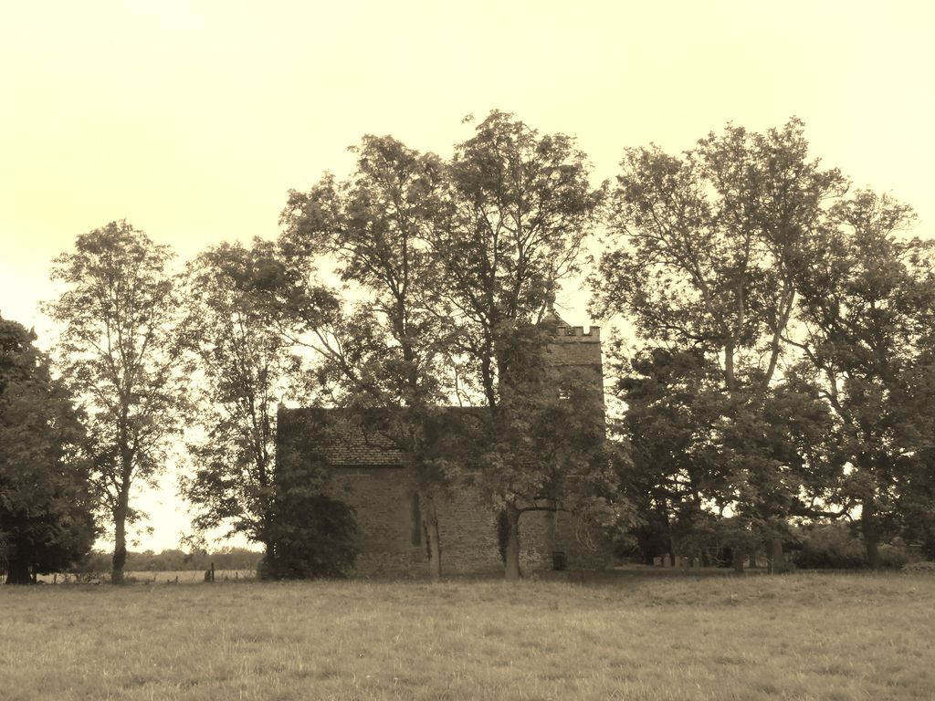
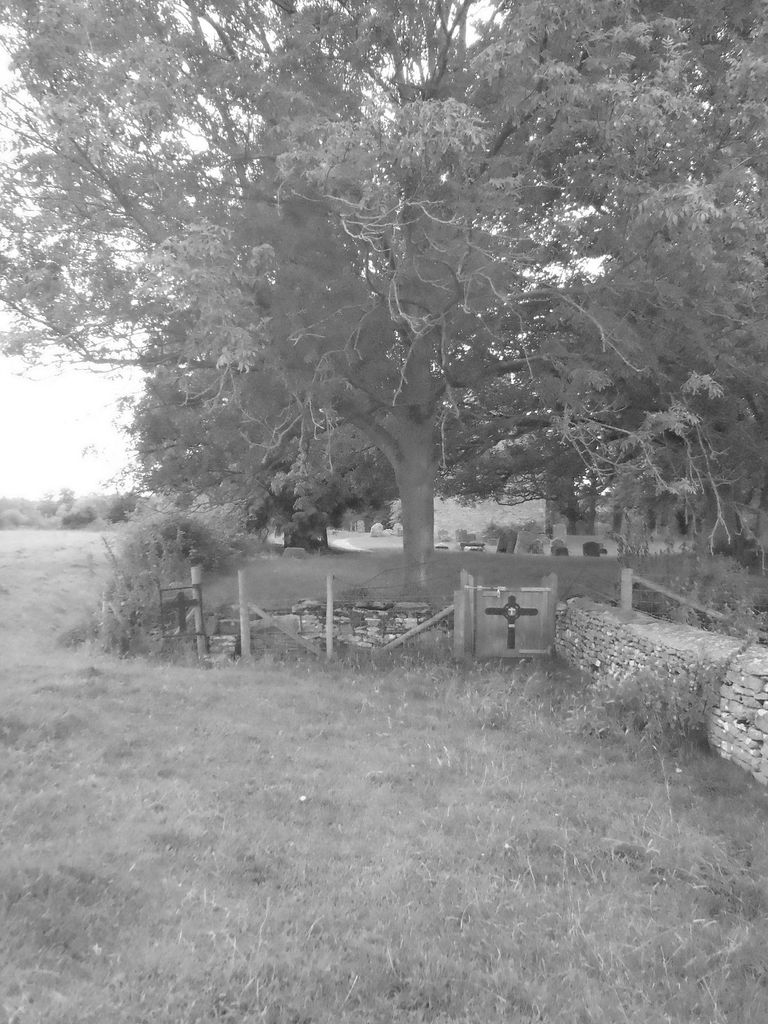
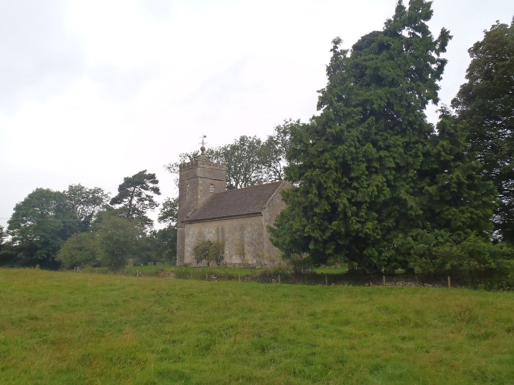
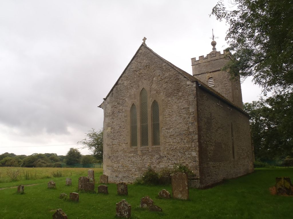
| Description | : | If you wish to visit Hampton Gay church it is a 10 Minute walk across fields. Tithe records show that Hampton Gay had a parish church by 1074.The Church of england parish church of Saint Giles had included features from at least as early as the 13th century, but in 1767–72 the Rev. Thomas Hindes, a member of the family that then owned the manor, had it completely rebuilt.In 1842 the antiquarian J.H. Parker condemned St. Giles' Georgian architecture as "a very bad specimen of the meeting-house style". In 1859–60 the curate, Rev. F.C. Hingeston, altered the church to his own... Read More |
frequently asked questions (FAQ):
-
Where is St Giles Churchyard?
St Giles Churchyard is located at Hampton Gay Shipton-on-Cherwell, Cherwell District ,Oxfordshire ,England.
-
St Giles Churchyard cemetery's updated grave count on graveviews.com?
0 memorials
-
Where are the coordinates of the St Giles Churchyard?
Latitude: 51.8444550
Longitude: -1.2981890
Nearby Cemetories:
1. Holy Cross Churchyard
Shipton-on-Cherwell, Cherwell District, England
Coordinate: 51.8452170, -1.3043260
2. St Mary the Virgin Churchyard
Hampton Poyle, Cherwell District, England
Coordinate: 51.8359630, -1.2780620
3. Kidlington Burial Ground
Kidlington, Cherwell District, England
Coordinate: 51.8266010, -1.2916660
4. St Mary the Virgin Churchyard
Kidlington, Cherwell District, England
Coordinate: 51.8296680, -1.2797360
5. St Giles Churchyard and Extension
Bletchingdon, Cherwell District, England
Coordinate: 51.8582500, -1.2655500
6. St. Michael's Churchyard
Begbroke, Cherwell District, England
Coordinate: 51.8221520, -1.3218069
7. North Oxfordshire Memorial Park and Crematorium
Tackley, West Oxfordshire District, England
Coordinate: 51.8647410, -1.3312160
8. St Mary the Virgin Churchyard
Kirtlington, Cherwell District, England
Coordinate: 51.8718610, -1.2742740
9. Hensington Road Cemetery
Woodstock, West Oxfordshire District, England
Coordinate: 51.8488700, -1.3495500
10. Lawn Cemetery
Woodstock, West Oxfordshire District, England
Coordinate: 51.8534220, -1.3512110
11. St. Nicholas Churchyard
Tackley, West Oxfordshire District, England
Coordinate: 51.8782400, -1.3102910
12. St. Martin's Churchyard
Bladon, West Oxfordshire District, England
Coordinate: 51.8304596, -1.3495430
13. St Mary Magdalene Churchyard
Woodstock, West Oxfordshire District, England
Coordinate: 51.8472890, -1.3569480
14. Blenheim Palace
Woodstock, West Oxfordshire District, England
Coordinate: 51.8414993, -1.3611000
15. St. Nicholas' Churchyard
Islip, Cherwell District, England
Coordinate: 51.8230010, -1.2375590
16. St. Bartholomew's Churchyard
Yarnton, Cherwell District, England
Coordinate: 51.8016610, -1.3087620
17. Yarnton Cemetery
Yarnton, Cherwell District, England
Coordinate: 51.8004080, -1.3103260
18. St Marys Churchyard
Weston-on-the-Green, Cherwell District, England
Coordinate: 51.8632420, -1.2302540
19. St Mary the Virgin Churchyard
Wootton, West Oxfordshire District, England
Coordinate: 51.8756430, -1.3636990
20. Wolvercote Cemetery
Oxford, City of Oxford, England
Coordinate: 51.7913666, -1.2721500
21. St Peter's Churchyard
Cassington, West Oxfordshire District, England
Coordinate: 51.7923610, -1.3423160
22. St. Peter Churchyard
Wolvercote, City of Oxford, England
Coordinate: 51.7848300, -1.2811100
23. Woodeaton Holy Rood Churchyard
Woodeaton, South Oxfordshire District, England
Coordinate: 51.8031620, -1.2257910
24. St Giles Churchyard
Noke, Cherwell District, England
Coordinate: 51.8145050, -1.2114790