
| Memorials | : | 1 |
| Location | : | Kirtlington, Cherwell District, England |
| Coordinate | : | 51.8718610, -1.2742740 |
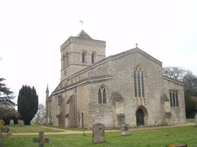
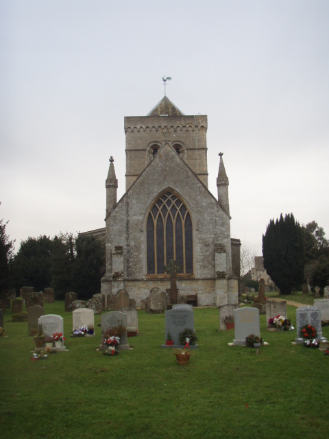
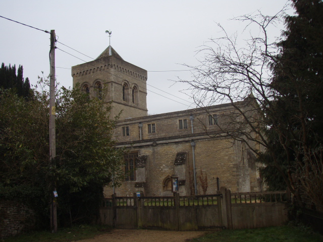
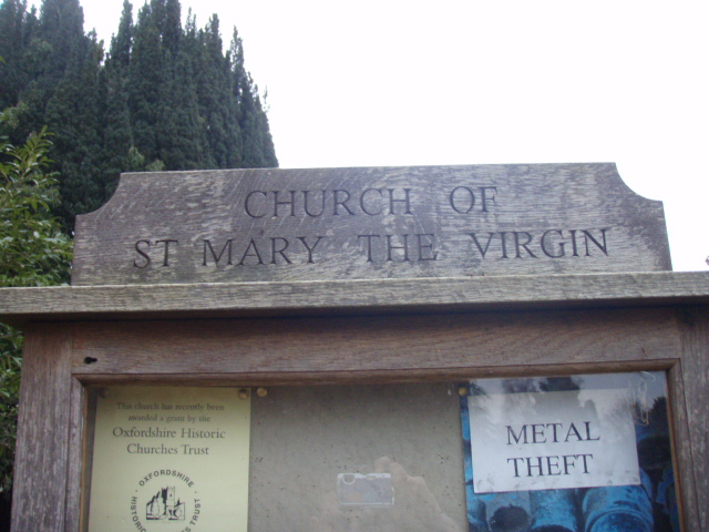
| Description | : | The earliest known record of a parish church at Kirtington is in the Domesday Book of 1086. The oldest visible parts of the present Church of England parish church of St. Mary the Virgin include the early 12th-century Norman arches supporting the central bell tower, and a tympanum of the same date that is now over the vestry door. Beneath the floor of the chancel are the foundations of a former apse that also was built early in the 12th century. About 1250 the nave was rebuilt and north and south aisles were added, each linked with the nave by... Read More |
frequently asked questions (FAQ):
-
Where is St Mary the Virgin Churchyard?
St Mary the Virgin Churchyard is located at Kirtlington, Cherwell District ,Oxfordshire , OX5 3HAEngland.
-
St Mary the Virgin Churchyard cemetery's updated grave count on graveviews.com?
1 memorials
-
Where are the coordinates of the St Mary the Virgin Churchyard?
Latitude: 51.8718610
Longitude: -1.2742740
Nearby Cemetories:
1. St Giles Churchyard and Extension
Bletchingdon, Cherwell District, England
Coordinate: 51.8582500, -1.2655500
2. St. Nicholas Churchyard
Tackley, West Oxfordshire District, England
Coordinate: 51.8782400, -1.3102910
3. St Marys Churchyard
Weston-on-the-Green, Cherwell District, England
Coordinate: 51.8632420, -1.2302540
4. St Giles Churchyard
Shipton-on-Cherwell, Cherwell District, England
Coordinate: 51.8444550, -1.2981890
5. Holy Cross Churchyard
Shipton-on-Cherwell, Cherwell District, England
Coordinate: 51.8452170, -1.3043260
6. North Oxfordshire Memorial Park and Crematorium
Tackley, West Oxfordshire District, England
Coordinate: 51.8647410, -1.3312160
7. St Mary the Virgin Churchyard
Hampton Poyle, Cherwell District, England
Coordinate: 51.8359630, -1.2780620
8. St Mary the Virgin Churchyard
Kidlington, Cherwell District, England
Coordinate: 51.8296680, -1.2797360
9. All Saints Churchyard
Middleton Stoney, Cherwell District, England
Coordinate: 51.9053470, -1.2295300
10. St Leonard and St James Churchyard
Rousham, West Oxfordshire District, England
Coordinate: 51.9139780, -1.3037790
11. Kidlington Burial Ground
Kidlington, Cherwell District, England
Coordinate: 51.8266010, -1.2916660
12. St Mary Churchyard
Lower Heyford, Cherwell District, England
Coordinate: 51.9202580, -1.2960220
13. Lawn Cemetery
Woodstock, West Oxfordshire District, England
Coordinate: 51.8534220, -1.3512110
14. Hensington Road Cemetery
Woodstock, West Oxfordshire District, England
Coordinate: 51.8488700, -1.3495500
15. St Giles Churchyard
Wendlebury, Cherwell District, England
Coordinate: 51.8730580, -1.1901000
16. St. Nicholas' Churchyard
Islip, Cherwell District, England
Coordinate: 51.8230010, -1.2375590
17. St Mary the Virgin Churchyard
Wootton, West Oxfordshire District, England
Coordinate: 51.8756430, -1.3636990
18. St Mary Magdalene Churchyard
Woodstock, West Oxfordshire District, England
Coordinate: 51.8472890, -1.3569480
19. St Mary Churchyard
Chesterton, Cherwell District, England
Coordinate: 51.8879880, -1.1851540
20. St Marys Churchyard
Upper Heyford, Cherwell District, England
Coordinate: 51.9290710, -1.2819670
21. St. Michael's Churchyard
Begbroke, Cherwell District, England
Coordinate: 51.8221520, -1.3218069
22. Upper Heyford Cemetery
Upper Heyford, Cherwell District, England
Coordinate: 51.9294701, -1.2808000
23. Blenheim Palace
Woodstock, West Oxfordshire District, England
Coordinate: 51.8414993, -1.3611000
24. St. Martin's Churchyard
Bladon, West Oxfordshire District, England
Coordinate: 51.8304596, -1.3495430