
| Memorials | : | 577 |
| Location | : | Lamberhurst, Tunbridge Wells Borough, England |
| Coordinate | : | 51.1040459, 0.4012690 |
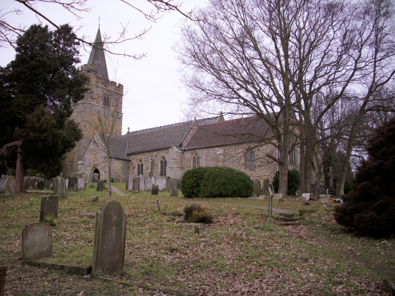
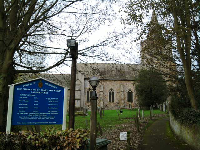
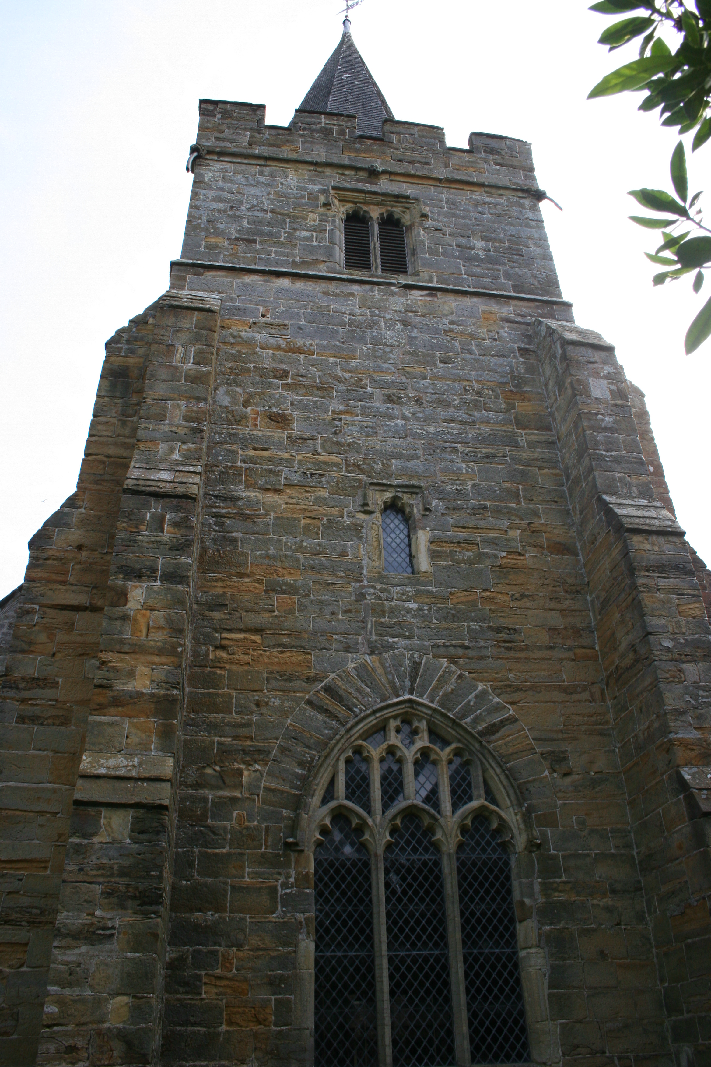
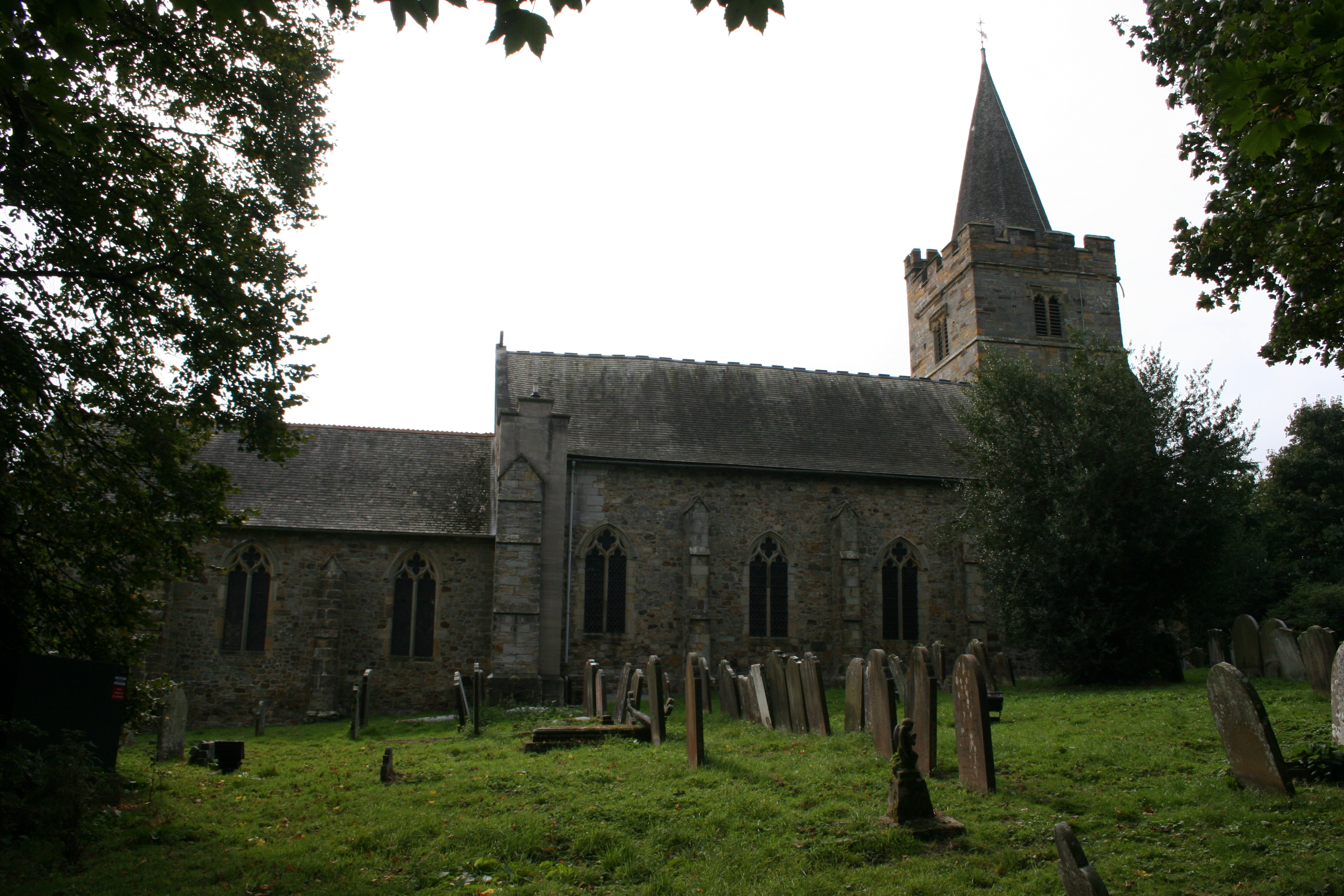
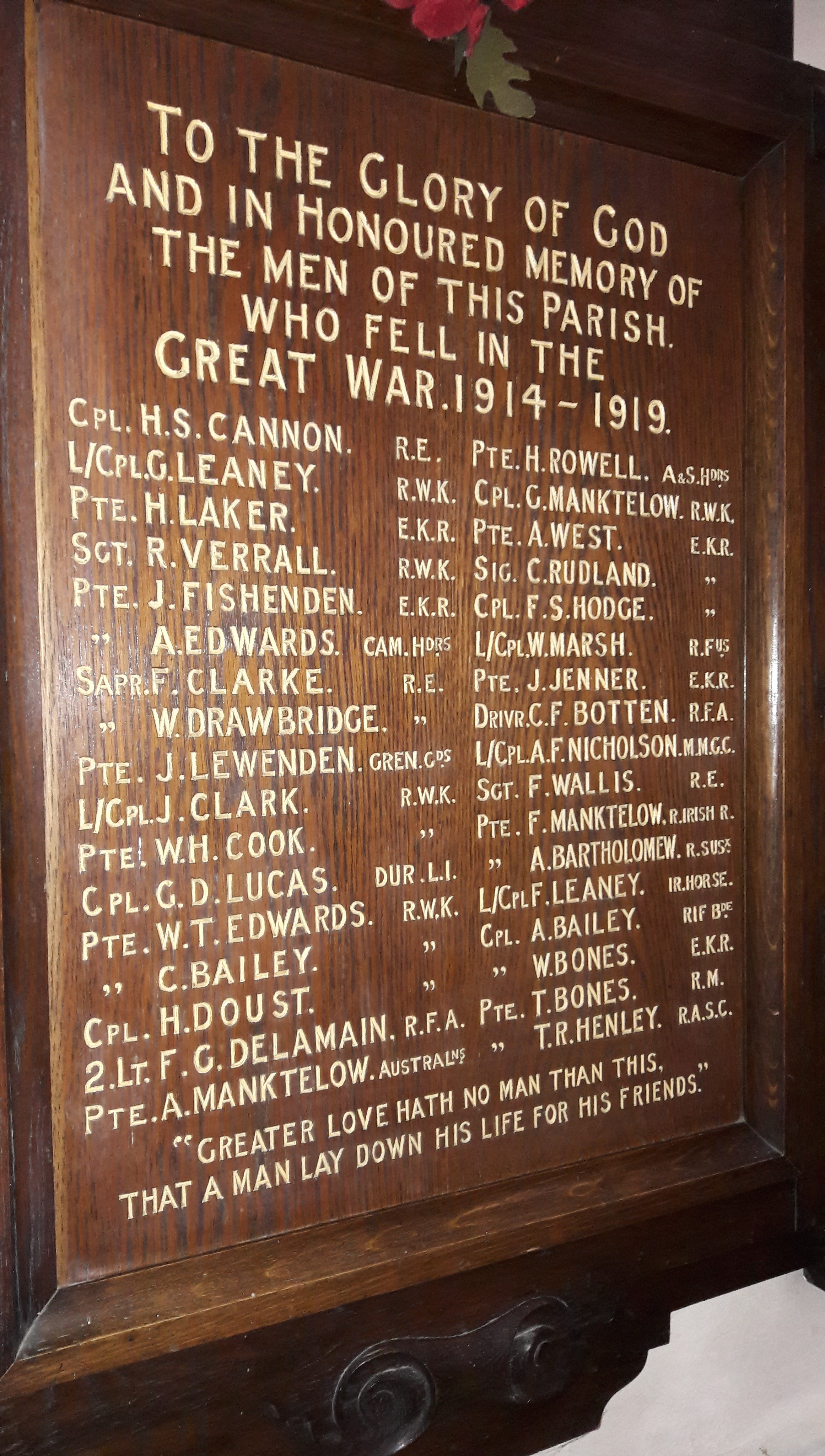
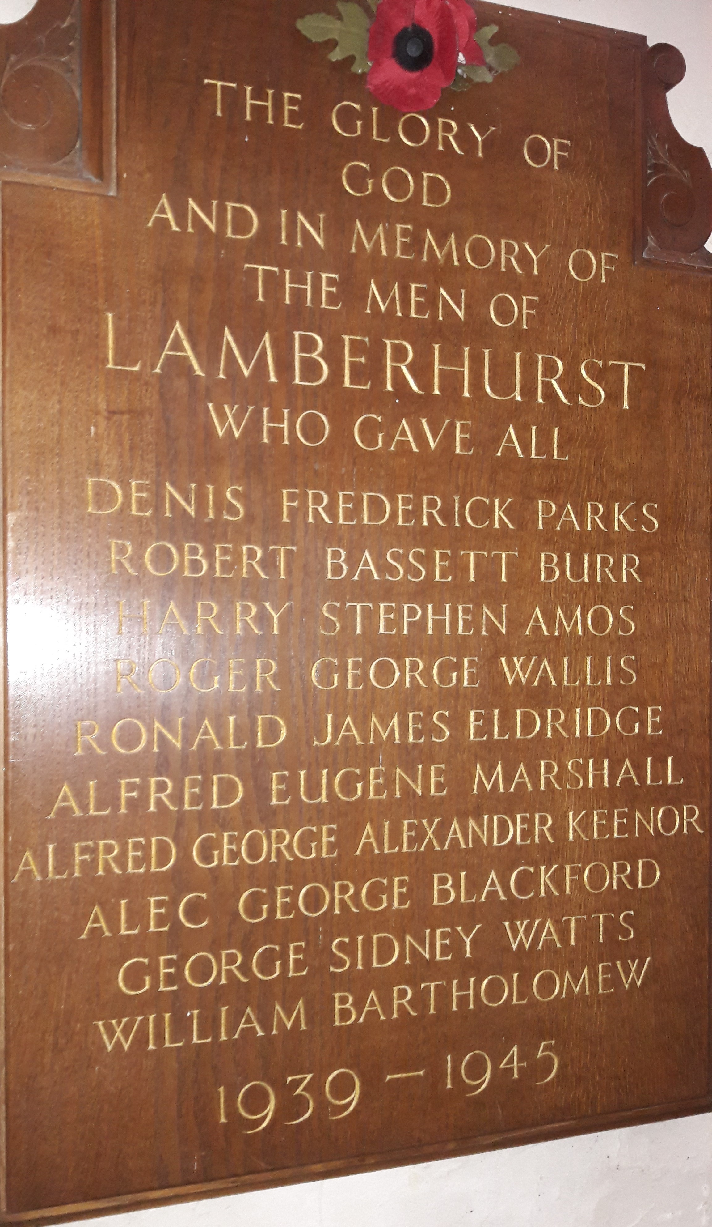
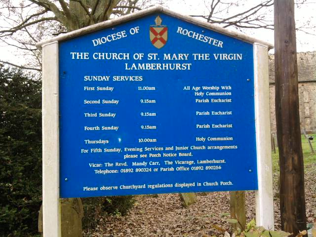
| Description | : | Prior to the Industrial Revolution, Lamberhurst was a centre for the Wealden iron industry, originally set up during Roman times. Since then it had some importance for the hop industry; was home to Margaret Thatcher; acquired an extensive golf course; has controversially been by-passed; and played a major role in English wine production. The Church of England parish church is 0.5 miles (0.80 km) east of the village. The Church of St Mary The Virgin, is a Grade I listed building and includes stained glass by John Piper. Lamberhurst civil parish on formation when they first became possible in the 19th century... Read More |
frequently asked questions (FAQ):
-
Where is St Mary the Virgin Churchyard?
St Mary the Virgin Churchyard is located at Church Road Lamberhurst, Tunbridge Wells Borough ,Kent , TN3 8DUEngland.
-
St Mary the Virgin Churchyard cemetery's updated grave count on graveviews.com?
576 memorials
-
Where are the coordinates of the St Mary the Virgin Churchyard?
Latitude: 51.1040459
Longitude: 0.4012690
Nearby Cemetories:
1. Christ Church Churchyard
Kilndown, Tunbridge Wells Borough, England
Coordinate: 51.0907820, 0.4269340
2. St Margarets Churchyard
Horsmonden, Tunbridge Wells Borough, England
Coordinate: 51.1169060, 0.4329730
3. Bayham Old Abbey
Lamberhurst, Tunbridge Wells Borough, England
Coordinate: 51.1032690, 0.3541800
4. Goudhurst War Memorial
Goudhurst, Tunbridge Wells Borough, England
Coordinate: 51.1129960, 0.4586850
5. St. Mary the Virgin Churchyard
Goudhurst, Tunbridge Wells Borough, England
Coordinate: 51.1136160, 0.4609480
6. Goudhurst Cemetery
Goudhurst, Tunbridge Wells Borough, England
Coordinate: 51.1134210, 0.4624930
7. St. Luke's Churchyard
Matfield, Tunbridge Wells Borough, England
Coordinate: 51.1426588, 0.3626785
8. All Saints Churchyard
Brenchley, Tunbridge Wells Borough, England
Coordinate: 51.1504200, 0.4001200
9. St. Peter & St. Paul Churchyard
Wadhurst, Wealden District, England
Coordinate: 51.0626960, 0.3400690
10. St. Mary's Churchyard
Ticehurst, Rother District, England
Coordinate: 51.0454030, 0.4077110
11. Pembury Burial Ground
Pembury, Tunbridge Wells Borough, England
Coordinate: 51.1416270, 0.3229290
12. Saint Augustine's Churchyard
Flimwell, Rother District, England
Coordinate: 51.0514170, 0.4580350
13. St Peter's New Churchyard
Pembury, Tunbridge Wells Borough, England
Coordinate: 51.1506200, 0.3269600
14. Paddock Wood New Cemetery
Paddock Wood, Tunbridge Wells Borough, England
Coordinate: 51.1761499, 0.3980419
15. St. Peter's Churchyard
Stonegate, Rother District, England
Coordinate: 51.0303090, 0.3747690
16. St. Andrew's Old Churchyard
Paddock Wood, Tunbridge Wells Borough, England
Coordinate: 51.1799720, 0.3923060
17. Old Churchyard of St Peter
Pembury, Tunbridge Wells Borough, England
Coordinate: 51.1629330, 0.3241620
18. Kent and Sussex Cemetery and Crematorium
Royal Tunbridge Wells, Tunbridge Wells Borough, England
Coordinate: 51.1173720, 0.2740330
19. St. Thomas A. Becket Churchyard
Capel, Tunbridge Wells Borough, England
Coordinate: 51.1764880, 0.3414880
20. St. Alban's Churchyard
Frant, Wealden District, England
Coordinate: 51.0980580, 0.2698300
21. Tidebrook Churchyard
Wadhurst, Wealden District, England
Coordinate: 51.0467700, 0.3013730
22. St Dunstan's Churchyard
Cranbrook, Tunbridge Wells Borough, England
Coordinate: 51.0973030, 0.5363690
23. St David's Bridge Strict Baptist Chapel
Cranbrook, Tunbridge Wells Borough, England
Coordinate: 51.0953430, 0.5378980
24. Marden Congregational Church
Marden, Maidstone Borough, England
Coordinate: 51.1745670, 0.4897280