
| Memorials | : | 0 |
| Location | : | Flimwell, Rother District, England |
| Coordinate | : | 51.0514170, 0.4580350 |
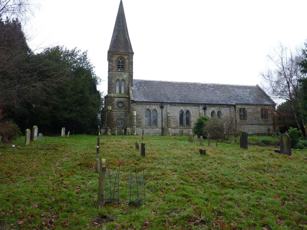
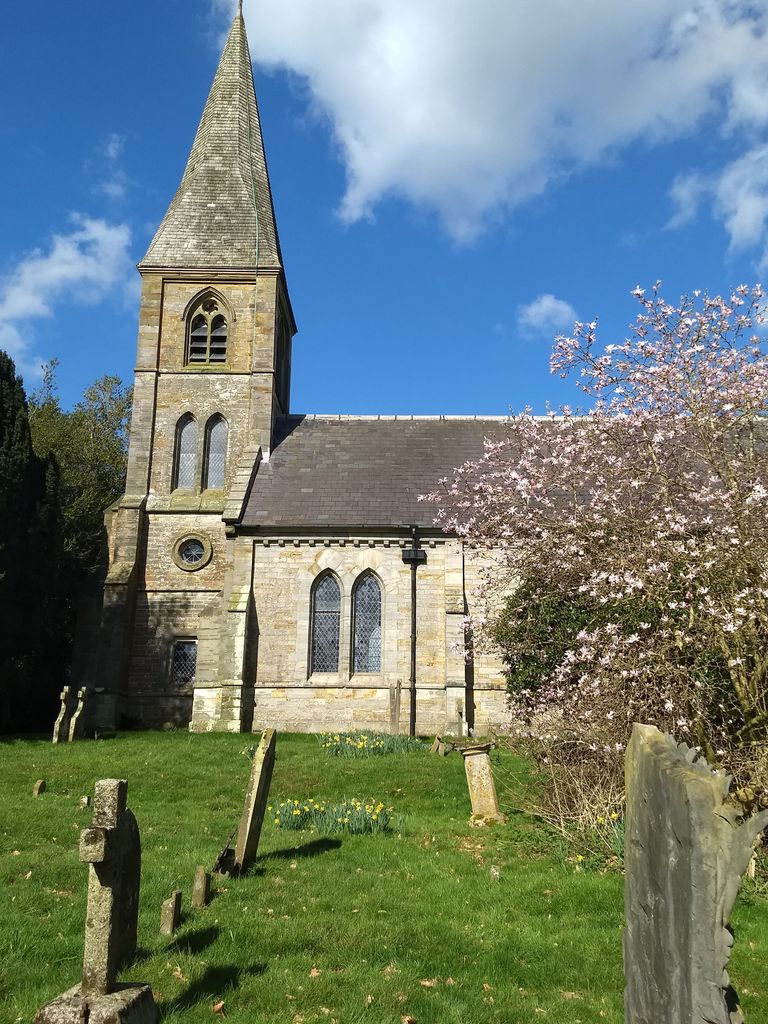
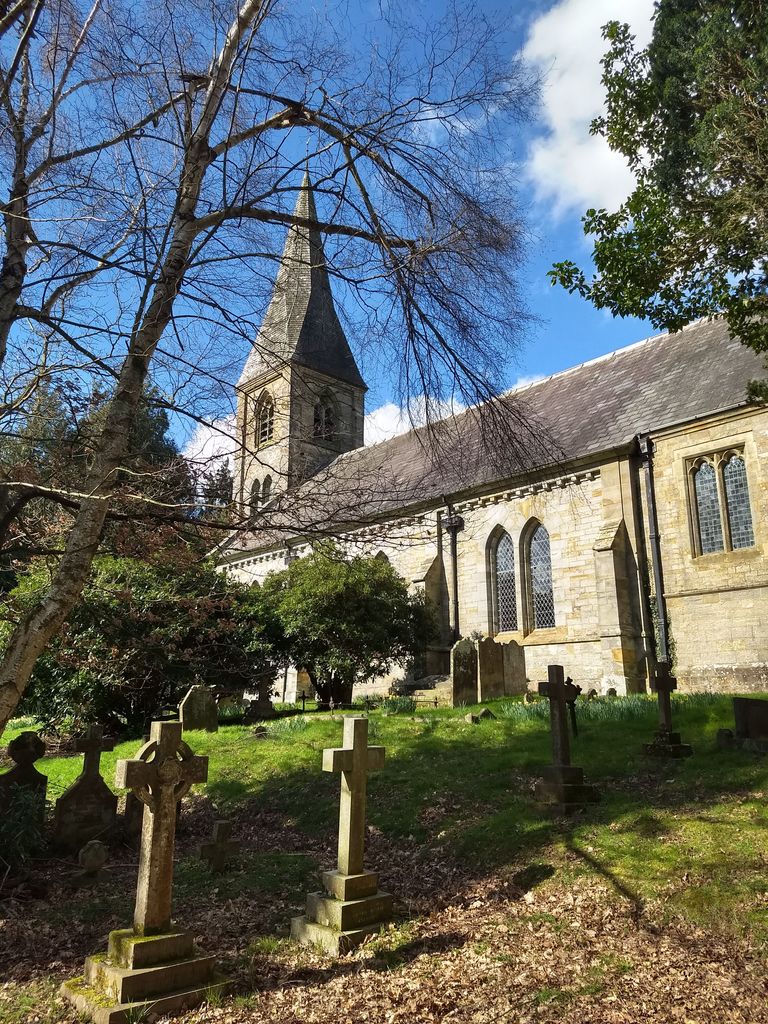
| Description | : | St Augustine's, Flimwell, is a relatively modern church, built in 1830, from local sandstone. The architect was Decimus Burton. Inside the church are memorials to George, 2nd Viscount Goschen. Most of the windows contain plain leaded glass, the originals having been destroyed by enemy bombing in 1945. Saint Augustine's is one of two churches in the parish of Ticehurst & Flimwell, the other being St. Mary's, Ticehurst. The parish is in the Diocese of Chichester, East Sussex. |
frequently asked questions (FAQ):
-
Where is Saint Augustine's Churchyard?
Saint Augustine's Churchyard is located at Hawkhurst Road Flimwell, Rother District ,East Sussex , TN5England.
-
Saint Augustine's Churchyard cemetery's updated grave count on graveviews.com?
0 memorials
-
Where are the coordinates of the Saint Augustine's Churchyard?
Latitude: 51.0514170
Longitude: 0.4580350
Nearby Cemetories:
1. St. Laurence Churchyard
Hawkhurst, Tunbridge Wells Borough, England
Coordinate: 51.0377240, 0.5031610
2. Holy Trinity Churchyard
Hurst Green, Rother District, England
Coordinate: 51.0201400, 0.4691080
3. St. Mary's Churchyard
Ticehurst, Rother District, England
Coordinate: 51.0454030, 0.4077110
4. Hawkhurst Cemetery
Hawkhurst, Tunbridge Wells Borough, England
Coordinate: 51.0302300, 0.5051300
5. Assumption of Blessed Mary & St. Nicholas Church
Etchingham, Rother District, England
Coordinate: 51.0095830, 0.4416420
6. Christ Church Churchyard
Kilndown, Tunbridge Wells Borough, England
Coordinate: 51.0907820, 0.4269340
7. St. Peter's Churchyard
Stonegate, Rother District, England
Coordinate: 51.0303090, 0.3747690
8. Goudhurst War Memorial
Goudhurst, Tunbridge Wells Borough, England
Coordinate: 51.1129960, 0.4586850
9. Goudhurst Cemetery
Goudhurst, Tunbridge Wells Borough, England
Coordinate: 51.1134210, 0.4624930
10. St. Mary the Virgin Churchyard
Goudhurst, Tunbridge Wells Borough, England
Coordinate: 51.1136160, 0.4609480
11. St Mary the Virgin Churchyard
Lamberhurst, Tunbridge Wells Borough, England
Coordinate: 51.1040459, 0.4012690
12. St Mary the Virgin Churchyard
Salehurst, Rother District, England
Coordinate: 50.9910170, 0.4911260
13. St David's Bridge Strict Baptist Chapel
Cranbrook, Tunbridge Wells Borough, England
Coordinate: 51.0953430, 0.5378980
14. St Dunstan's Churchyard
Cranbrook, Tunbridge Wells Borough, England
Coordinate: 51.0973030, 0.5363690
15. St Margarets Churchyard
Horsmonden, Tunbridge Wells Borough, England
Coordinate: 51.1169060, 0.4329730
16. Saint Giles' Churchyard
Bodiam, Rother District, England
Coordinate: 51.0074800, 0.5393000
17. St. Bartholomew's Churchyard
Burwash, Rother District, England
Coordinate: 50.9976470, 0.3887490
18. Darvell Bruderhof Cemetery
Robertsbridge, Rother District, England
Coordinate: 50.9790497, 0.4561470
19. St. Joseph's Roman Catholic Churchyard
Burwash, Rother District, England
Coordinate: 50.9963500, 0.3782670
20. St. Peter & St. Paul Churchyard
Wadhurst, Wealden District, England
Coordinate: 51.0626960, 0.3400690
21. Cranbrook Cemetery
Cranbrook, Tunbridge Wells Borough, England
Coordinate: 51.0962250, 0.5541360
22. St. George Parish Churchyard
Benenden, Tunbridge Wells Borough, England
Coordinate: 51.0648720, 0.5794570
23. Bayham Old Abbey
Lamberhurst, Tunbridge Wells Borough, England
Coordinate: 51.1032690, 0.3541800
24. Ewhurst Green Churchyard
Ewhurst, Rother District, England
Coordinate: 50.9924300, 0.5572900