
| Memorials | : | 2 |
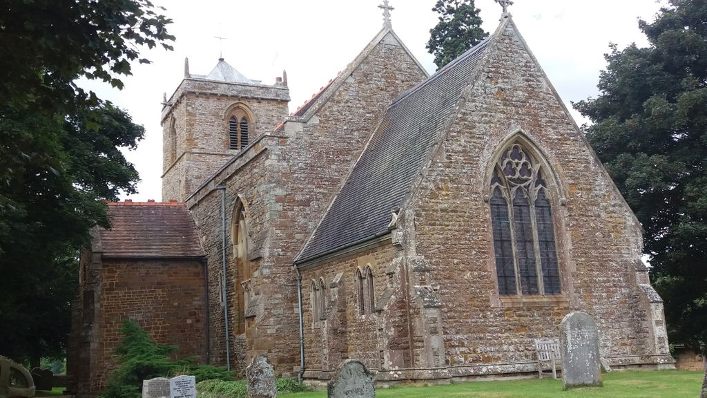
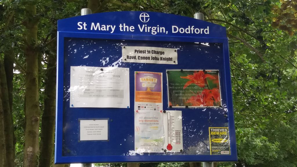
| Location | : | Dodford, Daventry District, England |
| Coordinate | : | 52.2396800, -1.1044500 |
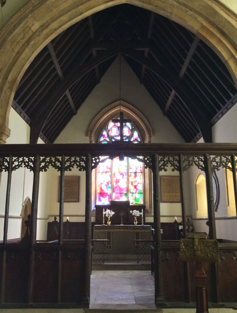
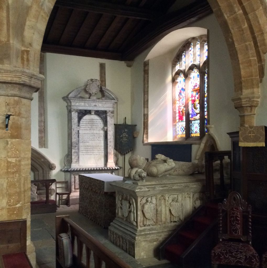
| Description | : | St Mary the Virgin is a Grade I listed parish church. It was founded by the Normans in 1066, rebuilt by Ralph de Keynes in 1100, and the tower and north chapel were added by William de Keynes in 1221. St Mary's has a nave with a north aisle and a clerestory on the north side only. The arcade, of four bays, is 14th century. The south wall of the nave has two plain 12th-century splayed windows, of which the west one is now blocked, and part of the plain arch of a doorway; on the exterior there is much... Read More |
frequently asked questions (FAQ):
-
Where is St Mary the Virgin Churchyard?
St Mary the Virgin Churchyard is located at Dodford, Daventry District ,Northamptonshire , NN7 4SUEngland.
-
St Mary the Virgin Churchyard cemetery's updated grave count on graveviews.com?
1 memorials
-
Where are the coordinates of the St Mary the Virgin Churchyard?
Latitude: 52.2396800
Longitude: -1.1044500
Nearby Cemetories:
1. United Reformed Churchyard
Weedon Bec, Daventry District, England
Coordinate: 52.2278000, -1.0776000
2. St. Peter & St. Paul's Churchyard
Weedon Bec, Daventry District, England
Coordinate: 52.2281180, -1.0741343
3. Weedon Bec Cemetery
Weedon Bec, Daventry District, England
Coordinate: 52.2275500, -1.0715300
4. All Saints Churchyard
Flore, Daventry District, England
Coordinate: 52.2331000, -1.0615000
5. All Saints Churchyard
Norton, Daventry District, England
Coordinate: 52.2681250, -1.1180030
6. Everdon Parish CHurchyard
Everdon, Daventry District, England
Coordinate: 52.2123168, -1.1310740
7. St Michael's Church
Stowe Nine Churches, Daventry District, England
Coordinate: 52.2120000, -1.0721000
8. Welton Road Daventry
Daventry, Daventry District, England
Coordinate: 52.2643510, -1.1590460
9. St. Andrew Churchyard
Whilton, Daventry District, England
Coordinate: 52.2776040, -1.0683450
10. Nether Heyford Cemetery
Nether Heyford, South Northamptonshire Borough, England
Coordinate: 52.2220715, -1.0385032
11. St. Mary the Virgin
Farthingstone, Daventry District, England
Coordinate: 52.1899123, -1.1043480
12. St. Mary the Virgin
Badby, Daventry District, England
Coordinate: 52.2240200, -1.1820100
13. St. Martin's Churchyard
Welton, Daventry District, England
Coordinate: 52.2893100, -1.1494100
14. St. Peter and St. Paul Churchyard
Preston Capes, Daventry District, England
Coordinate: 52.1893410, -1.1614570
15. Welton Cemetery
Welton, Daventry District, England
Coordinate: 52.2932126, -1.1567336
16. St Michael & All Angels Churchyard
Bugbrooke, South Northamptonshire Borough, England
Coordinate: 52.2096900, -1.0149000
17. United Reformed Churchyard
Long Buckby, Daventry District, England
Coordinate: 52.3016430, -1.0793930
18. Long Buckby & Brington Baptist Church
Long Buckby, Daventry District, England
Coordinate: 52.3022756, -1.0804149
19. St. Mary the Virgin Churchyard
Staverton, Daventry District, England
Coordinate: 52.2457070, -1.2090230
20. St Mary the Virgin with St John Churchyard
Great Brington, Daventry District, England
Coordinate: 52.2810470, -1.0235660
21. St. Lawrence Churchyard
Long Buckby, Daventry District, England
Coordinate: 52.3042680, -1.0815040
22. All Saints Churchyard
Harpole, South Northamptonshire Borough, England
Coordinate: 52.2427100, -0.9899750
23. Holy Trinity Churchyard
Charwelton, Daventry District, England
Coordinate: 52.1952913, -1.2044410
24. St. Luke Churchyard
Kislingbury, South Northamptonshire Borough, England
Coordinate: 52.2307300, -0.9806300