
| Memorials | : | 1 |
| Location | : | Weedon Bec, Daventry District, England |
| Phone | : | 01327 340524 |
| Coordinate | : | 52.2278000, -1.0776000 |
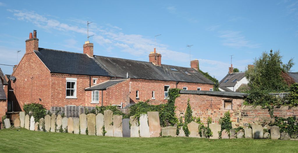
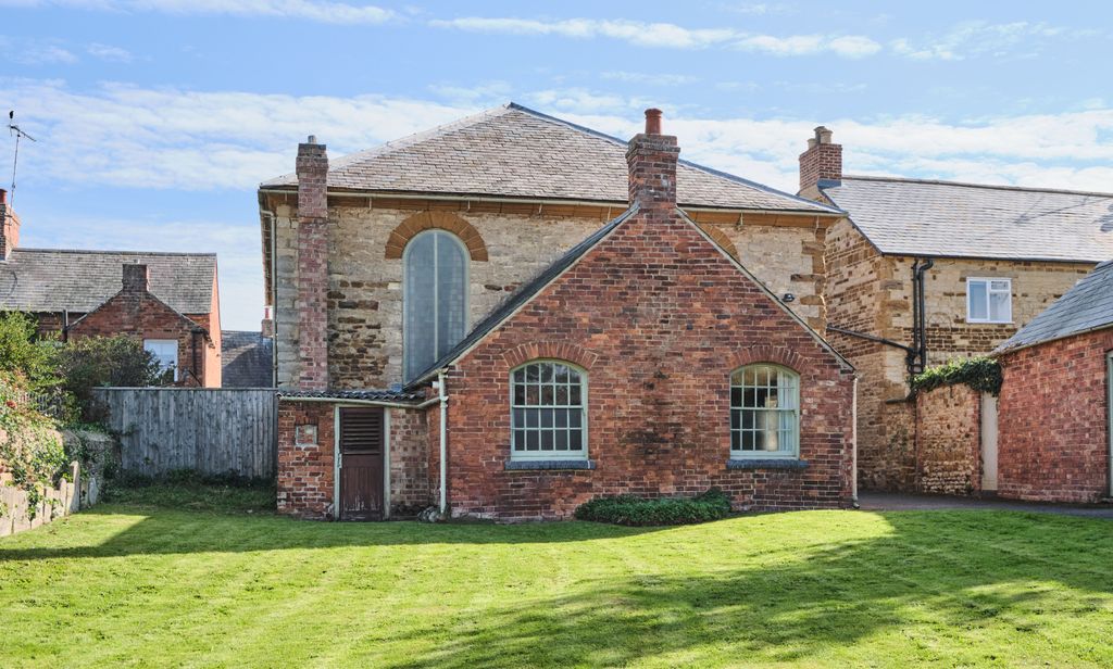
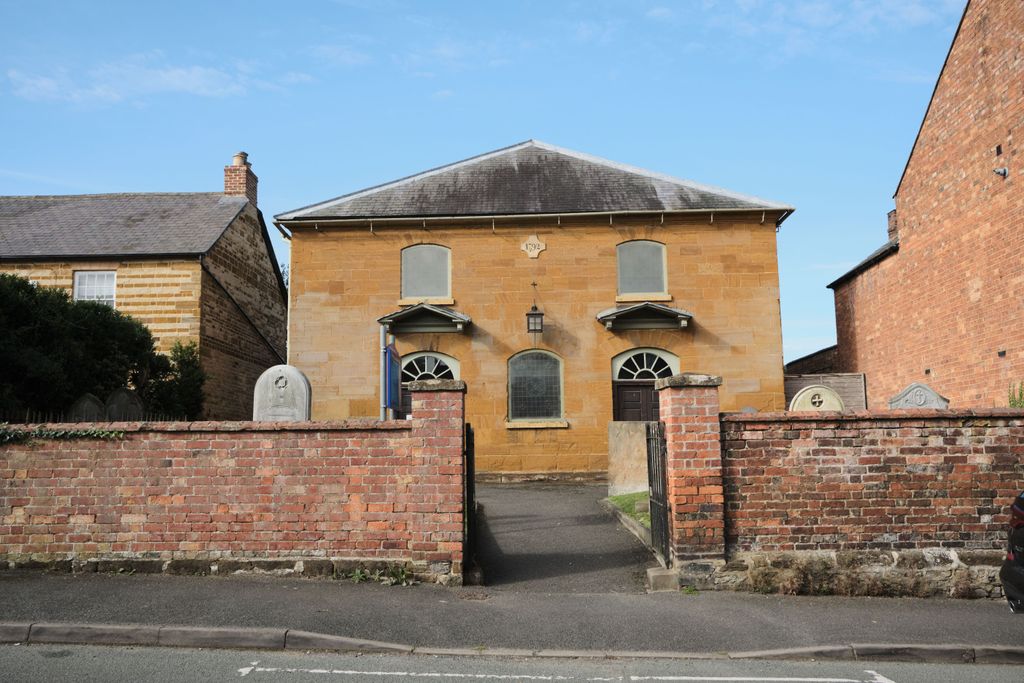
| Description | : | Cemetery is a small enlosed area around the church. The church was built in 1792 as a Presbyterian Church to replace the non-conformist meeting-houses of Flore and Weedon which were described as being 'out of repair'. Later it was a Congregational Church, then, when they and the Presbyterian Church entered into a union in 1972, it became the United Reformed Church. There are a few memorials in the small area to the front of the church, and a larger area to the rear of the building has been cleared and several stones have been arranged along the boundary wall |
frequently asked questions (FAQ):
-
Where is United Reformed Churchyard?
United Reformed Churchyard is located at Church Street, Weedon Bec, Northamptonshire Weedon Bec, Daventry District ,Northamptonshire , NN7 4PLEngland.
-
United Reformed Churchyard cemetery's updated grave count on graveviews.com?
1 memorials
-
Where are the coordinates of the United Reformed Churchyard?
Latitude: 52.2278000
Longitude: -1.0776000
Nearby Cemetories:
1. St. Peter & St. Paul's Churchyard
Weedon Bec, Daventry District, England
Coordinate: 52.2281180, -1.0741343
2. Weedon Bec Cemetery
Weedon Bec, Daventry District, England
Coordinate: 52.2275500, -1.0715300
3. All Saints Churchyard
Flore, Daventry District, England
Coordinate: 52.2331000, -1.0615000
4. St Michael's Church
Stowe Nine Churches, Daventry District, England
Coordinate: 52.2120000, -1.0721000
5. St Mary the Virgin Churchyard
Dodford, Daventry District, England
Coordinate: 52.2396800, -1.1044500
6. Nether Heyford Cemetery
Nether Heyford, South Northamptonshire Borough, England
Coordinate: 52.2220715, -1.0385032
7. Everdon Parish CHurchyard
Everdon, Daventry District, England
Coordinate: 52.2123168, -1.1310740
8. St. Mary the Virgin
Farthingstone, Daventry District, England
Coordinate: 52.1899123, -1.1043480
9. St Michael & All Angels Churchyard
Bugbrooke, South Northamptonshire Borough, England
Coordinate: 52.2096900, -1.0149000
10. All Saints Churchyard
Norton, Daventry District, England
Coordinate: 52.2681250, -1.1180030
11. St. Andrew Churchyard
Whilton, Daventry District, England
Coordinate: 52.2776040, -1.0683450
12. All Saints Churchyard
Harpole, South Northamptonshire Borough, England
Coordinate: 52.2427100, -0.9899750
13. Church of the Holy Cross
Pattishall, South Northamptonshire Borough, England
Coordinate: 52.1828670, -1.0197770
14. St. Luke's Churchyard
Cold Higham, South Northamptonshire Borough, England
Coordinate: 52.1759000, -1.0323000
15. St. Luke Churchyard
Kislingbury, South Northamptonshire Borough, England
Coordinate: 52.2307300, -0.9806300
16. Welton Road Daventry
Daventry, Daventry District, England
Coordinate: 52.2643510, -1.1590460
17. St Mary the Virgin with St John Churchyard
Great Brington, Daventry District, England
Coordinate: 52.2810470, -1.0235660
18. St. Mary the Virgin
Badby, Daventry District, England
Coordinate: 52.2240200, -1.1820100
19. St. Peter and St. Paul Churchyard
Preston Capes, Daventry District, England
Coordinate: 52.1893410, -1.1614570
20. United Reformed Churchyard
Long Buckby, Daventry District, England
Coordinate: 52.3016430, -1.0793930
21. Long Buckby & Brington Baptist Church
Long Buckby, Daventry District, England
Coordinate: 52.3022756, -1.0804149
22. St. Martin's Churchyard
Welton, Daventry District, England
Coordinate: 52.2893100, -1.1494100
23. Rothersthorpe Extension
Rothersthorpe, South Northamptonshire Borough, England
Coordinate: 52.2046235, -0.9591382
24. St. Lawrence Churchyard
Long Buckby, Daventry District, England
Coordinate: 52.3042680, -1.0815040