
| Memorials | : | 5 |
| Location | : | Harpole, South Northamptonshire Borough, England |
| Phone | : | (01604) 831621 |
| Website | : | harpolevillage.org.uk/all-saints-church/ |
| Coordinate | : | 52.2427100, -0.9899750 |
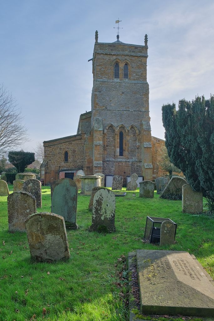
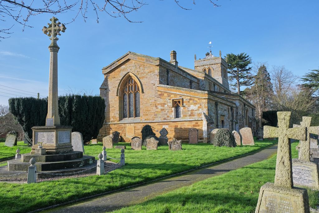
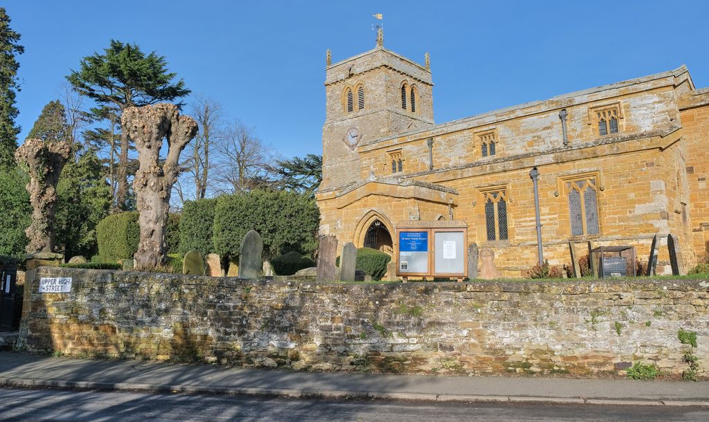
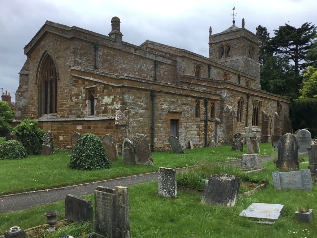
| Description | : | National Gred ref: SP 691 610 All Saints, Harpole is part of the Benefice of Bugbrooke, Harpole, Kislingbury and Rothersthorpe, which means that we share our Rector, who lives at Bugbrooke. "Harpole is a rare example of an estate held by the same man before and after the Conquest. This is Bisceop, who held it freely in the Confessor's time, but from William Peverel in 1086. A priest was recorded at that time. Harpole remained a rectory with the advowson in the hands of the lord of the manor throughout the Middle Ages, although some tithes were granted to St... Read More |
frequently asked questions (FAQ):
-
Where is All Saints Churchyard?
All Saints Churchyard is located at Corner of High Street and School Lane Lane Harpole, South Northamptonshire Borough ,Northamptonshire , NN7 4DJEngland.
-
All Saints Churchyard cemetery's updated grave count on graveviews.com?
5 memorials
-
Where are the coordinates of the All Saints Churchyard?
Latitude: 52.2427100
Longitude: -0.9899750
Nearby Cemetories:
1. St. Luke Churchyard
Kislingbury, South Northamptonshire Borough, England
Coordinate: 52.2307300, -0.9806300
2. St Michael's Churchyard
Upton, Northampton Borough, England
Coordinate: 52.2356600, -0.9508160
3. Saint Luke Churchyard
Duston, Northampton Borough, England
Coordinate: 52.2428820, -0.9396550
4. Nether Heyford Cemetery
Nether Heyford, South Northamptonshire Borough, England
Coordinate: 52.2220715, -1.0385032
5. St Michael & All Angels Churchyard
Bugbrooke, South Northamptonshire Borough, England
Coordinate: 52.2096900, -1.0149000
6. Dallington Cemetery
Northampton, Northampton Borough, England
Coordinate: 52.2505200, -0.9287200
7. Spencer Estate Grounds
Althorp, Daventry District, England
Coordinate: 52.2839190, -0.9889520
8. Rothersthorpe Extension
Rothersthorpe, South Northamptonshire Borough, England
Coordinate: 52.2046235, -0.9591382
9. St Mary the Virgin with St John Churchyard
Great Brington, Daventry District, England
Coordinate: 52.2810470, -1.0235660
10. St Peter and St Paul
Rothersthorpe, South Northamptonshire Borough, England
Coordinate: 52.2034651, -0.9566385
11. All Saints Churchyard
Flore, Daventry District, England
Coordinate: 52.2331000, -1.0615000
12. St Botolph Churchyard
Church Brampton, Daventry District, England
Coordinate: 52.2849866, -0.9486724
13. Weedon Bec Cemetery
Weedon Bec, Daventry District, England
Coordinate: 52.2275500, -1.0715300
14. St. Peter & St. Paul's Churchyard
Weedon Bec, Daventry District, England
Coordinate: 52.2281180, -1.0741343
15. Towcester Road Cemetery
Far Cotton, Northampton Borough, England
Coordinate: 52.2178190, -0.9117050
16. Counties Crematorium
Northampton, Northampton Borough, England
Coordinate: 52.2058720, -0.9245220
17. United Reformed Churchyard
Weedon Bec, Daventry District, England
Coordinate: 52.2278000, -1.0776000
18. St. Sepulchre Churchyard
Northampton, Northampton Borough, England
Coordinate: 52.2414600, -0.8973600
19. St. Mary the Virgin Churchyard
Gayton, South Northamptonshire Borough, England
Coordinate: 52.1869000, -0.9687000
20. All Saints Church
Northampton, Northampton Borough, England
Coordinate: 52.2371129, -0.8964385
21. Northampton Gaol Cemetery
Northampton, Northampton Borough, England
Coordinate: 52.2418540, -0.8940440
22. Northampton County Goal Cemetery
Northampton, Northampton Borough, England
Coordinate: 52.2364470, -0.8945440
23. St Michael's Church
Stowe Nine Churches, Daventry District, England
Coordinate: 52.2120000, -1.0721000
24. St. Andrew Churchyard
Whilton, Daventry District, England
Coordinate: 52.2776040, -1.0683450