
| Memorials | : | 0 |
| Location | : | Woughton on the Green, Milton Keynes Borough, England |
| Coordinate | : | 52.0298869, -0.7234442 |
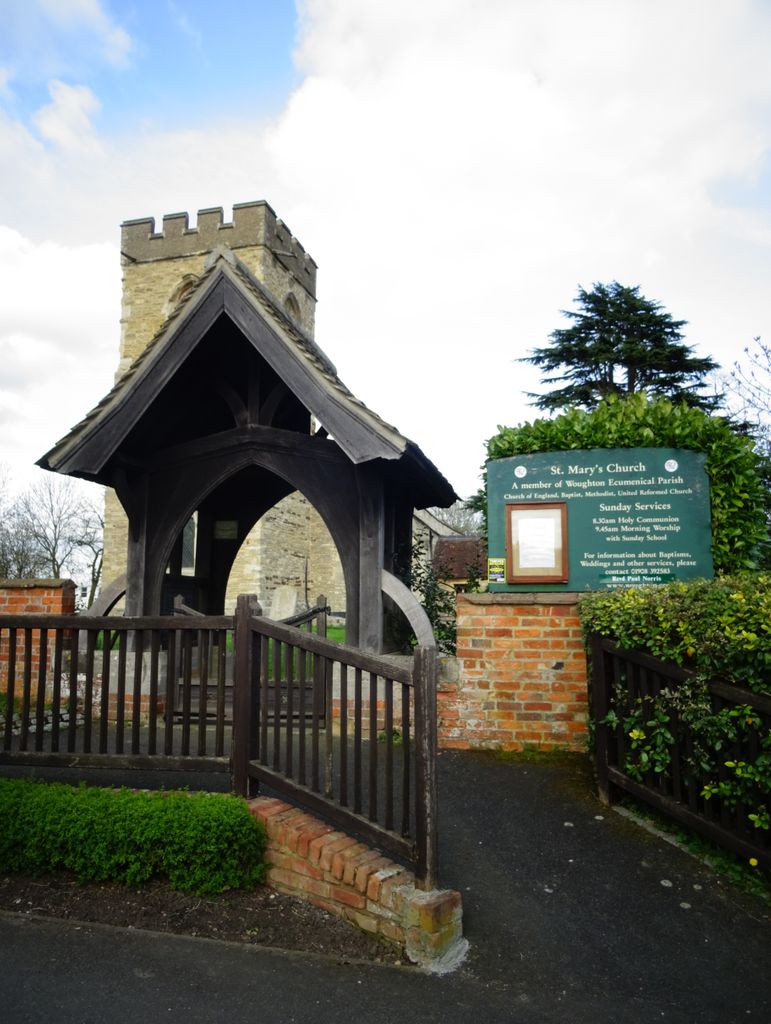
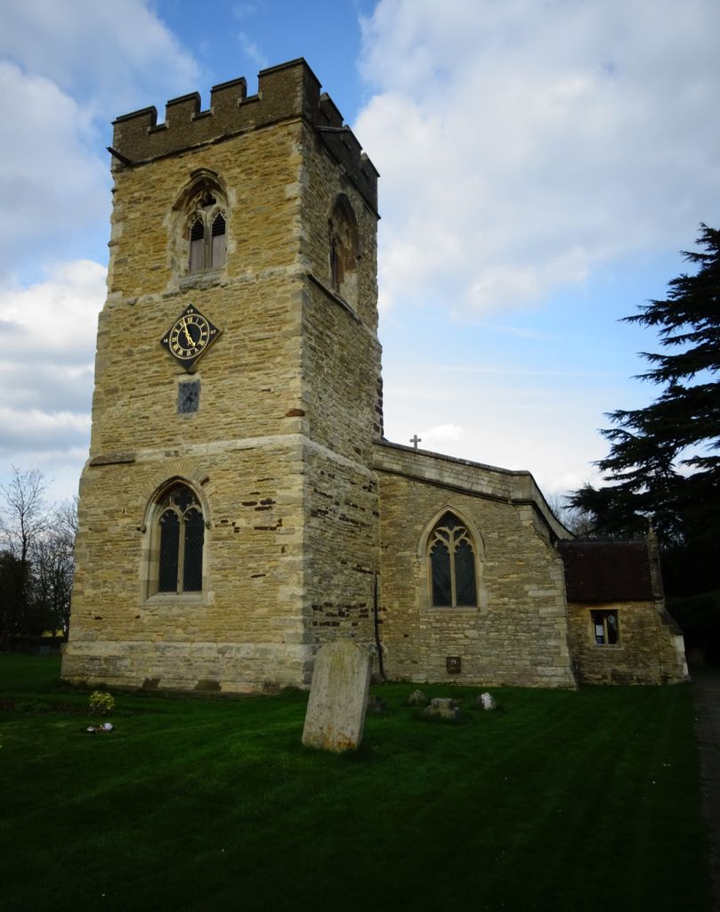
| Description | : | Woughton on the Green is a traditional Buckinghamshire village that is now part of Milton Keynes in England. It gives its name to the Civil parish of Woughton, of which it is now a part. St Mary's parish church The village was originally just called "Woughton", but by 1750 it was already being referred to as "Wofton on the Green". It has been suggested that the suffix was added to distinguish the village from other nearby places with the same name. On the Green refers to the large grassy area that lay in the centre of the village: the traditional... Read More |
frequently asked questions (FAQ):
-
Where is St Marys Churchyard?
St Marys Churchyard is located at Newport Road Woughton on the Green, Milton Keynes Borough ,Buckinghamshire , MK6 3BEEngland.
-
St Marys Churchyard cemetery's updated grave count on graveviews.com?
0 memorials
-
Where are the coordinates of the St Marys Churchyard?
Latitude: 52.0298869
Longitude: -0.7234442
Nearby Cemetories:
1. Holy Trinity Churchyard
Milton Keynes, Milton Keynes Borough, England
Coordinate: 52.0390700, -0.7253500
2. St. Michael's Churchyard Open University
Milton Keynes Borough, England
Coordinate: 52.0233487, -0.7118339
3. St. Thomas' Churchyard
Simpson, Milton Keynes Borough, England
Coordinate: 52.0170487, -0.7142377
4. Holy Trinity Churchyard
Woolstone, Milton Keynes Borough, England
Coordinate: 52.0450548, -0.7245233
5. All Saints Churchyard
Milton Keynes, Milton Keynes Borough, England
Coordinate: 52.0438000, -0.7070000
6. St. Lawrence's Churchyard
Broughton, Milton Keynes Borough, England
Coordinate: 52.0522000, -0.6980000
7. St. Mary's Churchyard
Wavendon, Milton Keynes Borough, England
Coordinate: 52.0257000, -0.6730000
8. St. Martin's Churchyard
Fenny Stratford, Milton Keynes Borough, England
Coordinate: 51.9982400, -0.7157800
9. Willen Churchyard
Campbell Park, Milton Keynes Borough, England
Coordinate: 52.0624000, -0.7200000
10. All Saints Churchyard
Loughton, Milton Keynes Borough, England
Coordinate: 52.0326533, -0.7797109
11. Bletchley Cemetery
Bletchley, Milton Keynes Borough, England
Coordinate: 51.9947900, -0.7189600
12. Whalley Drive Cemetery
Bletchley, Milton Keynes Borough, England
Coordinate: 51.9964870, -0.7456010
13. St. Mary's Churchyard
Bletchley, Milton Keynes Borough, England
Coordinate: 51.9960183, -0.7444740
14. St. Mary Churchyard
Milton Keynes Borough, England
Coordinate: 52.0222200, -0.7885200
15. All Saints Churchyard
Bow Brickhill, Milton Keynes Borough, England
Coordinate: 52.0005240, -0.6737110
16. All Saints Churchyard Extension
Bow Brickhill, Milton Keynes Borough, England
Coordinate: 52.0002300, -0.6737940
17. St Lawrence's Churchyard
Bradwell, Milton Keynes Borough, England
Coordinate: 52.0474500, -0.7891000
18. Selbourne Avenue Cemetery
Bletchley, Milton Keynes Borough, England
Coordinate: 51.9880347, -0.7493144
19. Assumption of the Blessed Virgin Mary Churchyard
Moulsoe, Milton Keynes Borough, England
Coordinate: 52.0666500, -0.6790070
20. St. Andrew's Churchyard
Great Linford, Milton Keynes Borough, England
Coordinate: 52.0728600, -0.7597100
21. New Bradwell Cemetery
Stantonbury, Milton Keynes Borough, England
Coordinate: 52.0684700, -0.7743500
22. Woburn Sands & Aspley Heath War Memorial
Woburn, Central Bedfordshire Unitary Authority, England
Coordinate: 52.0115470, -0.6473350
23. Crownhill Cemetery and Crematorium
Milton Keynes, Milton Keynes Borough, England
Coordinate: 52.0321870, -0.8054640
24. St. Michael's Churchyard
Woburn Sands, Milton Keynes Borough, England
Coordinate: 52.0087770, -0.6485350