
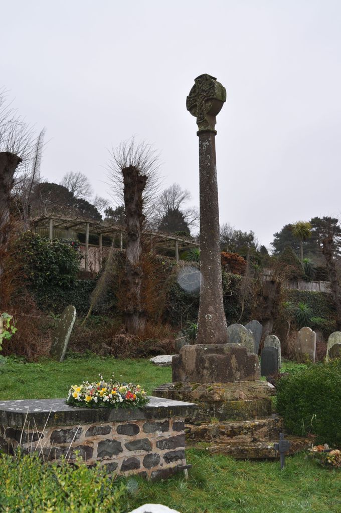
| Memorials | : | 0 |
| Location | : | Minehead, West Somerset District, England |
| Phone | : | 44 1643 818904 |
| Website | : | www.achurchnearyou.com/church/11302/ |
| Coordinate | : | 51.2110390, -3.4808250 |
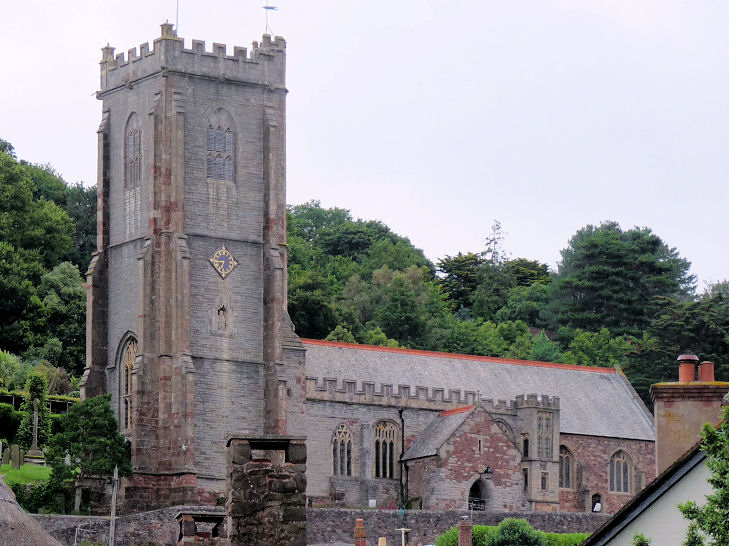
| Description | : | Saint Michael's Anglican Church in Minehead, Somerset, England was built in the 15th century. The church was built on the site of a previous building from which parts of the south porch can still be seen. William de Mohun gave the church to Bruton Priory in the 12th century. The Augustinian Canons held the advowson until the Dissolution of the Monasteries. Its tower used to display a beacon light for ships approaching the harbour. After being caught in a violent storm at sea, Robert Quirke dedicated a ship and its cargo to God's service, as well as donating a cellar... Read More |
frequently asked questions (FAQ):
-
Where is St. Michael's Anglican Church Cemetery?
St. Michael's Anglican Church Cemetery is located at Saint Michael's Road Minehead, West Somerset District ,Somerset , TA24 5RZEngland.
-
St. Michael's Anglican Church Cemetery cemetery's updated grave count on graveviews.com?
0 memorials
-
Where are the coordinates of the St. Michael's Anglican Church Cemetery?
Latitude: 51.2110390
Longitude: -3.4808250


Nearby Cemetories:
1. Minehead Cemetery
Minehead, West Somerset District, England
Coordinate: 51.2050650, -3.4982030
2. George Street Cemetery
Dunster, West Somerset District, England
Coordinate: 51.1833740, -3.4483046
3. Grabbist Hill Cemetery
Dunster, West Somerset District, England
Coordinate: 51.1820510, -3.4492540
4. Priory Churchyard of St. George
Dunster, West Somerset District, England
Coordinate: 51.1832000, -3.4459000
5. All Saints Churchyard
Wootton Courtenay, West Somerset District, England
Coordinate: 51.1801840, -3.5203550
6. All Saints Churchyard
Selworthy, West Somerset District, England
Coordinate: 51.2101800, -3.5475440
7. Selworthy Extension Cemeteries
Selworthy, West Somerset District, England
Coordinate: 51.2098330, -3.5481240
8. St. Petrock's Churchyard
Timberscombe, West Somerset District, England
Coordinate: 51.1680950, -3.4948210
9. Saint John the Baptist Churchyard
Carhampton, West Somerset District, England
Coordinate: 51.1746000, -3.4186000
10. St. Mary's Churchyard
Luccombe, West Somerset District, England
Coordinate: 51.1895770, -3.5596880
11. Luccombe Extension Cemetery
Luccombe, West Somerset District, England
Coordinate: 51.1897360, -3.5609100
12. St Nicholas Churchyard
Withycombe, West Somerset District, England
Coordinate: 51.1624530, -3.4096990
13. St Dubricius Churchyard
Porlock, West Somerset District, England
Coordinate: 51.2083000, -3.5955000
14. Porlock Cemetery
Porlock, West Somerset District, England
Coordinate: 51.2033790, -3.5954070
15. St. John the Evangelist Churchyard
Cutcombe, West Somerset District, England
Coordinate: 51.1424576, -3.5295319
16. Blesssed Virgin Mary Churchyard
Luxborough, West Somerset District, England
Coordinate: 51.1321490, -3.4680500
17. St. Andrew's Parish of Old Cleeve Churchyard
Old Cleeve, West Somerset District, England
Coordinate: 51.1683560, -3.3733090
18. Stoke Pero Churchyard
Porlock, West Somerset District, England
Coordinate: 51.1796510, -3.6060674
19. St Decuman's Churchyard
Watchet, West Somerset District, England
Coordinate: 51.1757020, -3.3383800
20. Watchet Town Cemetery
Watchet, West Somerset District, England
Coordinate: 51.1745790, -3.3379850
21. Treborough Parish Churchyard
Treborough, West Somerset District, England
Coordinate: 51.1180220, -3.4147610
22. St. Giles Churchyard of Leighland
Old Cleeve, West Somerset District, England
Coordinate: 51.1199950, -3.3842729
23. St Peter's Churchyard
Williton, West Somerset District, England
Coordinate: 51.1584870, -3.3235670
24. Culbone St. Bueno's Churchyard
Oare, West Somerset District, England
Coordinate: 51.2213640, -3.6594820