
| Memorials | : | 0 |
| Location | : | Oare, West Somerset District, England |
| Coordinate | : | 51.2213640, -3.6594820 |
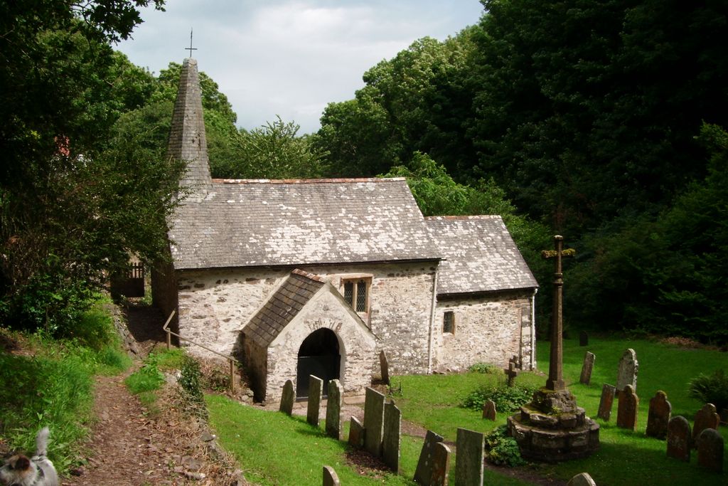
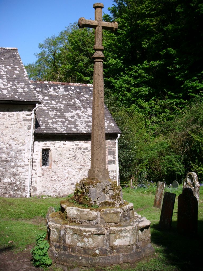
| Description | : | St.Bueno's Church can be only reached on foot. A downward walk through the woods from 'The Culbone Inn' on the A39 - Lynmouth to Porlock road or, a very uphill climb directly from Porlock Weir passing by the remains of the Gothic Castle of Ada Lovelace, daughter of Lord Byron, by way of the South West Coast Path. A sentiment to her son Ralph is mounted on the Cemetery wall. At only 33' long, it's reputed to be the smallest Church in England, and seats 30. Dedicated to the Welsh Saint ~ Bueno, the Church is a Grade I listed building -... Read More |
frequently asked questions (FAQ):
-
Where is Culbone St. Bueno's Churchyard?
Culbone St. Bueno's Churchyard is located at Oare, West Somerset District ,Somerset ,England.
-
Culbone St. Bueno's Churchyard cemetery's updated grave count on graveviews.com?
0 memorials
-
Where are the coordinates of the Culbone St. Bueno's Churchyard?
Latitude: 51.2213640
Longitude: -3.6594820

Nearby Cemetories:
1. St. Mary the Virgin Churchyard
Oare, West Somerset District, England
Coordinate: 51.2124350, -3.7164290
2. St Dubricius Churchyard
Porlock, West Somerset District, England
Coordinate: 51.2083000, -3.5955000
3. Porlock Cemetery
Porlock, West Somerset District, England
Coordinate: 51.2033790, -3.5954070
4. Stoke Pero Churchyard
Porlock, West Somerset District, England
Coordinate: 51.1796510, -3.6060674
5. Luccombe Extension Cemetery
Luccombe, West Somerset District, England
Coordinate: 51.1897360, -3.5609100
6. St. Mary's Churchyard
Luccombe, West Somerset District, England
Coordinate: 51.1895770, -3.5596880
7. Selworthy Extension Cemeteries
Selworthy, West Somerset District, England
Coordinate: 51.2098330, -3.5481240
8. All Saints Churchyard
Selworthy, West Somerset District, England
Coordinate: 51.2101800, -3.5475440
9. St. Brendon's Churchyard
Brendon, North Devon District, England
Coordinate: 51.2149390, -3.7910490
10. St. Mary Magdalene Churchyard
Exford, West Somerset District, England
Coordinate: 51.1341450, -3.6342160
11. All Saints Churchyard
Wootton Courtenay, West Somerset District, England
Coordinate: 51.1801840, -3.5203550
12. St.Luke's Churchyard
Simonsbath, West Somerset District, England
Coordinate: 51.1408600, -3.7514560
13. Minehead Cemetery
Minehead, West Somerset District, England
Coordinate: 51.2050650, -3.4982030
14. St. Mary the Virgin Churchyard
Lynton, North Devon District, England
Coordinate: 51.2298700, -3.8339800
15. St. Michael's Anglican Church Cemetery
Minehead, West Somerset District, England
Coordinate: 51.2110390, -3.4808250
16. St. John the Evangelist Churchyard
Cutcombe, West Somerset District, England
Coordinate: 51.1424576, -3.5295319
17. Saint Andrew's Churchyard
Withypool, West Somerset District, England
Coordinate: 51.1078060, -3.6492700
18. St. Petrock's Churchyard
Timberscombe, West Somerset District, England
Coordinate: 51.1680950, -3.4948210
19. Lynton New Cemetery
Lynton, North Devon District, England
Coordinate: 51.2293000, -3.8453100
20. Winsford Churchyard
Winsford, West Somerset District, England
Coordinate: 51.1038000, -3.5665000
21. Grabbist Hill Cemetery
Dunster, West Somerset District, England
Coordinate: 51.1820510, -3.4492540
22. George Street Cemetery
Dunster, West Somerset District, England
Coordinate: 51.1833740, -3.4483046
23. Priory Churchyard of St. George
Dunster, West Somerset District, England
Coordinate: 51.1832000, -3.4459000
24. Blesssed Virgin Mary Churchyard
Luxborough, West Somerset District, England
Coordinate: 51.1321490, -3.4680500