
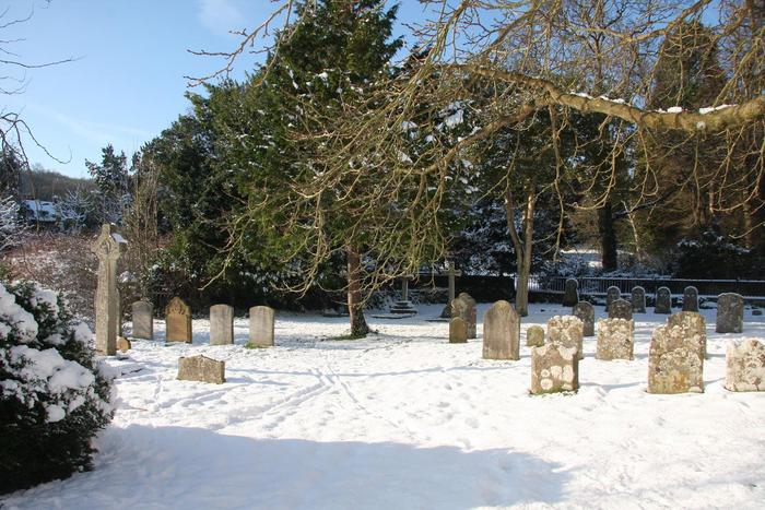
| Memorials | : | 3 |
| Location | : | Stanmer, Brighton and Hove Unitary Authority, England |
| Coordinate | : | 50.8702740, -0.1019400 |
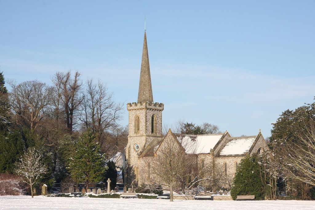
| Description | : | The original 14th century church was demolished in 1838, when the present "new" church was constructed. It was built in the Early English style at a cost of £14,000 by the the 3rd Earl of Chichester, Henry Thomas Pelham. For the time it was still a small church, and according to the then practice a west gallery was constructed. Upon the gallery are the Royal Coat of Arms of King George III. The organ uses much of the central space, but there are two rows of benches immediately in front of it. The east window... Read More |
frequently asked questions (FAQ):
-
Where is Stanmer Churchyard?
Stanmer Churchyard is located at Stanmer, Brighton and Hove Unitary Authority ,East Sussex ,England.
-
Stanmer Churchyard cemetery's updated grave count on graveviews.com?
3 memorials
-
Where are the coordinates of the Stanmer Churchyard?
Latitude: 50.8702740
Longitude: -0.1019400


Nearby Cemetories:
1. St Laurence Churchyard
Falmer, Lewes District, England
Coordinate: 50.8623110, -0.0762390
2. All Saints Churchyard
Patcham, Brighton and Hove Unitary Authority, England
Coordinate: 50.8665100, -0.1510800
3. Patcham Down Indian Forces Cremation Memorial
Patcham, Brighton and Hove Unitary Authority, England
Coordinate: 50.8841200, -0.1473900
4. Brighton Jewish Cemetery
Brighton, Brighton and Hove Unitary Authority, England
Coordinate: 50.8383460, -0.1091340
5. City Cemetery
Brighton, Brighton and Hove Unitary Authority, England
Coordinate: 50.8367290, -0.1115980
6. Downs Crematorium
Brighton, Brighton and Hove Unitary Authority, England
Coordinate: 50.8364060, -0.1113840
7. Extra-Mural Cemetery
Brighton, Brighton and Hove Unitary Authority, England
Coordinate: 50.8373830, -0.1242430
8. Woodvale Cemetery and Crematorium
Brighton, Brighton and Hove Unitary Authority, England
Coordinate: 50.8373730, -0.1242390
9. St Martin Churchyard
Westmeston, Lewes District, England
Coordinate: 50.9066840, -0.0971980
10. Florence Place Jewish Cemetery
Brighton, Brighton and Hove Unitary Authority, England
Coordinate: 50.8386221, -0.1325497
11. Lawn Memorial Cemetery
Woodingdean, Brighton and Hove Unitary Authority, England
Coordinate: 50.8350190, -0.0832060
12. Brighton and Preston Cemetery
Brighton, Brighton and Hove Unitary Authority, England
Coordinate: 50.8341990, -0.1201990
13. St Michael and All Angels Churchyard
Plumpton, Lewes District, England
Coordinate: 50.9050700, -0.0717450
14. St Martin with St Wilfrid and St Alban Church
Brighton, Brighton and Hove Unitary Authority, England
Coordinate: 50.8331604, -0.1287570
15. Saint Peter's Churchyard
Preston, Brighton and Hove Unitary Authority, England
Coordinate: 50.8430580, -0.1506110
16. St Bartholemew Church
Brighton, Brighton and Hove Unitary Authority, England
Coordinate: 50.8306541, -0.1369860
17. St. Peters
Brighton, Brighton and Hove Unitary Authority, England
Coordinate: 50.8282670, -0.1349480
18. Church of the Transfiguration Churchyard
Pyecombe, Mid Sussex District, England
Coordinate: 50.8984590, -0.1642370
19. Cardinal Newman Catholic School Cemetery
Hove, Brighton and Hove Unitary Authority, England
Coordinate: 50.8369870, -0.1586370
20. Ditchling Cemetery
Ditchling, Lewes District, England
Coordinate: 50.9196160, -0.1050510
21. St Pancras Churchyard
Kingston, Lewes District, England
Coordinate: 50.8562900, -0.0245250
22. The Browne Burial Ground
Ditchling, Lewes District, England
Coordinate: 50.9213097, -0.1128219
23. Ditchling Unitarian Chapel Chapelyard
Ditchling, Lewes District, England
Coordinate: 50.9214096, -0.1129916
24. Hanover Chapel Burial Ground
Brighton, Brighton and Hove Unitary Authority, England
Coordinate: 50.8252920, -0.1423620