
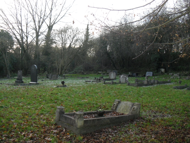
| Memorials | : | 0 |
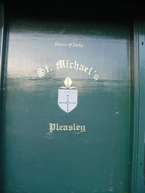
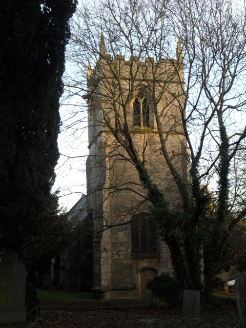
| Location | : | Pleasley, Bolsover District, England |
| Coordinate | : | 53.1755900, -1.2469200 |
frequently asked questions (FAQ):
-
Where is St Michael Churchyard?
St Michael Churchyard is located at Church Lane Pleasley, Bolsover District ,Derbyshire , NG19 7TDEngland.
-
St Michael Churchyard cemetery's updated grave count on graveviews.com?
0 memorials
-
Where are the coordinates of the St Michael Churchyard?
Latitude: 53.1755900
Longitude: -1.2469200
Nearby Cemetories:
1. St John the Baptist Churchyard
Ault Hucknall, Bolsover District, England
Coordinate: 53.1821350, -1.3021210
2. Saint Andrew's Parish Churchyard
Skegby, Ashfield District, England
Coordinate: 53.1429900, -1.2661100
3. St. Edmund King & Martyr Churchyard Extension
Mansfield, Mansfield District, England
Coordinate: 53.1638200, -1.1900600
4. Saint Leonard Churchyard
Scarcliffe, Bolsover District, England
Coordinate: 53.2139400, -1.2597200
5. St. Peter's Churchyard
Mansfield, Mansfield District, England
Coordinate: 53.1434700, -1.1928900
6. Heath Old Churchyard
Chesterfield Borough, England
Coordinate: 53.1990661, -1.3240162
7. St. Mary Magdalene Churchyard
Sutton-in-Ashfield, Ashfield District, England
Coordinate: 53.1255500, -1.2700820
8. Sutton Cemetery
Sutton-in-Ashfield, Ashfield District, England
Coordinate: 53.1238890, -1.2714690
9. All Saints Church
Heath, North East Derbyshire District, England
Coordinate: 53.1986620, -1.3305840
10. All Saints Churchyard
Heath, North East Derbyshire District, England
Coordinate: 53.1988682, -1.3305255
11. St Alban the Martyr Churchyard
Forest Town, Mansfield District, England
Coordinate: 53.1524570, -1.1632350
12. Langwith Road Cemetery
Bolsover, Bolsover District, England
Coordinate: 53.2252800, -1.2883500
13. St. Mary Old Churchyard
Bolsover, Bolsover District, England
Coordinate: 53.2276370, -1.2909470
14. Nottingham Road Cemetery
Mansfield, Mansfield District, England
Coordinate: 53.1270400, -1.1920500
15. Mansfield Cemetery
Mansfield, Mansfield District, England
Coordinate: 53.1250960, -1.1934520
16. Mansfield Crematorium
Mansfield, Mansfield District, England
Coordinate: 53.1214230, -1.1946980
17. St. John the Baptist Churchyard
Tibshelf, Bolsover District, England
Coordinate: 53.1431860, -1.3427080
18. Oxcroft Lane Cemetery
Bolsover, Bolsover District, England
Coordinate: 53.2374098, -1.2871212
19. St. Lukes Whaley Thorns Burial Ground
Nether Langwith, Bassetlaw District, England
Coordinate: 53.2383210, -1.2034396
20. St. Peter & St. Paul's Churchyard
Church Warsop, Mansfield District, England
Coordinate: 53.2134000, -1.1511200
21. Warsop Cemetery
Warsop, Mansfield District, England
Coordinate: 53.2160000, -1.1497000
22. St. Werburgh's Churchyard
Blackwell, Bolsover District, England
Coordinate: 53.1209850, -1.3380680
23. North Wingfield Municipal Cemetery
North Wingfield, North East Derbyshire District, England
Coordinate: 53.1813170, -1.3773240
24. Clipstone Parish Cemetery
Clipstone, Newark and Sherwood District, England
Coordinate: 53.1657350, -1.1171430