
| Memorials | : | 0 |
| Location | : | Biddestone, Wiltshire Unitary Authority, England |
| Website | : | bybrook.org.uk/ |
| Coordinate | : | 51.4646692, -2.2322248 |
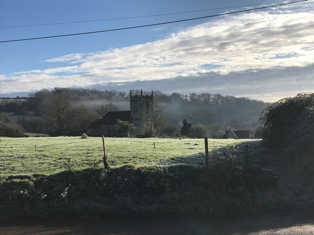
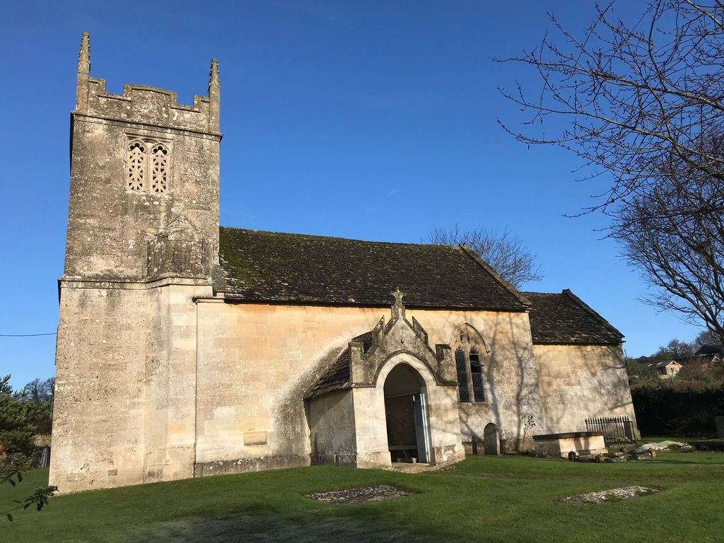
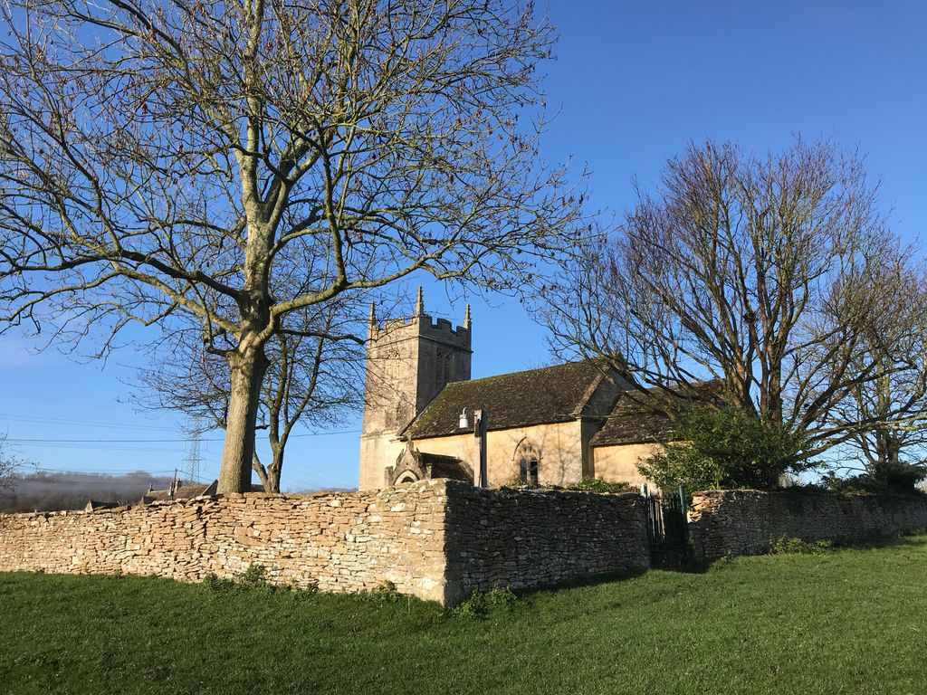
| Description | : | Slaughterford is a small village and former civil parish about 5 miles (8 km) west of Chippenham, Wiltshire, England. The village has a crossing point of the Bybrook River, in a wooded valley between Castle Combe and Box. The Church of St Nicholas is Grade II* listed.[4] Built in the 15th century, it was partly destroyed about 1649 by Richard Cromwell's troops on their way to Ireland, and lay in ruins until rebuilt in 1823. There was further restoration in 1883. Slaughterford was a separate parish with its own church until the village was merged with Biddestone in 1844. Bybrook Team... Read More |
frequently asked questions (FAQ):
-
Where is St. Nicholas' Churchyard?
St. Nicholas' Churchyard is located at Germain Biddestone, Wiltshire Unitary Authority ,Wiltshire , SN14 8REEngland.
-
St. Nicholas' Churchyard cemetery's updated grave count on graveviews.com?
0 memorials
-
Where are the coordinates of the St. Nicholas' Churchyard?
Latitude: 51.4646692
Longitude: -2.2322248
Nearby Cemetories:
1. St Nicholas Churchyard Extension
Biddestone, Wiltshire Unitary Authority, England
Coordinate: 51.4586102, -2.2046090
2. St. Nicholas' Churchyard
Biddestone, Wiltshire Unitary Authority, England
Coordinate: 51.4606100, -2.2003700
3. St Andrew Churchyard
Castle Combe, Wiltshire Unitary Authority, England
Coordinate: 51.4933830, -2.2296560
4. St John the Baptist Churchyard
Colerne, Wiltshire Unitary Authority, England
Coordinate: 51.4391000, -2.2597000
5. Church of St. Mary the Virgin
Wiltshire Unitary Authority, England
Coordinate: 51.4967160, -2.2703700
6. St Bartholomew Churchyard
Corsham, Wiltshire Unitary Authority, England
Coordinate: 51.4338640, -2.1822900
7. St Paul with Allington Mission
Allington, Wiltshire Unitary Authority, England
Coordinate: 51.4753340, -2.1530720
8. St. Thomas A. Becket Churchyard
Box, Wiltshire Unitary Authority, England
Coordinate: 51.4151440, -2.2550730
9. St Mary the Virgin Churchyard
Marshfield, South Gloucestershire Unitary Authority, England
Coordinate: 51.4616500, -2.3149230
10. Box Cemetery
Box, Wiltshire Unitary Authority, England
Coordinate: 51.4142265, -2.2597129
11. St. Philip’s and St. James’
Corsham, Wiltshire Unitary Authority, England
Coordinate: 51.4125733, -2.2017900
12. St Catherine Churchyard
Batheaston, Bath and North East Somerset Unitary Authority, England
Coordinate: 51.4307700, -2.3209500
13. Church of St Catherine
St Catherine, Bath and North East Somerset Unitary Authority, England
Coordinate: 51.4308200, -2.3212100
14. St Mary Churchyard
Acton Turville, South Gloucestershire Unitary Authority, England
Coordinate: 51.5263850, -2.2775330
15. St James Churchyard
West Littleton, South Gloucestershire Unitary Authority, England
Coordinate: 51.4780400, -2.3458000
16. Atworth Independent Churchyard
Atworth, Wiltshire Unitary Authority, England
Coordinate: 51.3926890, -2.1991210
17. St. Michael's Churchyard
Atworth, Wiltshire Unitary Authority, England
Coordinate: 51.3910250, -2.2037350
18. St Mary Magdelene Churchyard
Tormarton, South Gloucestershire Unitary Authority, England
Coordinate: 51.5082250, -2.3334930
19. St John the Baptist Churchyard
Batheaston, Bath and North East Somerset Unitary Authority, England
Coordinate: 51.4097940, -2.3213520
20. Quaker Burial Ground
Batheaston, Bath and North East Somerset Unitary Authority, England
Coordinate: 51.4024970, -2.3100210
21. Holy Trinity Churchyard
Cold Ashton, South Gloucestershire Unitary Authority, England
Coordinate: 51.4530440, -2.3597430
22. St Swithun Churchyard
Bathford, Bath and North East Somerset Unitary Authority, England
Coordinate: 51.3981960, -2.3060840
23. Saint Michael's
Badminton, South Gloucestershire Unitary Authority, England
Coordinate: 51.5400900, -2.2818500
24. St Giles Churchyard
Alderton, Wiltshire Unitary Authority, England
Coordinate: 51.5461670, -2.2294570