
| Memorials | : | 0 |
| Location | : | Biddestone, Wiltshire Unitary Authority, England |
| Coordinate | : | 51.4606100, -2.2003700 |
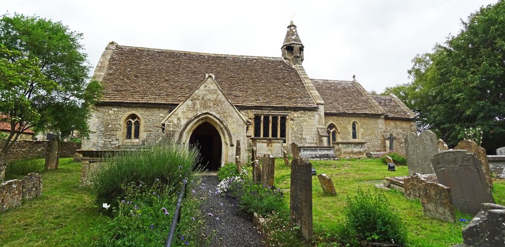
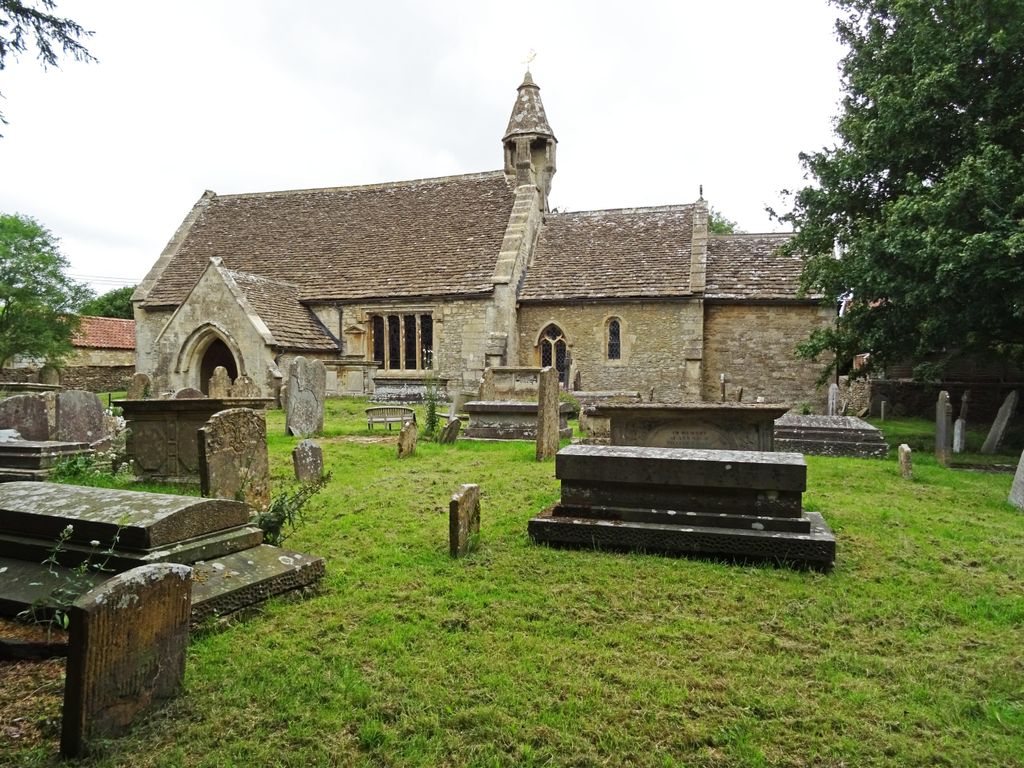
| Description | : | The Anglican parish church is built of rubble stone with stone tiled roofs and coped gables. The church has Saxon foundations but is mostly Norman with a 300 year old oak door in the Norman doorway. The font is also 300 years old. The north and south walls were built to throw light onto the altar. In 1250 a two light decorated window was inserted on the south wall. The north wall's low window was blocked up from inside around 1280. The bell turret was re-built on the new east gable, c.1480 and is very rare. It was built to... Read More |
frequently asked questions (FAQ):
-
Where is St. Nicholas' Churchyard?
St. Nicholas' Churchyard is located at Biddestone, Wiltshire Unitary Authority ,Wiltshire ,England.
-
St. Nicholas' Churchyard cemetery's updated grave count on graveviews.com?
0 memorials
-
Where are the coordinates of the St. Nicholas' Churchyard?
Latitude: 51.4606100
Longitude: -2.2003700
Nearby Cemetories:
1. St Nicholas Churchyard Extension
Biddestone, Wiltshire Unitary Authority, England
Coordinate: 51.4586102, -2.2046090
2. St. Nicholas' Churchyard
Biddestone, Wiltshire Unitary Authority, England
Coordinate: 51.4646692, -2.2322248
3. St Bartholomew Churchyard
Corsham, Wiltshire Unitary Authority, England
Coordinate: 51.4338640, -2.1822900
4. St Paul with Allington Mission
Allington, Wiltshire Unitary Authority, England
Coordinate: 51.4753340, -2.1530720
5. St Andrew Churchyard
Castle Combe, Wiltshire Unitary Authority, England
Coordinate: 51.4933830, -2.2296560
6. St John the Baptist Churchyard
Colerne, Wiltshire Unitary Authority, England
Coordinate: 51.4391000, -2.2597000
7. St. Philip’s and St. James’
Corsham, Wiltshire Unitary Authority, England
Coordinate: 51.4125733, -2.2017900
8. Church of St. Mary the Virgin
Wiltshire Unitary Authority, England
Coordinate: 51.4967160, -2.2703700
9. St. Thomas A. Becket Churchyard
Box, Wiltshire Unitary Authority, England
Coordinate: 51.4151440, -2.2550730
10. Box Cemetery
Box, Wiltshire Unitary Authority, England
Coordinate: 51.4142265, -2.2597129
11. London Road Cemetery
Chippenham, Wiltshire Unitary Authority, England
Coordinate: 51.4506852, -2.0978890
12. Atworth Independent Churchyard
Atworth, Wiltshire Unitary Authority, England
Coordinate: 51.3926890, -2.1991210
13. St. Michael's Churchyard
Atworth, Wiltshire Unitary Authority, England
Coordinate: 51.3910250, -2.2037350
14. St Mary the Virgin Churchyard
Marshfield, South Gloucestershire Unitary Authority, England
Coordinate: 51.4616500, -2.3149230
15. St Barnabas Churchyard
Beanacre, Wiltshire Unitary Authority, England
Coordinate: 51.3936935, -2.1398827
16. St Giles Church Tytherton Kellaways
Chippenham, Wiltshire Unitary Authority, England
Coordinate: 51.4805660, -2.0756870
17. St Catherine Churchyard
Batheaston, Bath and North East Somerset Unitary Authority, England
Coordinate: 51.4307700, -2.3209500
18. Church of St Catherine
St Catherine, Bath and North East Somerset Unitary Authority, England
Coordinate: 51.4308200, -2.3212100
19. St Mary Churchyard
Acton Turville, South Gloucestershire Unitary Authority, England
Coordinate: 51.5263850, -2.2775330
20. Christ Church
Derry Hill, Wiltshire Unitary Authority, England
Coordinate: 51.4368890, -2.0654300
21. St Giles Churchyard
Alderton, Wiltshire Unitary Authority, England
Coordinate: 51.5461670, -2.2294570
22. Quaker Burial Ground
Batheaston, Bath and North East Somerset Unitary Authority, England
Coordinate: 51.4024970, -2.3100210
23. St Swithun Churchyard
Bathford, Bath and North East Somerset Unitary Authority, England
Coordinate: 51.3981960, -2.3060840
24. St John the Baptist Churchyard
Batheaston, Bath and North East Somerset Unitary Authority, England
Coordinate: 51.4097940, -2.3213520