
| Memorials | : | 0 |
| Location | : | Stanningley, Metropolitan Borough of Leeds, England |
| Coordinate | : | 53.8043000, -1.6650200 |
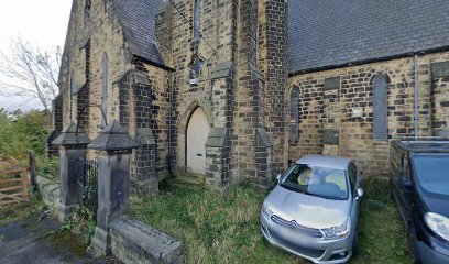
| Description | : | The church was built in 1853, although the parish was formed on 9th June 1846 to serve the people of Stanningley (now a district of Pudsey). The registers for St Paul begin in 1856 with the last burial taking place in 1939. The church was closed in 1982 and the building is now a commercial property. The St Paul parish was merged with St Lawrence parish of Pudsey after the church building was closed. |
frequently asked questions (FAQ):
-
Where is St Paul Churchyard?
St Paul Churchyard is located at 17 Park Top, off Richardshaw Lane Stanningley, Metropolitan Borough of Leeds ,West Yorkshire , LS28 6BYEngland.
-
St Paul Churchyard cemetery's updated grave count on graveviews.com?
0 memorials
-
Where are the coordinates of the St Paul Churchyard?
Latitude: 53.8043000
Longitude: -1.6650200
Nearby Cemetories:
1. St. Thomas' Churchyard
Stanningley, Metropolitan Borough of Leeds, England
Coordinate: 53.8077200, -1.6562500
2. Pudsey Cemetery
Pudsey, Metropolitan Borough of Leeds, England
Coordinate: 53.7975970, -1.6679480
3. St. John the Evangelist Churchyard
Farsley, Metropolitan Borough of Leeds, England
Coordinate: 53.8109500, -1.6720100
4. St Lawrence Churchyard
Pudsey, Metropolitan Borough of Leeds, England
Coordinate: 53.7933560, -1.6669650
5. Rehoboth Baptist Burial Ground
Farsley, Metropolitan Borough of Leeds, England
Coordinate: 53.8160750, -1.6622590
6. Fulneck Moravian Burial Ground
Pudsey, Metropolitan Borough of Leeds, England
Coordinate: 53.7840300, -1.6623700
7. Bramley Baptist Churchyard
Bramley, Metropolitan Borough of Leeds, England
Coordinate: 53.8100700, -1.6310800
8. St Peter Churchyard
Bramley, Metropolitan Borough of Leeds, England
Coordinate: 53.8110770, -1.6295020
9. Farnley Cemetery
New Farnley, Metropolitan Borough of Leeds, England
Coordinate: 53.7863130, -1.6351690
10. St. Wilfrid Churchyard
Calverley, Metropolitan Borough of Leeds, England
Coordinate: 53.8303600, -1.6849920
11. Horsforth Cemetery
Horsforth, Metropolitan Borough of Leeds, England
Coordinate: 53.8334500, -1.6516100
12. St Michael and All Angels Churchyard
New Farnley, Metropolitan Borough of Leeds, England
Coordinate: 53.7852600, -1.6247830
13. Armley Hill Top Cemetery
Leeds, Metropolitan Borough of Leeds, England
Coordinate: 53.8020600, -1.6128900
14. Our Lady of Perpetual Succour & St Cla
Bradford, Metropolitan Borough of Bradford, England
Coordinate: 53.8078740, -1.7188450
15. St James Churchyard
Tong, Metropolitan Borough of Bradford, England
Coordinate: 53.7706700, -1.6689800
16. Cragg Hill Baptist Chapelyard
Horsforth, Metropolitan Borough of Leeds, England
Coordinate: 53.8333600, -1.6349900
17. St Luke Churchyard
Bradford, Metropolitan Borough of Bradford, England
Coordinate: 53.8159600, -1.7200700
18. Horsforth Peace Gardens
Horsforth, Metropolitan Borough of Leeds, England
Coordinate: 53.8364395, -1.6430796
19. Salem Congregational Chapel Chapelyard
Bradford, Metropolitan Borough of Bradford, England
Coordinate: 53.8191010, -1.7193240
20. St Margaret's Burial Ground
Horsforth, Metropolitan Borough of Leeds, England
Coordinate: 53.8376300, -1.6428400
21. Rawdon Crematorium
Rawdon, Metropolitan Borough of Leeds, England
Coordinate: 53.8401170, -1.6628580
22. St Andrew's Undercliffe Methodist Church Graveyard
Bradford, Metropolitan Borough of Bradford, England
Coordinate: 53.8082733, -1.7303250
23. New Farnley Jewish Cemetery
New Farnley, Metropolitan Borough of Leeds, England
Coordinate: 53.7711990, -1.6305990
24. Norman Lane Methodist Burial Ground
Idle, Metropolitan Borough of Bradford, England
Coordinate: 53.8232117, -1.7268900