
| Memorials | : | 0 |
| Location | : | Etwall, South Derbyshire District, England |
| Coordinate | : | 52.8847700, -1.6017500 |
frequently asked questions (FAQ):
-
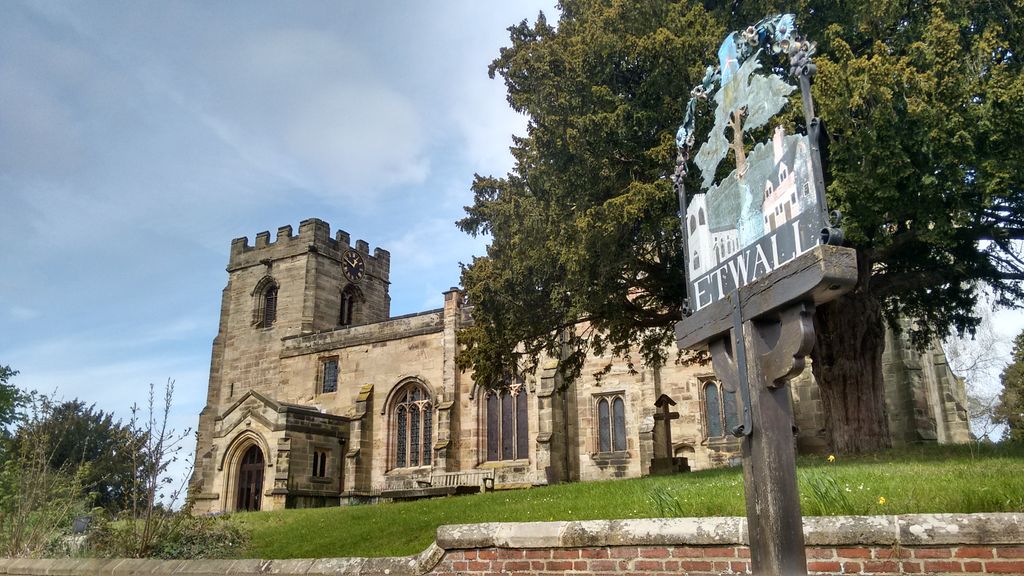
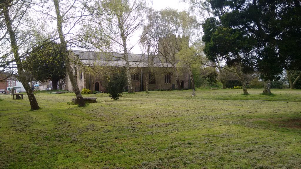
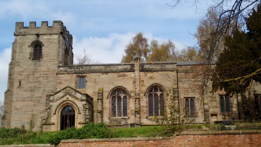
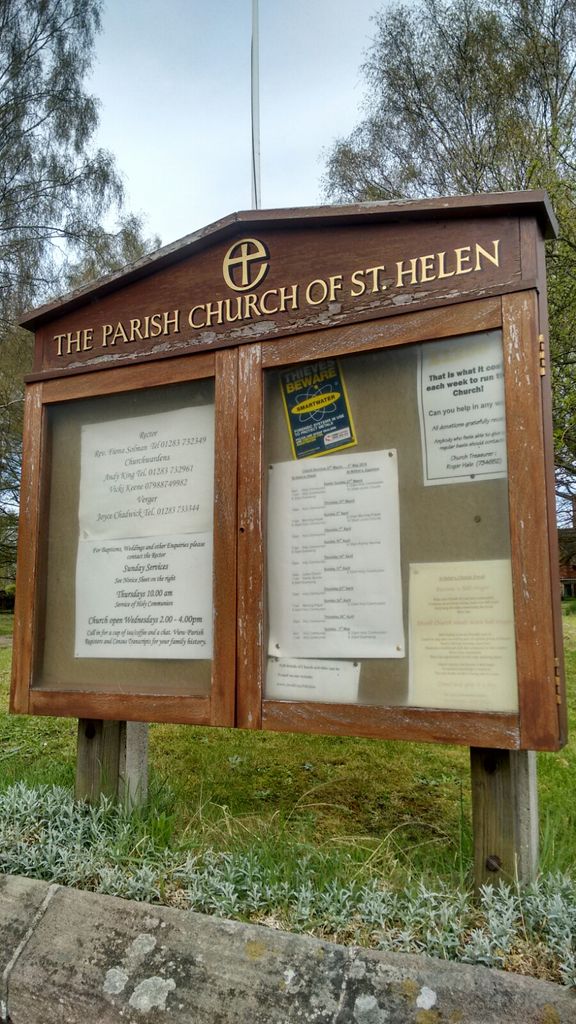
Where is Saint Helen's Churchyard?
Saint Helen's Churchyard is located at Main Street Etwall, South Derbyshire District ,Derbyshire , DE65 6LWEngland.
-
Saint Helen's Churchyard cemetery's updated grave count on graveviews.com?
0 memorials
-
Where are the coordinates of the Saint Helen's Churchyard?
Latitude: 52.8847700
Longitude: -1.6017500
Nearby Cemetories:
1. Etwall Cemetery
Etwall, South Derbyshire District, England
Coordinate: 52.8856100, -1.6025100
2. All Saints Churchyard
Dalbury Lees, South Derbyshire District, England
Coordinate: 52.9053450, -1.6096710
3. All Saints Churchyard
Trusley, South Derbyshire District, England
Coordinate: 52.9166300, -1.6243670
4. St Michael Churchyard
Sutton-on-the-Hill, South Derbyshire District, England
Coordinate: 52.9050080, -1.6484320
5. St. Wilfrid Churchyard
Egginton, South Derbyshire District, England
Coordinate: 52.8474570, -1.6041750
6. All Saints Churchyard
Mickleover, Derby Unitary Authority, England
Coordinate: 52.9043630, -1.5476790
7. Marston-on-Dove Cemetery
Marston-on-Dove, South Derbyshire District, England
Coordinate: 52.8640550, -1.6552780
8. St Mary's
Marston-on-Dove, South Derbyshire District, England
Coordinate: 52.8633910, -1.6547730
9. St Andrews Churchyard
Radbourne, South Derbyshire District, England
Coordinate: 52.9207000, -1.5759800
10. St Michael Churchyard
Willington, South Derbyshire District, England
Coordinate: 52.8501540, -1.5636540
11. St. Mary's Churchyard
Rolleston-on-Dove, East Staffordshire Borough, England
Coordinate: 52.8465144, -1.6519844
12. Rolleston Cemetery
Rolleston-on-Dove, East Staffordshire Borough, England
Coordinate: 52.8483757, -1.6643849
13. St Mary's Church
Stretton, East Staffordshire Borough, England
Coordinate: 52.8341478, -1.6247215
14. St Mary's Churchyard
Stretton, South Staffordshire Borough, England
Coordinate: 52.8336500, -1.6253400
15. St. Wystan's Churchyard
Repton, South Derbyshire District, England
Coordinate: 52.8411570, -1.5516380
16. Christ Church Cemetery
Long Lane, Derbyshire Dales District, England
Coordinate: 52.9391990, -1.6264140
17. Priory Church of St. Mary the Virgin
Tutbury, East Staffordshire Borough, England
Coordinate: 52.8590900, -1.6877900
18. St Michael and All Angels Churchyard
Church Broughton, South Derbyshire District, England
Coordinate: 52.9009460, -1.6962610
19. St Peter's Churchyard
Littleover, Derby Unitary Authority, England
Coordinate: 52.9039020, -1.5068650
20. St Michaels Churchyard
Kirk Langley, Amber Valley Borough, England
Coordinate: 52.9463000, -1.5747000
21. Saint John the Divine Churchyard
Horninglow, East Staffordshire Borough, England
Coordinate: 52.8237520, -1.6426170
22. Normanton Cemetery
Normanton, Derby Unitary Authority, England
Coordinate: 52.8968930, -1.4927830
23. All Saints Churchyard
Mackworth, Amber Valley Borough, England
Coordinate: 52.9362637, -1.5249797
24. St. Paul's Churchyard Extension
Scropton, South Derbyshire District, England
Coordinate: 52.8687230, -1.7133750