
| Memorials | : | 6 |
| Location | : | Irthlingborough, East Northamptonshire Borough, England |
| Website | : | www.nenecrossings.org.uk |
| Coordinate | : | 52.3251642, -0.6101925 |
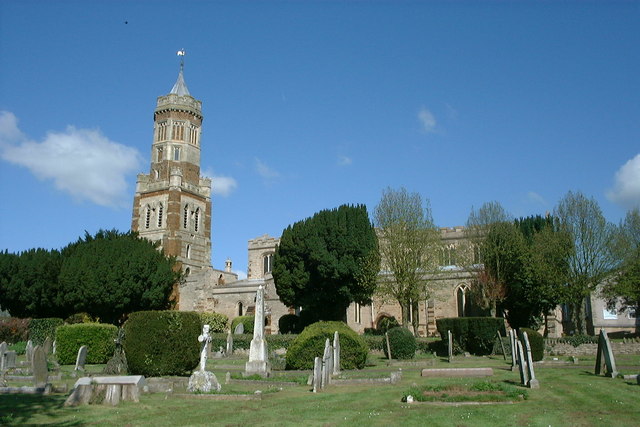
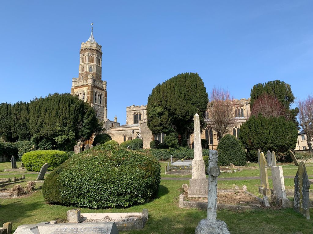
| Description | : | Irthlingborough is a town on the River Nene in Northamptonshire, England. Irthlingborough was called Yrtlingaburg in the 8th century, Erdiburn in the Domesday Book, and later Artleborough. The parish church, St Peter, has a lantern tower which is unusual for Northamptonshire churches. This was built to guide travellers across the Nene valley in foggy weather. |
frequently asked questions (FAQ):
-
Where is St Peter's Churchyard?
St Peter's Churchyard is located at Church Street Irthlingborough, East Northamptonshire Borough ,Northamptonshire , NN9 5SDEngland.
-
St Peter's Churchyard cemetery's updated grave count on graveviews.com?
6 memorials
-
Where are the coordinates of the St Peter's Churchyard?
Latitude: 52.3251642
Longitude: -0.6101925
Nearby Cemetories:
1. New Irthlingborough Cemetery
Irthlingborough, East Northamptonshire Borough, England
Coordinate: 52.3178531, -0.6294229
2. Higham Ferrers Cemetery
Higham Ferrers, East Northamptonshire Borough, England
Coordinate: 52.3084850, -0.5945270
3. St. Mary the Virgin Churchyard
Higham Ferrers, East Northamptonshire Borough, England
Coordinate: 52.3065500, -0.5915240
4. St. Laurence Churchyard Stanwick
Stanwick, East Northamptonshire Borough, England
Coordinate: 52.3324970, -0.5628585
5. Saint Mary the Virgin Churchyard Extension
Finedon, Wellingborough Borough, England
Coordinate: 52.3385489, -0.6613748
6. Stanwick Cemetery
Stanwick, East Northamptonshire Borough, England
Coordinate: 52.3298800, -0.5531500
7. Finedon
Finedon, Wellingborough Borough, England
Coordinate: 52.3407999, -0.6648562
8. St Mary Churchyard
Rushden, East Northamptonshire Borough, England
Coordinate: 52.2885570, -0.5973860
9. St. John the Baptist Churchyard
Chelveston, East Northamptonshire Borough, England
Coordinate: 52.3112800, -0.5501200
10. Newton Road Cemetery
Rushden, East Northamptonshire Borough, England
Coordinate: 52.2882140, -0.5859750
11. All Saints Churchyard
Great Addington, East Northamptonshire Borough, England
Coordinate: 52.3657660, -0.5937010
12. Raunds Cemetery
Raunds, East Northamptonshire Borough, England
Coordinate: 52.3494100, -0.5467400
13. Irchester Cemetery
Irchester, Wellingborough Borough, England
Coordinate: 52.2848000, -0.6456000
14. Irchester Saint Katherine Churchyard
Irchester, Wellingborough Borough, England
Coordinate: 52.2843900, -0.6446900
15. Station Road Cemetery
Ringsted Kommune, Denmark
Coordinate: 52.3638126, -0.5592430
16. Station Street Cemetery
Ringstead, East Northamptonshire Borough, England
Coordinate: 52.3654427, -0.5538628
17. Nativity of the Blessed Virgin Mary Churchyard
Ringstead, East Northamptonshire Borough, England
Coordinate: 52.3652660, -0.5533620
18. All Saints Churchyard
Wellingborough, Wellingborough Borough, England
Coordinate: 52.3010890, -0.6879730
19. London Road Cemetery
Wellingborough, Wellingborough Borough, England
Coordinate: 52.2986000, -0.6878000
20. Burton Latimer Cemetery
Burton Latimer, Kettering Borough, England
Coordinate: 52.3642100, -0.6733200
21. Burton Latimer Parish Council Cemetery
Burton Latimer, Kettering Borough, England
Coordinate: 52.3649700, -0.6738600
22. All Hallows Churchyard
Wellingborough Borough, England
Coordinate: 52.3024740, -0.6937430
23. St Lawrence Churchyard
Wymington, Bedford Borough, England
Coordinate: 52.2694310, -0.6017230
24. Baptist Church
Burton Latimer, Kettering Borough, England
Coordinate: 52.3642183, -0.6773429