
| Memorials | : | 149 |
| Location | : | Higham Ferrers, East Northamptonshire Borough, England |
| Coordinate | : | 52.3065500, -0.5915240 |
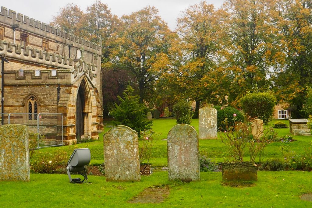
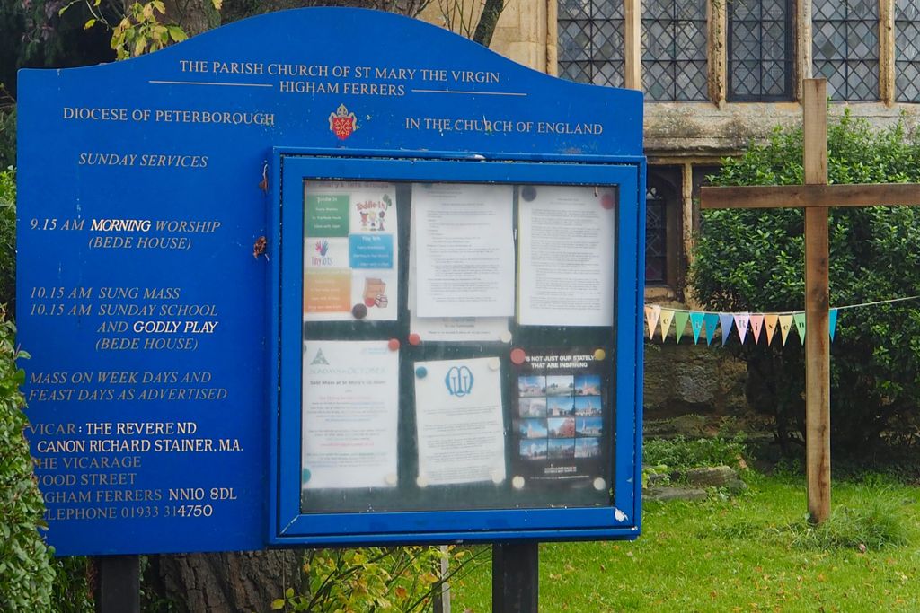
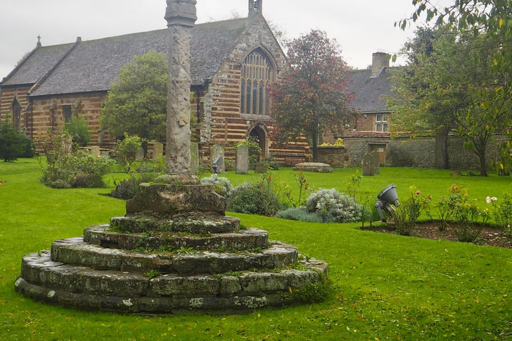
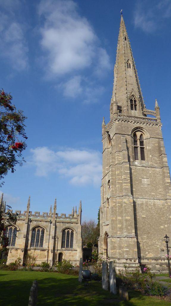
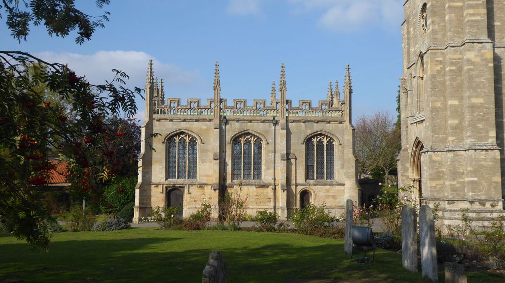
| Description | : | The Church built in 1300 is a Church of England Parish in Catholic Tradition. |
frequently asked questions (FAQ):
-
Where is St. Mary the Virgin Churchyard?
St. Mary the Virgin Churchyard is located at College Street Higham Ferrers, East Northamptonshire Borough ,Northamptonshire , NN10 8DLEngland.
-
St. Mary the Virgin Churchyard cemetery's updated grave count on graveviews.com?
149 memorials
-
Where are the coordinates of the St. Mary the Virgin Churchyard?
Latitude: 52.3065500
Longitude: -0.5915240
Nearby Cemetories:
1. Higham Ferrers Cemetery
Higham Ferrers, East Northamptonshire Borough, England
Coordinate: 52.3084850, -0.5945270
2. St Mary Churchyard
Rushden, East Northamptonshire Borough, England
Coordinate: 52.2885570, -0.5973860
3. Newton Road Cemetery
Rushden, East Northamptonshire Borough, England
Coordinate: 52.2882140, -0.5859750
4. St Peter's Churchyard
Irthlingborough, East Northamptonshire Borough, England
Coordinate: 52.3251642, -0.6101925
5. St. John the Baptist Churchyard
Chelveston, East Northamptonshire Borough, England
Coordinate: 52.3112800, -0.5501200
6. New Irthlingborough Cemetery
Irthlingborough, East Northamptonshire Borough, England
Coordinate: 52.3178531, -0.6294229
7. St. Laurence Churchyard Stanwick
Stanwick, East Northamptonshire Borough, England
Coordinate: 52.3324970, -0.5628585
8. Stanwick Cemetery
Stanwick, East Northamptonshire Borough, England
Coordinate: 52.3298800, -0.5531500
9. St Lawrence Churchyard
Wymington, Bedford Borough, England
Coordinate: 52.2694310, -0.6017230
10. Irchester Saint Katherine Churchyard
Irchester, Wellingborough Borough, England
Coordinate: 52.2843900, -0.6446900
11. Irchester Cemetery
Irchester, Wellingborough Borough, England
Coordinate: 52.2848000, -0.6456000
12. St. Peter Churchyard
Newton Bromswold, East Northamptonshire Borough, England
Coordinate: 52.2815200, -0.5376600
13. St. Mary the Virgin Churchyard
Yelden, Bedford Borough, England
Coordinate: 52.2930600, -0.5182700
14. Raunds Cemetery
Raunds, East Northamptonshire Borough, England
Coordinate: 52.3494100, -0.5467400
15. St. Michael's Church
Farndish, Bedford Borough, England
Coordinate: 52.2638108, -0.6416839
16. Saint Mary the Virgin Churchyard Extension
Finedon, Wellingborough Borough, England
Coordinate: 52.3385489, -0.6613748
17. St Mary the Virgin Churchyard
Podington, Bedford Borough, England
Coordinate: 52.2539100, -0.6220900
18. Finedon
Finedon, Wellingborough Borough, England
Coordinate: 52.3407999, -0.6648562
19. St. Margaret of Antioch Churchyard
Knotting, Bedford Borough, England
Coordinate: 52.2599172, -0.5323686
20. All Saints Churchyard
Wellingborough, Wellingborough Borough, England
Coordinate: 52.3010890, -0.6879730
21. All Saints Churchyard
Great Addington, East Northamptonshire Borough, England
Coordinate: 52.3657660, -0.5937010
22. London Road Cemetery
Wellingborough, Wellingborough Borough, England
Coordinate: 52.2986000, -0.6878000
23. Station Road Cemetery
Ringsted Kommune, Denmark
Coordinate: 52.3638126, -0.5592430
24. All Hallows Churchyard
Wellingborough Borough, England
Coordinate: 52.3024740, -0.6937430