
| Memorials | : | 0 |
| Location | : | Ringsted Kommune, Denmark |
| Coordinate | : | 52.3638126, -0.5592430 |
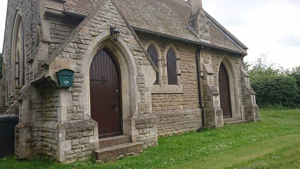
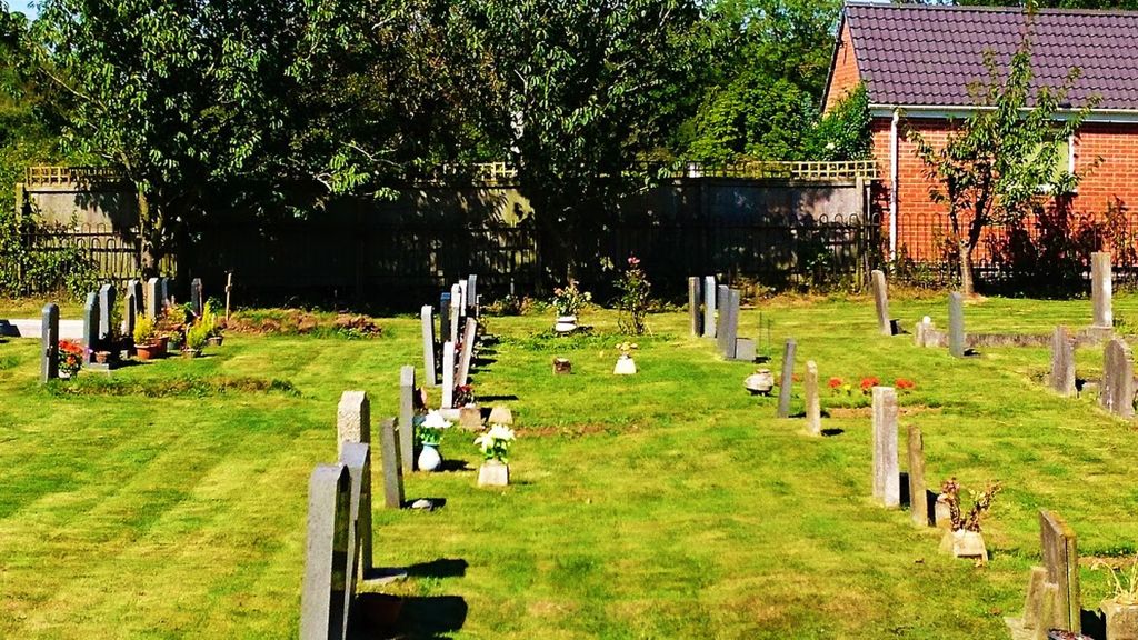
| Description | : | ringstead cemetery station rd ringstead NN14 4TW |
frequently asked questions (FAQ):
-
Where is Station Road Cemetery?
Station Road Cemetery is located at Ringstead, Kettering Ringsted Kommune ,Sjælland , NN14 4TWDenmark.
-
Station Road Cemetery cemetery's updated grave count on graveviews.com?
0 memorials
-
Where are the coordinates of the Station Road Cemetery?
Latitude: 52.3638126
Longitude: -0.5592430
Nearby Cemetories:
1. Station Street Cemetery
Ringstead, East Northamptonshire Borough, England
Coordinate: 52.3654427, -0.5538628
2. Nativity of the Blessed Virgin Mary Churchyard
Ringstead, East Northamptonshire Borough, England
Coordinate: 52.3652660, -0.5533620
3. Raunds Cemetery
Raunds, East Northamptonshire Borough, England
Coordinate: 52.3494100, -0.5467400
4. Holy Trinity Church
Denford, East Northamptonshire Borough, England
Coordinate: 52.3787353, -0.5450568
5. All Saints Churchyard
Great Addington, East Northamptonshire Borough, England
Coordinate: 52.3657660, -0.5937010
6. St. Laurence Churchyard Stanwick
Stanwick, East Northamptonshire Borough, England
Coordinate: 52.3324970, -0.5628585
7. Stanwick Cemetery
Stanwick, East Northamptonshire Borough, England
Coordinate: 52.3298800, -0.5531500
8. St. Nicholas Churchyard
Islip, East Northamptonshire Borough, England
Coordinate: 52.3991300, -0.5513600
9. St. Nicholas' Churchyard
Twywell, East Northamptonshire Borough, England
Coordinate: 52.3936001, -0.6024166
10. Thrapston Cemetery
Thrapston, East Northamptonshire Borough, England
Coordinate: 52.4000170, -0.5292640
11. St. Peter's Churchyard
Lowick, East Northamptonshire Borough, England
Coordinate: 52.4116300, -0.5570600
12. St Peter's Churchyard
Irthlingborough, East Northamptonshire Borough, England
Coordinate: 52.3251642, -0.6101925
13. St. John's Churchyard
Cranford St John, Kettering Borough, England
Coordinate: 52.3840560, -0.6391670
14. St. John the Baptist Churchyard
Chelveston, East Northamptonshire Borough, England
Coordinate: 52.3112800, -0.5501200
15. St. Andrew's Churchyard
Cranford, Kettering Borough, England
Coordinate: 52.3856700, -0.6438700
16. St. Mary's Churchyard
Titchmarsh, East Northamptonshire Borough, England
Coordinate: 52.4076080, -0.4998860
17. Higham Ferrers Cemetery
Higham Ferrers, East Northamptonshire Borough, England
Coordinate: 52.3084850, -0.5945270
18. St. Mary the Virgin Churchyard
Higham Ferrers, East Northamptonshire Borough, England
Coordinate: 52.3065500, -0.5915240
19. All Hallow's Church Hargrave Churchyard
Hargrave, East Northamptonshire Borough, England
Coordinate: 52.3242316, -0.4800580
20. New Irthlingborough Cemetery
Irthlingborough, East Northamptonshire Borough, England
Coordinate: 52.3178531, -0.6294229
21. All Saints Churchyard
Aldwincle, East Northamptonshire Borough, England
Coordinate: 52.4222080, -0.5142150
22. All Saints Church
Sudborough, East Northamptonshire Borough, England
Coordinate: 52.4283980, -0.5782500
23. Aldwincle St Peters Churchyard
Aldwincle, East Northamptonshire Borough, England
Coordinate: 52.4255060, -0.5217460
24. Saint Mary the Virgin Churchyard Extension
Finedon, Wellingborough Borough, England
Coordinate: 52.3385489, -0.6613748