
| Memorials | : | 0 |
| Location | : | Cockfield, Babergh District, England |
| Coordinate | : | 52.1597570, 0.7826470 |
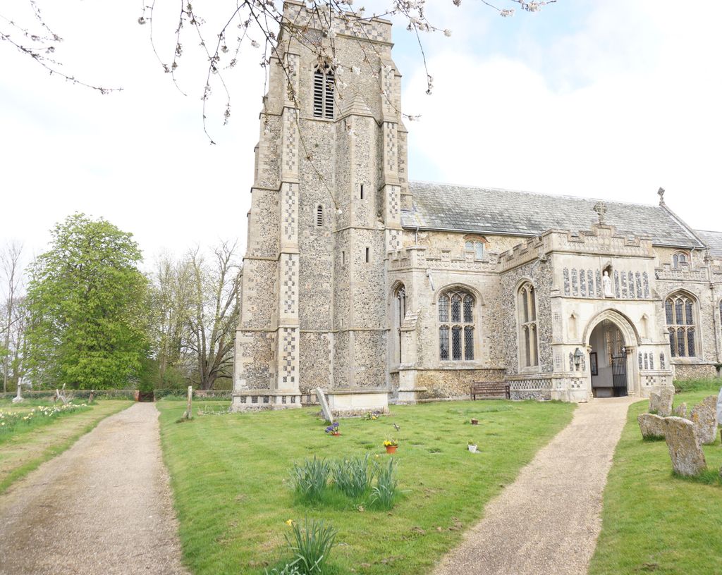
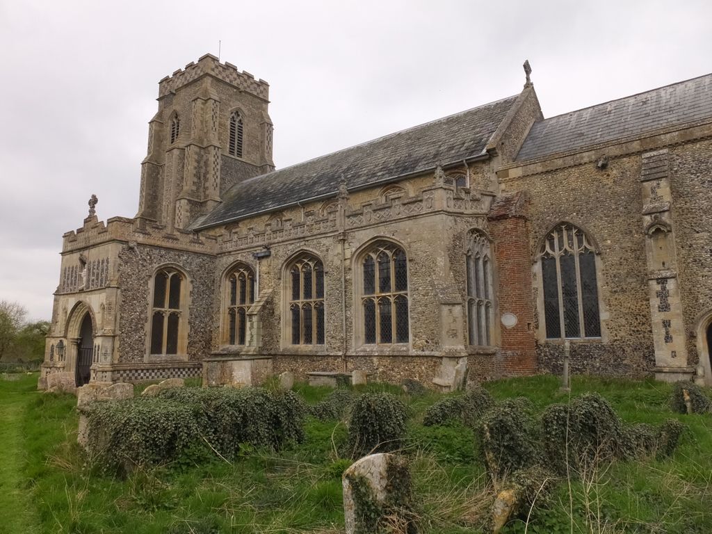
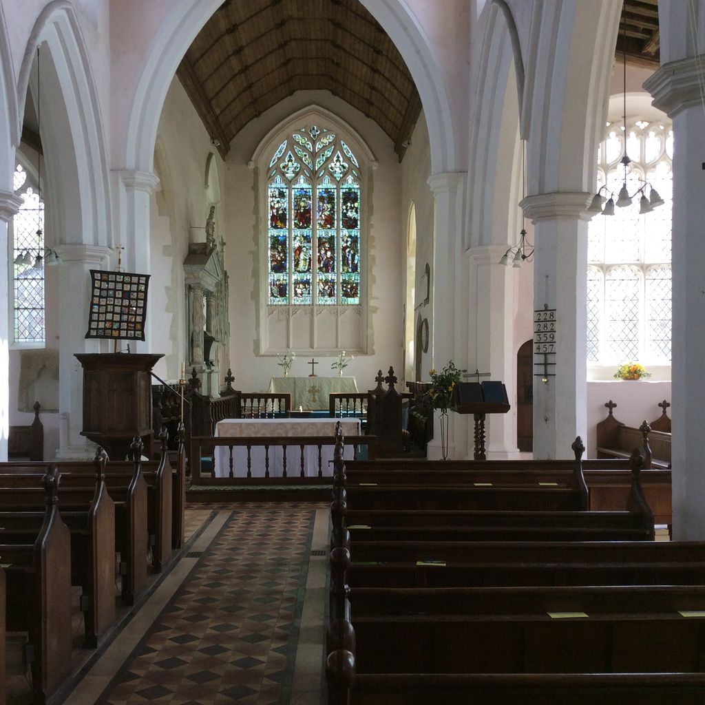
| Description | : | The first surviving record of the parish's ecclesiastical history dates from 1190 when William de Cullum was installed as the first rector, with most of its architecture dating from the 14th and 15th centuries. |
frequently asked questions (FAQ):
-
Where is St Peter's Churchyard?
St Peter's Churchyard is located at Cockfield, Babergh District ,Suffolk ,England.
-
St Peter's Churchyard cemetery's updated grave count on graveviews.com?
0 memorials
-
Where are the coordinates of the St Peter's Churchyard?
Latitude: 52.1597570
Longitude: 0.7826470
Nearby Cemetories:
1. Cockfield Burial Ground
Cockfield, Babergh District, England
Coordinate: 52.1587375, 0.7894545
2. Cockfield Congregational Churchyard
Cockfield, Babergh District, England
Coordinate: 52.1635212, 0.7976324
3. Bradfield Combust Methodist Churchyard
Bradfield Combust, St Edmundsbury Borough, England
Coordinate: 52.1727200, 0.7602400
4. All Saints Churchyard
Bradfield Combust, St Edmundsbury Borough, England
Coordinate: 52.1814730, 0.7663800
5. Saint Clare
Bradfield St Clare, St Edmundsbury Borough, England
Coordinate: 52.1854050, 0.7920340
6. St. Nicholas Churchyard
Stanningfield, St Edmundsbury Borough, England
Coordinate: 52.1734800, 0.7436500
7. All Saints Churchyard
Lawshall, Babergh District, England
Coordinate: 52.1552780, 0.7239140
8. St. Mary's Churchyard
Thorpe Morieux, Babergh District, England
Coordinate: 52.1443020, 0.8387590
9. St. Peter's Churchyard
Felsham, Mid Suffolk District, England
Coordinate: 52.1769650, 0.8458780
10. Saint George Churchyard
Bradfield St George, St Edmundsbury Borough, England
Coordinate: 52.2045960, 0.7894600
11. Church of St. Thomas à Becket
Great Whelnetham, St Edmundsbury Borough, England
Coordinate: 52.2003200, 0.7468860
12. St Mary Magdalene Churchyard
Little Whelnetham, St Edmundsbury Borough, England
Coordinate: 52.2062540, 0.7628880
13. Ss Peter & Paul Churchyard
Alpheton, Babergh District, England
Coordinate: 52.1207310, 0.7350230
14. St. Mary's Churchyard
Gedding, Mid Suffolk District, England
Coordinate: 52.1865920, 0.8540510
15. Saint Peter and Saint Paul Churchyard
Lavenham, Babergh District, England
Coordinate: 52.1062530, 0.7917130
16. Lavenham Cemetery
Lavenham, Babergh District, England
Coordinate: 52.1039670, 0.7883200
17. St Mary's Churchyard
Preston St Mary, Babergh District, England
Coordinate: 52.1166280, 0.8410180
18. St. Mary The Virgin Churchyard
Brettenham, Babergh District, England
Coordinate: 52.1509480, 0.8742360
19. All Saints Churchyard
Hawstead, St Edmundsbury Borough, England
Coordinate: 52.1998300, 0.7143900
20. St Nicholas Churchyard
Rushbrooke, St Edmundsbury Borough, England
Coordinate: 52.2193810, 0.7704070
21. St Peter's Churchyard
Nowton, St Edmundsbury Borough, England
Coordinate: 52.2109220, 0.7257590
22. Whepstead Baptist Churchyard
Whepstead, St Edmundsbury Borough, England
Coordinate: 52.1886000, 0.6873500
23. Hartest Cemetery
Hartest, Babergh District, England
Coordinate: 52.1387840, 0.6819620
24. All Saints Churchyard
Hartest, Babergh District, England
Coordinate: 52.1396780, 0.6793500