
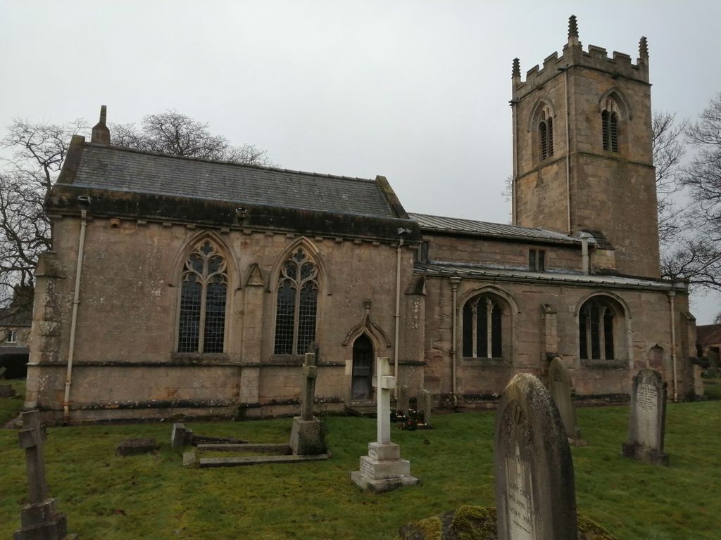
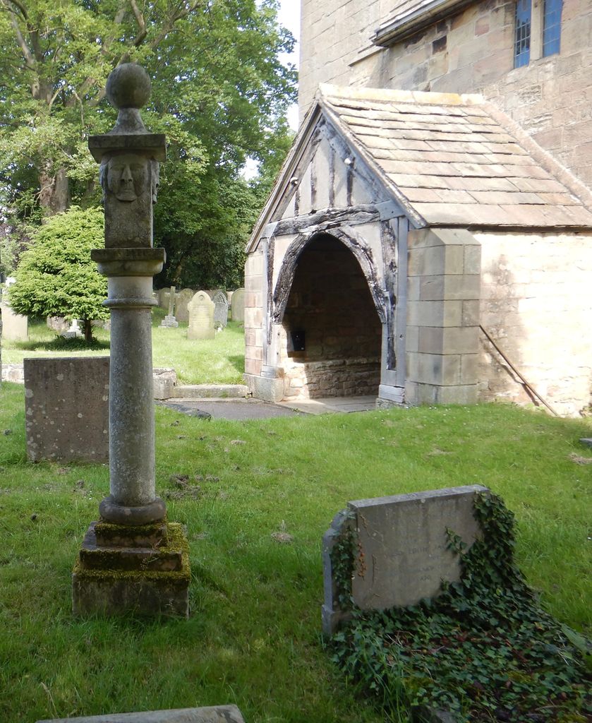
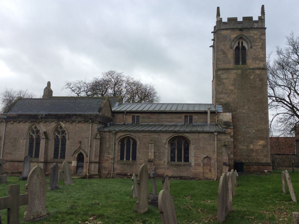
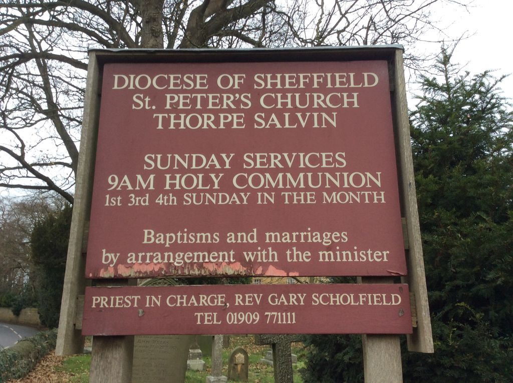
| Memorials | : | 0 |
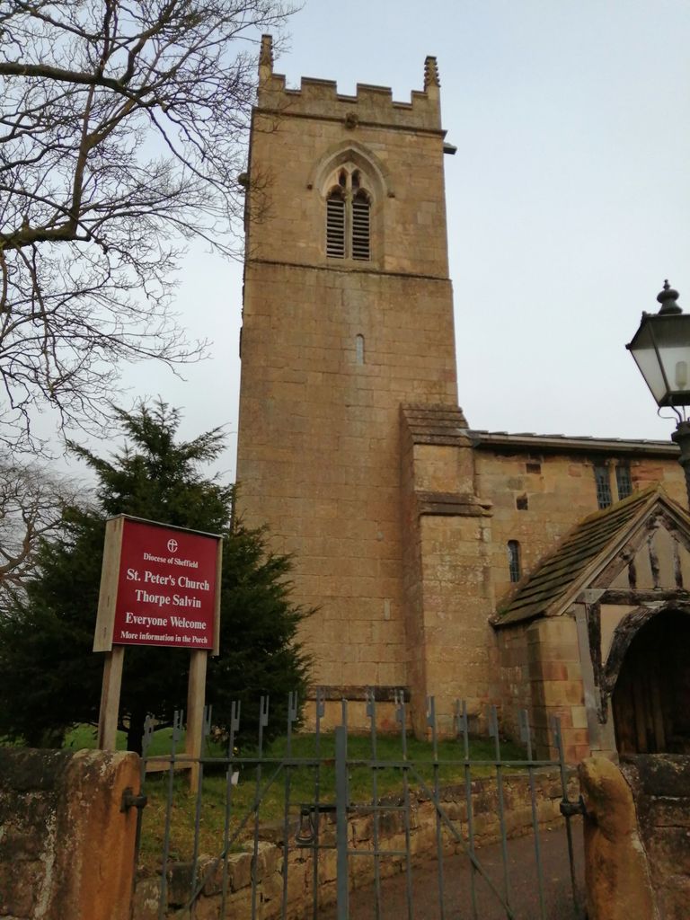
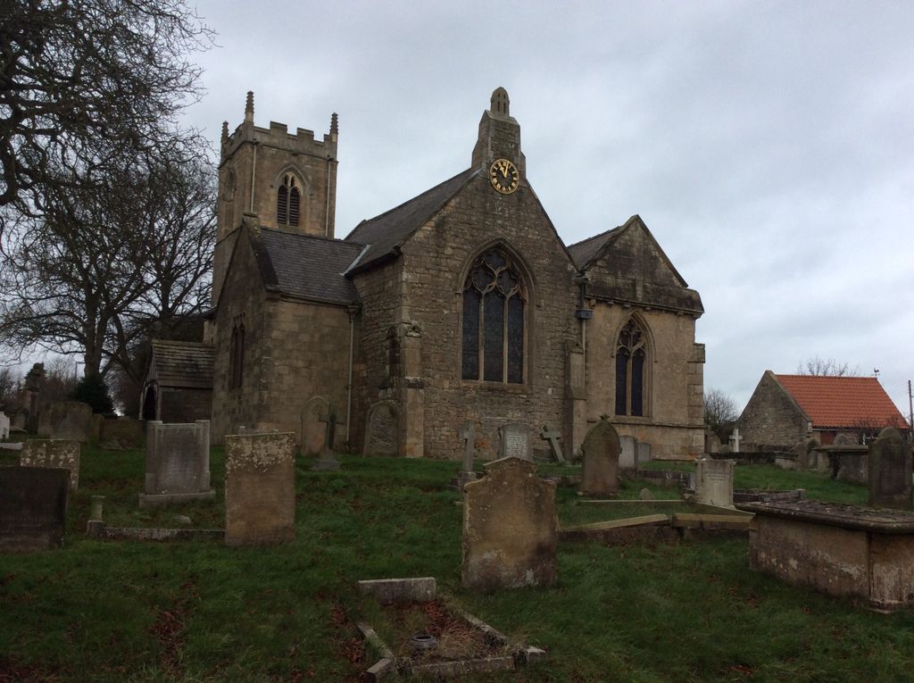
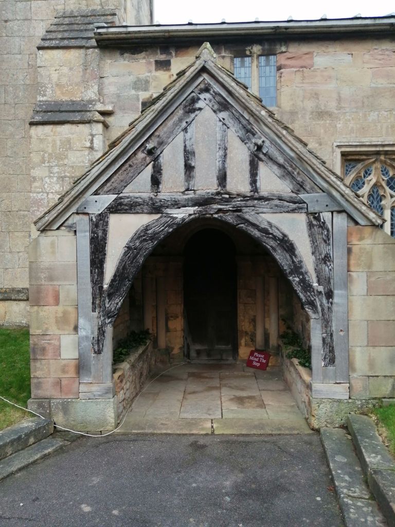
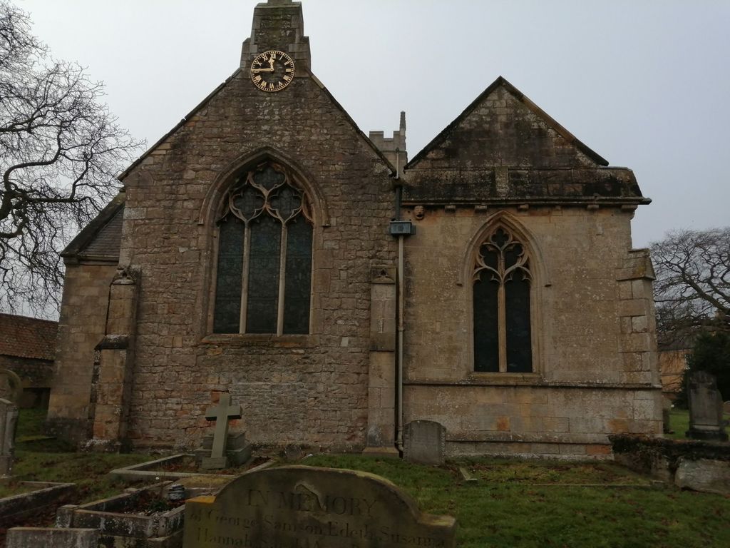
| Location | : | Thorpe Salvin, Metropolitan Borough of Rotherham, England |
| Coordinate | : | 53.3247920, -1.2200350 |
frequently asked questions (FAQ):
-
Where is St. Peter's Churchyard?
St. Peter's Churchyard is located at Thorpe Salvin, Metropolitan Borough of Rotherham ,South Yorkshire ,England.
-
St. Peter's Churchyard cemetery's updated grave count on graveviews.com?
0 memorials
-
Where are the coordinates of the St. Peter's Churchyard?
Latitude: 53.3247920
Longitude: -1.2200350
Nearby Cemetories:
1. Anston Burial Ground
Anston, Metropolitan Borough of Rotherham, England
Coordinate: 53.3452140, -1.2139500
2. St. James' Churchyard
Anston, Metropolitan Borough of Rotherham, England
Coordinate: 53.3476690, -1.2208800
3. All Hallows Churchyard
Harthill, Metropolitan Borough of Rotherham, England
Coordinate: 53.3232800, -1.2604170
4. All Saints Chapel
Bolsover District, England
Coordinate: 53.3027370, -1.1859097
5. St. Peter and St. Paul's Churchyard
Todwick, Metropolitan Borough of Rotherham, England
Coordinate: 53.3514144, -1.2540578
6. St. George's Churchyard
Woodsetts, Metropolitan Borough of Rotherham, England
Coordinate: 53.3476000, -1.1729800
7. Park Avenue Cemetery
Dinnington St John's, Metropolitan Borough of Rotherham, England
Coordinate: 53.3633710, -1.2100700
8. Saint Lawrence Churchyard
Whitwell, Bolsover District, England
Coordinate: 53.2859088, -1.2126154
9. St. John the Baptist Church Cemetery
Wales, Metropolitan Borough of Rotherham, England
Coordinate: 53.3365267, -1.2841334
10. St. John the Baptist Churchyard
Wales, Metropolitan Borough of Rotherham, England
Coordinate: 53.3389540, -1.2843530
11. St. John The Baptist Churchyard
Rotherham, Metropolitan Borough of Rotherham, England
Coordinate: 53.3391500, -1.2842450
12. Dinnington Church Cemetery
Dinnington St John's, Metropolitan Borough of Rotherham, England
Coordinate: 53.3699557, -1.2117994
13. Killamarsh Cemetery
Killamarsh, North East Derbyshire District, England
Coordinate: 53.3231700, -1.3081400
14. St. Giles Parish Church
Killamarsh, North East Derbyshire District, England
Coordinate: 53.3236200, -1.3092600
15. St. John The Baptist Churchyard
Clowne, Bolsover District, England
Coordinate: 53.2810167, -1.2750722
16. St John's Church Cemetery
Dinnington St John's, Metropolitan Borough of Rotherham, England
Coordinate: 53.3818248, -1.2135210
17. St John's Churchyard
Throapham, Metropolitan Borough of Rotherham, England
Coordinate: 53.3823850, -1.2147036
18. Clowne Cemetery
Clowne, Bolsover District, England
Coordinate: 53.2839777, -1.2917831
19. All Saints Churchyard
Aston, Metropolitan Borough of Rotherham, England
Coordinate: 53.3621450, -1.2978130
20. All Saints Church
Sheffield, Metropolitan Borough of Sheffield, England
Coordinate: 53.3618734, -1.2981901
21. Aston-Cum-Aughton Cemetery
Aston, Metropolitan Borough of Rotherham, England
Coordinate: 53.3644400, -1.2991600
22. St Mary Magdalene Churchyard
Creswell, Stafford Borough, England
Coordinate: 53.2631170, -1.2132800
23. St. Mary Magdalene's Churchyard
Creswell, Bolsover District, England
Coordinate: 53.2630820, -1.2132450
24. St. Peter's Churchyard
Letwell, Metropolitan Borough of Rotherham, England
Coordinate: 53.3773774, -1.1606489