
| Memorials | : | 0 |
| Location | : | Bolsover District, England |
| Phone | : | 01909722378 |
| Coordinate | : | 53.3027370, -1.1859097 |
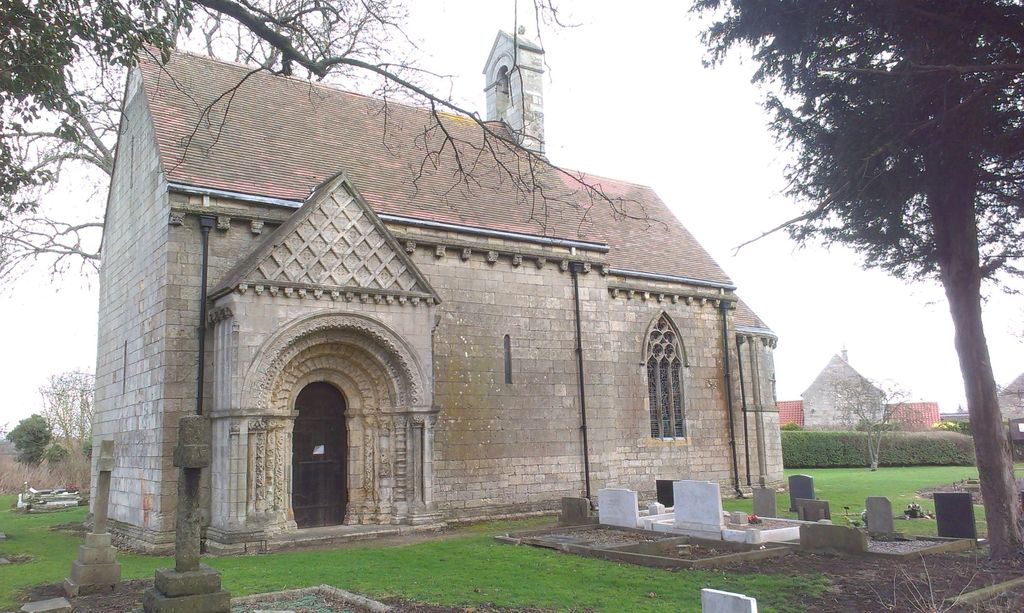
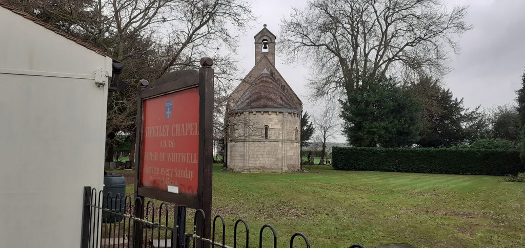
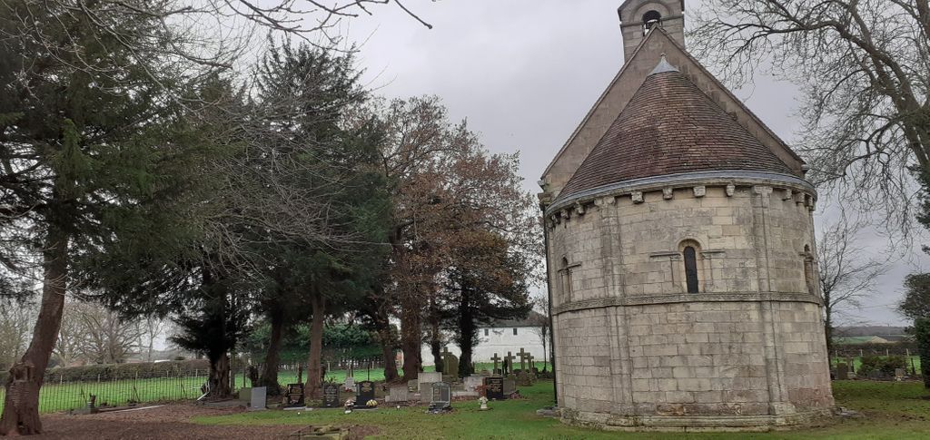
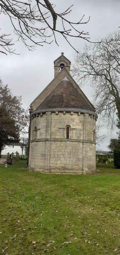
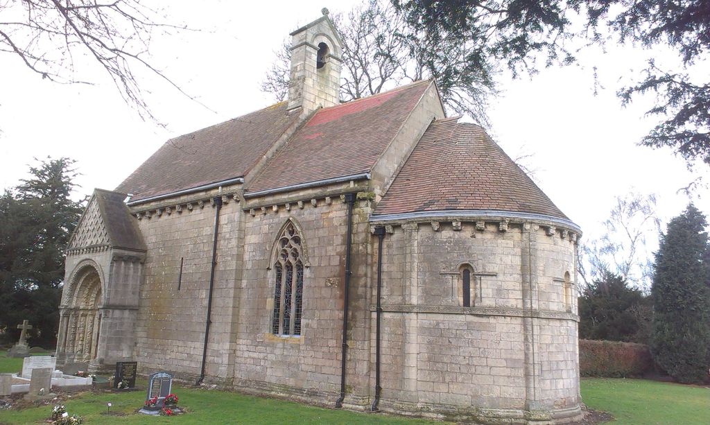
| Description | : | The Chapel is 56 feet long. It is divided into 3 parts – a nave, a chancel and an apse (a rectangle, a square and a semi-circle). The nave is 15 feet 9 inches broad and the chancel measures 13 feet 9 inches across. The Chapel has been described as the most perfect and elaborate specimen of Norman architecture to be found anywhere in Europe. |
frequently asked questions (FAQ):
-
Where is All Saints Chapel?
All Saints Chapel is located at Steetley, Worksop Bolsover District ,Derbyshire , s803dzEngland.
-
All Saints Chapel cemetery's updated grave count on graveviews.com?
0 memorials
-
Where are the coordinates of the All Saints Chapel?
Latitude: 53.3027370
Longitude: -1.1859097


Nearby Cemetories:
1. Saint Lawrence Churchyard
Whitwell, Bolsover District, England
Coordinate: 53.2859088, -1.2126154
2. St. Peter's Churchyard
Thorpe Salvin, Metropolitan Borough of Rotherham, England
Coordinate: 53.3247920, -1.2200350
3. Worksop Priory
Worksop, Bassetlaw District, England
Coordinate: 53.3039030, -1.1150690
4. St Mary Magdalene Churchyard
Creswell, Stafford Borough, England
Coordinate: 53.2631170, -1.2132800
5. St. Mary Magdalene's Churchyard
Creswell, Bolsover District, England
Coordinate: 53.2630820, -1.2132450
6. St. George's Churchyard
Woodsetts, Metropolitan Borough of Rotherham, England
Coordinate: 53.3476000, -1.1729800
7. Anston Burial Ground
Anston, Metropolitan Borough of Rotherham, England
Coordinate: 53.3452140, -1.2139500
8. All Hallows Churchyard
Harthill, Metropolitan Borough of Rotherham, England
Coordinate: 53.3232800, -1.2604170
9. St. Winifred Churchyard
Holbeck, Bassetlaw District, England
Coordinate: 53.2536780, -1.1817640
10. St. James' Churchyard
Anston, Metropolitan Borough of Rotherham, England
Coordinate: 53.3476690, -1.2208800
11. Retford Road Cemetery
Worksop, Bassetlaw District, England
Coordinate: 53.3021540, -1.1010040
12. St. John The Baptist Churchyard
Clowne, Bolsover District, England
Coordinate: 53.2810167, -1.2750722
13. Saint John the Evangelist Churchyard
Carlton-in-Lindrick, Bassetlaw District, England
Coordinate: 53.3486389, -1.1180278
14. Park Avenue Cemetery
Dinnington St John's, Metropolitan Borough of Rotherham, England
Coordinate: 53.3633710, -1.2100700
15. St. Peter and St. Paul's Churchyard
Todwick, Metropolitan Borough of Rotherham, England
Coordinate: 53.3514144, -1.2540578
16. St. Lukes Whaley Thorns Burial Ground
Nether Langwith, Bassetlaw District, England
Coordinate: 53.2383210, -1.2034396
17. Clowne Cemetery
Clowne, Bolsover District, England
Coordinate: 53.2839777, -1.2917831
18. St. John the Baptist Church Cemetery
Wales, Metropolitan Borough of Rotherham, England
Coordinate: 53.3365267, -1.2841334
19. Dinnington Church Cemetery
Dinnington St John's, Metropolitan Borough of Rotherham, England
Coordinate: 53.3699557, -1.2117994
20. St. John the Baptist Churchyard
Wales, Metropolitan Borough of Rotherham, England
Coordinate: 53.3389540, -1.2843530
21. St. John The Baptist Churchyard
Rotherham, Metropolitan Borough of Rotherham, England
Coordinate: 53.3391500, -1.2842450
22. St. Mary's Churchyard
Norton, Bassetlaw District, England
Coordinate: 53.2364800, -1.1530400
23. Killamarsh Cemetery
Killamarsh, North East Derbyshire District, England
Coordinate: 53.3231700, -1.3081400
24. St. Peter's Churchyard
Letwell, Metropolitan Borough of Rotherham, England
Coordinate: 53.3773774, -1.1606489