
| Memorials | : | 1 |
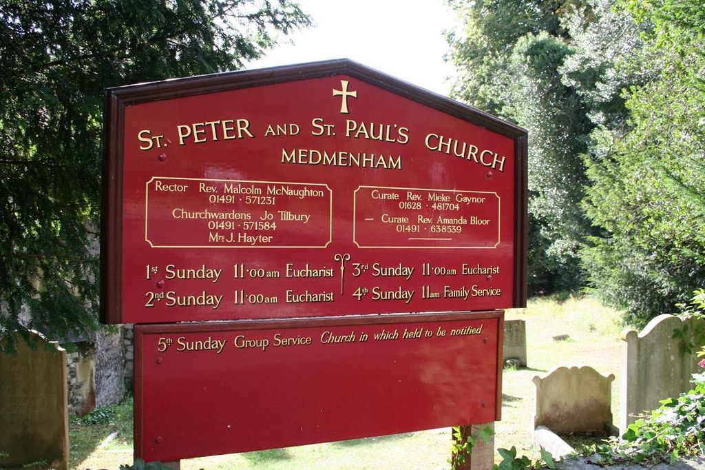
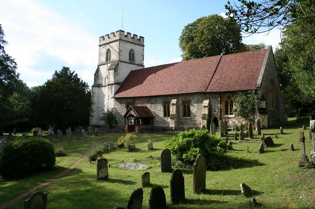
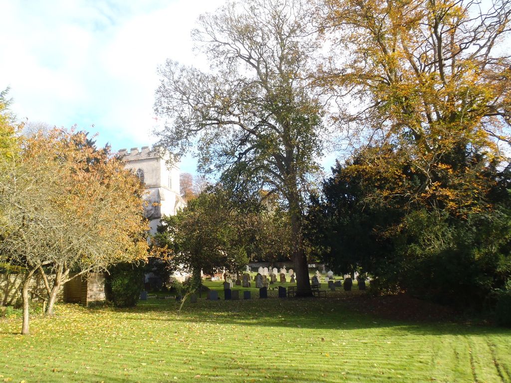
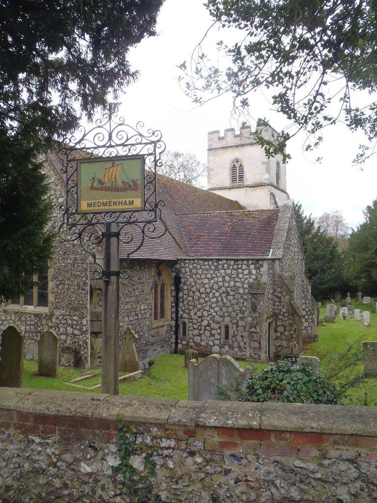
| Location | : | Medmenham, Wycombe District, England |
| Coordinate | : | 51.5533800, -0.8407110 |
frequently asked questions (FAQ):
-
Where is St Peter and St Paul Churchyard?
St Peter and St Paul Churchyard is located at Medmenham, Wycombe District ,Buckinghamshire ,England.
-
St Peter and St Paul Churchyard cemetery's updated grave count on graveviews.com?
1 memorials
-
Where are the coordinates of the St Peter and St Paul Churchyard?
Latitude: 51.5533800
Longitude: -0.8407110
Nearby Cemetories:
1. St Mary the Virgin Churchyard
Hurley, Windsor and Maidenhead Royal Borough, England
Coordinate: 51.5492640, -0.8103620
2. Saint Mary the Virgin Churchyard
Hambleden, Wycombe District, England
Coordinate: 51.5773100, -0.8709500
3. Bisham Priory
Bisham, Windsor and Maidenhead Royal Borough, England
Coordinate: 51.5566350, -0.7796570
4. All Saints Churchyard
Bisham, Windsor and Maidenhead Royal Borough, England
Coordinate: 51.5611410, -0.7780430
5. Sir William Borlase's Grammar School Chapel
Marlow, Wycombe District, England
Coordinate: 51.5702500, -0.7811730
6. St. Mary the Virgin Churchyard
Henley-on-Thames, South Oxfordshire District, England
Coordinate: 51.5377790, -0.9017520
7. Christ Church
Marlow, Wycombe District, England
Coordinate: 51.5712799, -0.7795249
8. Christ Church
Henley-on-Thames, South Oxfordshire District, England
Coordinate: 51.5347880, -0.9032820
9. All Saints Churchyard
Marlow, Wycombe District, England
Coordinate: 51.5679730, -0.7732080
10. Holy Trinity Churchyard
Marlow, Wycombe District, England
Coordinate: 51.5750000, -0.7768000
11. Holy Trinity Churchyard
Henley-on-Thames, South Oxfordshire District, England
Coordinate: 51.5338500, -0.9066600
12. St. Peter Roman Catholic Churchyard
Marlow, Wycombe District, England
Coordinate: 51.5695438, -0.7723466
13. Marlow Cemetery
Marlow, Wycombe District, England
Coordinate: 51.5773094, -0.7761266
14. St. Peter's Churchyard
Knowl Hill, Windsor and Maidenhead Royal Borough, England
Coordinate: 51.5093351, -0.8126725
15. St James the Less Churchyard
Stubbings, Windsor and Maidenhead Royal Borough, England
Coordinate: 51.5274840, -0.7759100
16. St Margaret's Churchyard
Harpsden, South Oxfordshire District, England
Coordinate: 51.5219160, -0.9012270
17. St. Mary the Virgin Churchyard
Fawley, Wycombe District, England
Coordinate: 51.5743000, -0.9140000
18. St. John the Evangelist Churchyard
Hambleden, Wycombe District, England
Coordinate: 51.6052700, -0.8514000
19. Henley-on-Thames Cemetery
Henley-on-Thames, South Oxfordshire District, England
Coordinate: 51.5543570, -0.9271320
20. St. Mary's Churchyard
Wargrave, Wokingham Borough, England
Coordinate: 51.4998329, -0.8735808
21. St John the Baptist Churchyard
Cookham Dean, Windsor and Maidenhead Royal Borough, England
Coordinate: 51.5581960, -0.7447210
22. Holy Trinity Churchyard Extension
Lane End, Wycombe District, England
Coordinate: 51.6172700, -0.8382920
23. Holy Trinity Churchyard
Lane End, Wycombe District, England
Coordinate: 51.6176000, -0.8368900
24. St. Bartholomew Churchyard
Fingest, Wycombe District, England
Coordinate: 51.6137200, -0.8791500