
| Memorials | : | 0 |
| Location | : | Hambleden, Wycombe District, England |
| Coordinate | : | 51.6052700, -0.8514000 |
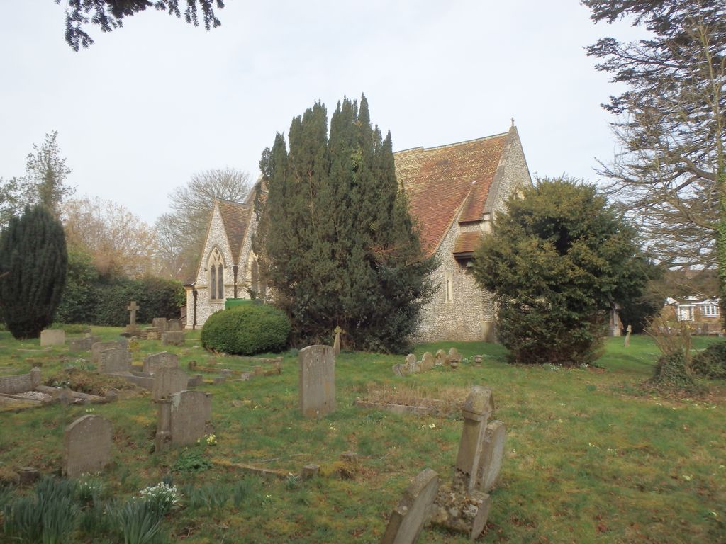
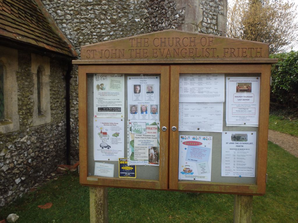
| Description | : | Frieth is part of the parish of Hambleden with Frieth and Skirmett, and the church was built in 1848 as a Chapel of Ease, due to the distance of the village from Hambleden. (The former church in Skirmett is now a private house.) Flint from the ruined wing of the Old Rectory (now Kenricks) at Hambleden was used for the new church built to the design of JP Harrison. The South aisle was added later, probably by Woodyer dated 1872 on the rainwater heads. The church is built of flint with stone mullions and edges, and has an attractive tiled... Read More |
frequently asked questions (FAQ):
-
Where is St. John the Evangelist Churchyard?
St. John the Evangelist Churchyard is located at Frieth Hambleden, Wycombe District ,Buckinghamshire , RG9 6PLEngland.
-
St. John the Evangelist Churchyard cemetery's updated grave count on graveviews.com?
0 memorials
-
Where are the coordinates of the St. John the Evangelist Churchyard?
Latitude: 51.6052700
Longitude: -0.8514000
Nearby Cemetories:
1. Holy Trinity Churchyard Extension
Lane End, Wycombe District, England
Coordinate: 51.6172700, -0.8382920
2. Holy Trinity Churchyard
Lane End, Wycombe District, England
Coordinate: 51.6176000, -0.8368900
3. St. Bartholomew Churchyard
Fingest, Wycombe District, England
Coordinate: 51.6137200, -0.8791500
4. St. Mary-le-Moor Churchyard
Cadmore End, Wycombe District, England
Coordinate: 51.6263500, -0.8686600
5. St Mary's Churchyard
Turville, Wycombe District, England
Coordinate: 51.6139860, -0.8938190
6. Saint Mary the Virgin Churchyard
Hambleden, Wycombe District, England
Coordinate: 51.5773100, -0.8709500
7. St Nicholas Churchyard
Ibstone, Wycombe District, England
Coordinate: 51.6247660, -0.9093120
8. Stonor Park Cemetery
Henley-on-Thames, South Oxfordshire District, England
Coordinate: 51.5967370, -0.9289660
9. St. Mary the Virgin Churchyard
Fawley, Wycombe District, England
Coordinate: 51.5743000, -0.9140000
10. Dashwood Mausoleum
West Wycombe, Wycombe District, England
Coordinate: 51.6471210, -0.8047420
11. St. Lawrence Churchyard
West Wycombe, Wycombe District, England
Coordinate: 51.6479900, -0.8060200
12. St Peter and St Paul Churchyard
Medmenham, Wycombe District, England
Coordinate: 51.5533800, -0.8407110
13. Marlow Cemetery
Marlow, Wycombe District, England
Coordinate: 51.5773094, -0.7761266
14. Holy Trinity Churchyard
Marlow, Wycombe District, England
Coordinate: 51.5750000, -0.7768000
15. Sir William Borlase's Grammar School Chapel
Marlow, Wycombe District, England
Coordinate: 51.5702500, -0.7811730
16. Christ Church
Marlow, Wycombe District, England
Coordinate: 51.5712799, -0.7795249
17. Stokenchurch Church Cemetery
Stokenchurch, Wycombe District, England
Coordinate: 51.6572200, -0.8960300
18. St. Peter Roman Catholic Churchyard
Marlow, Wycombe District, England
Coordinate: 51.5695438, -0.7723466
19. All Saints Churchyard
Marlow, Wycombe District, England
Coordinate: 51.5679730, -0.7732080
20. St Mary the Virgin Churchyard
Hurley, Windsor and Maidenhead Royal Borough, England
Coordinate: 51.5492640, -0.8103620
21. Pishill Parish Church Cemetery
Pishill, South Oxfordshire District, England
Coordinate: 51.6027550, -0.9527530
22. All Saints Churchyard
Bisham, Windsor and Maidenhead Royal Borough, England
Coordinate: 51.5611410, -0.7780430
23. Getty Family Estate
Stokenchurch, Wycombe District, England
Coordinate: 51.6437360, -0.9334510
24. St Peter and St Paul Churchyard
Stokenchurch, Wycombe District, England
Coordinate: 51.6615290, -0.9022940