
| Memorials | : | 0 |
| Location | : | Lane End, Wycombe District, England |
| Coordinate | : | 51.6176000, -0.8368900 |
frequently asked questions (FAQ):
-
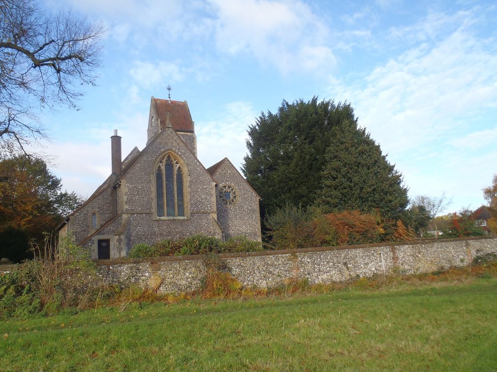
Where is Holy Trinity Churchyard?
Holy Trinity Churchyard is located at Church Road Lane End, Wycombe District ,Buckinghamshire , HP14 3HGEngland.
-
Holy Trinity Churchyard cemetery's updated grave count on graveviews.com?
0 memorials
-
Where are the coordinates of the Holy Trinity Churchyard?
Latitude: 51.6176000
Longitude: -0.8368900
Nearby Cemetories:
1. Holy Trinity Churchyard Extension
Lane End, Wycombe District, England
Coordinate: 51.6172700, -0.8382920
2. St. John the Evangelist Churchyard
Hambleden, Wycombe District, England
Coordinate: 51.6052700, -0.8514000
3. St. Mary-le-Moor Churchyard
Cadmore End, Wycombe District, England
Coordinate: 51.6263500, -0.8686600
4. St. Bartholomew Churchyard
Fingest, Wycombe District, England
Coordinate: 51.6137200, -0.8791500
5. St Mary's Churchyard
Turville, Wycombe District, England
Coordinate: 51.6139860, -0.8938190
6. Dashwood Mausoleum
West Wycombe, Wycombe District, England
Coordinate: 51.6471210, -0.8047420
7. St. Lawrence Churchyard
West Wycombe, Wycombe District, England
Coordinate: 51.6479900, -0.8060200
8. Saint Mary the Virgin Churchyard
Hambleden, Wycombe District, England
Coordinate: 51.5773100, -0.8709500
9. St Nicholas Churchyard
Ibstone, Wycombe District, England
Coordinate: 51.6247660, -0.9093120
10. St. Botolph Churchyard
Bradenham, Wycombe District, England
Coordinate: 51.6668380, -0.8041850
11. Stokenchurch Church Cemetery
Stokenchurch, Wycombe District, England
Coordinate: 51.6572200, -0.8960300
12. All Saints Churchyard
High Wycombe, Wycombe District, England
Coordinate: 51.6298810, -0.7507090
13. Marlow Cemetery
Marlow, Wycombe District, England
Coordinate: 51.5773094, -0.7761266
14. St Paul's Churchyard
Bledlow Ridge, Wycombe District, England
Coordinate: 51.6726230, -0.8484280
15. Holy Trinity Churchyard
Marlow, Wycombe District, England
Coordinate: 51.5750000, -0.7768000
16. Christ Church
Marlow, Wycombe District, England
Coordinate: 51.5712799, -0.7795249
17. Sir William Borlase's Grammar School Chapel
Marlow, Wycombe District, England
Coordinate: 51.5702500, -0.7811730
18. High Wycombe Friends Burial Ground
High Wycombe, Wycombe District, England
Coordinate: 51.6282800, -0.7428870
19. St Mary Churchyard
Radnage, Wycombe District, England
Coordinate: 51.6747990, -0.8647210
20. St Peter and St Paul Churchyard
Stokenchurch, Wycombe District, England
Coordinate: 51.6615290, -0.9022940
21. Stonor Park Cemetery
Henley-on-Thames, South Oxfordshire District, England
Coordinate: 51.5967370, -0.9289660
22. High Wycombe Cemetery
High Wycombe, Wycombe District, England
Coordinate: 51.6383160, -0.7432510
23. St. Peter Roman Catholic Churchyard
Marlow, Wycombe District, England
Coordinate: 51.5695438, -0.7723466
24. St. Michael and All Angels Churchyard
Hughenden, Wycombe District, England
Coordinate: 51.6518960, -0.7522470