
| Memorials | : | 0 |
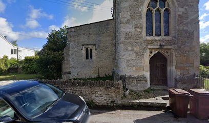
| Location | : | Drayton, Vale of White Horse District, England |
| Coordinate | : | 51.6440300, -1.3073700 |
| Description | : | Technically, this is a church cemetery because it is detached/remote from the churchyard. |
frequently asked questions (FAQ):
-
Where is St. Peter Churchyard Extension?
St. Peter Churchyard Extension is located at Church Lane Drayton, Vale of White Horse District ,Oxfordshire , OX14 4JWEngland.
-
St. Peter Churchyard Extension cemetery's updated grave count on graveviews.com?
0 memorials
-
Where are the coordinates of the St. Peter Churchyard Extension?
Latitude: 51.6440300
Longitude: -1.3073700
Nearby Cemetories:
1. St Peter Churchyard
Drayton, Vale of White Horse District, England
Coordinate: 51.6440000, -1.3070340
2. Drayton Burial Ground
Drayton, Vale of White Horse District, England
Coordinate: 51.6443618, -1.3055533
3. St Blaise Churchyard
Milton, Vale of White Horse District, England
Coordinate: 51.6284810, -1.3003670
4. St. Paul's Churchyard
Culham, South Oxfordshire District, England
Coordinate: 51.6512320, -1.2762060
5. Sutton Courtenay Village Cemetery
Sutton Courtenay, Vale of White Horse District, England
Coordinate: 51.6394000, -1.2746000
6. All Saints Churchyard
Sutton Courtenay, Vale of White Horse District, England
Coordinate: 51.6442680, -1.2718070
7. St. Helen's Churchyard
Abingdon, Vale of White Horse District, England
Coordinate: 51.6672868, -1.2830793
8. St Michaels and All Angels Churchyard
Steventon, Vale of White Horse District, England
Coordinate: 51.6196200, -1.3305500
9. Abingdon Baptist Church Burial Ground
Abingdon, Vale of White Horse District, England
Coordinate: 51.6700100, -1.2870810
10. Spring Road Cemetery
Abingdon, Vale of White Horse District, England
Coordinate: 51.6722620, -1.2951410
11. Abingdon War Memorial
Abingdon, Vale of White Horse District, England
Coordinate: 51.6702940, -1.2839070
12. St Nicholas Church
Abingdon, Vale of White Horse District, England
Coordinate: 51.6702720, -1.2808640
13. Spring Garden Cemetery
Abingdon, Vale of White Horse District, England
Coordinate: 51.6750410, -1.2970850
14. Abingdon Abbey (Defunct)
Abingdon, Vale of White Horse District, England
Coordinate: 51.6704790, -1.2783620
15. St. Mary Magdalene Churchyard
Shippon, Vale of White Horse District, England
Coordinate: 51.6788360, -1.3060940
16. All Saints Churchyard
Marcham, Vale of White Horse District, England
Coordinate: 51.6676980, -1.3496990
17. Our Lady and St Edmund of Abingdon Roman Catholic
Abingdon, Vale of White Horse District, England
Coordinate: 51.6747940, -1.2776270
18. South Oxfordshire Memorial Park and Crematorium
Garford, Vale of White Horse District, England
Coordinate: 51.6535980, -1.3767840
19. Ss. Peter and Paul Churchyard
Appleford, Vale of White Horse District, England
Coordinate: 51.6396800, -1.2356090
20. Saint Matthews Churchyard
Harwell, Vale of White Horse District, England
Coordinate: 51.5983510, -1.2908880
21. Harwell Cemetery
Harwell, Vale of White Horse District, England
Coordinate: 51.5985200, -1.2885900
22. All Saints Churchyard
Didcot, South Oxfordshire District, England
Coordinate: 51.6107791, -1.2508990
23. St. Luke's Churchyard
Garford, Vale of White Horse District, England
Coordinate: 51.6637514, -1.3815467
24. Cat Street Cemetery
East Hendred, Vale of White Horse District, England
Coordinate: 51.5964877, -1.3397450