
| Memorials | : | 0 |
| Location | : | Hungerford, West Berkshire Unitary Authority, England |
| Coordinate | : | 51.4207210, -1.5054790 |
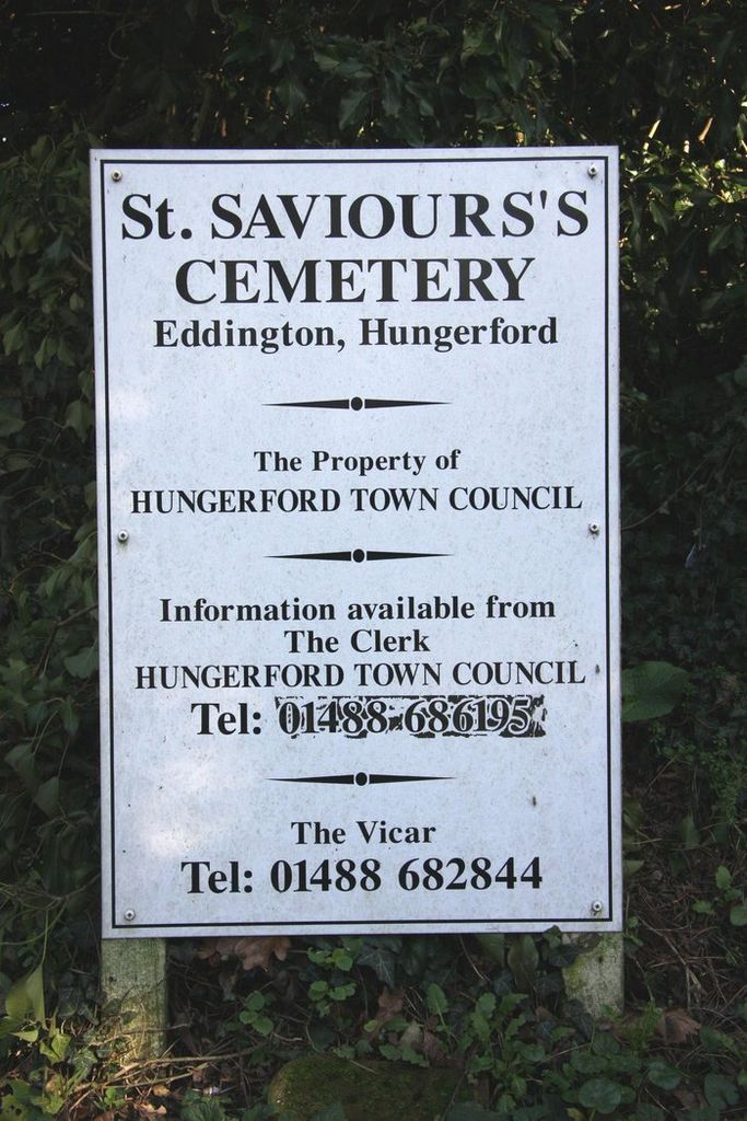
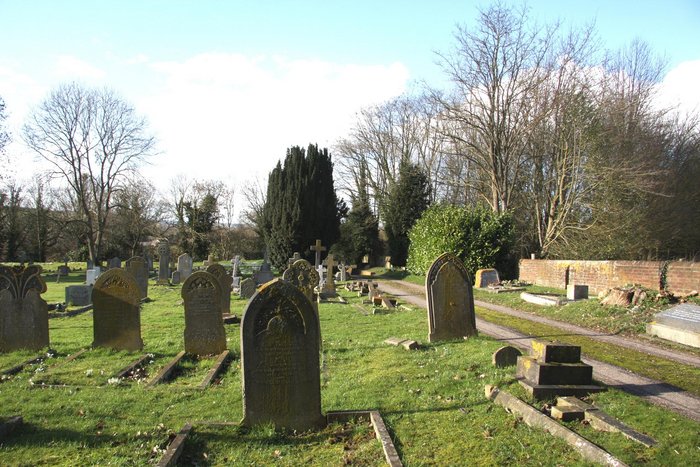
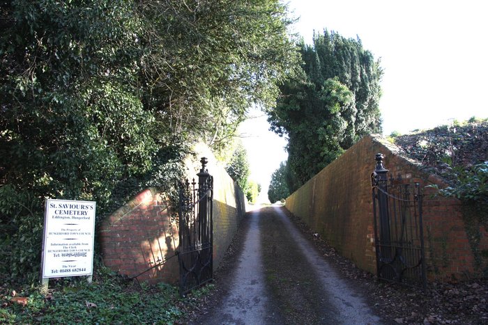
| Description | : | Hungerford lies approximately 8-miles west of Newbury in the county of Berkshire. The cemetery is located about a half-a-mile outside Hungerford town off Eddington Hill, on the A338 trunk road. The cemetery is signposted right (east) from the road. Also known as St Saviour's Churchyard, Eddington. Saint Saviours Church is now a private dwelling. |
frequently asked questions (FAQ):
-
Where is St Saviour Churchyard?
St Saviour Churchyard is located at Hungerford, West Berkshire Unitary Authority ,Berkshire ,England.
-
St Saviour Churchyard cemetery's updated grave count on graveviews.com?
0 memorials
-
Where are the coordinates of the St Saviour Churchyard?
Latitude: 51.4207210
Longitude: -1.5054790

Nearby Cemetories:
1. Saint Lawrence Churchyard
Hungerford, West Berkshire Unitary Authority, England
Coordinate: 51.4164100, -1.5208820
2. St Mary Churchyard
Chilton Foliat, Wiltshire Unitary Authority, England
Coordinate: 51.4330700, -1.5423800
3. Foxfield Churchyard
Hungerford, West Berkshire Unitary Authority, England
Coordinate: 51.4325160, -1.5648470
4. St. Mary the Virgin Churchyard
Kintbury, West Berkshire Unitary Authority, England
Coordinate: 51.4007840, -1.4505240
5. St. Michael's Churchyard
Inkpen, West Berkshire Unitary Authority, England
Coordinate: 51.3722999, -1.4877492
6. St. Mary's Churchyard
Lambourn, West Berkshire Unitary Authority, England
Coordinate: 51.4731746, -1.5204365
7. St. Mary's Churchyard
Great Shefford, West Berkshire Unitary Authority, England
Coordinate: 51.4761000, -1.4541700
8. Saint Thomas Churchyard
Little Shefford, West Berkshire Unitary Authority, England
Coordinate: 51.4697450, -1.4390310
9. West Woodhay Churchyard
West Woodhay, West Berkshire Unitary Authority, England
Coordinate: 51.3637960, -1.4385220
10. St Mary Churchyard
Hamstead Marshall, West Berkshire Unitary Authority, England
Coordinate: 51.3981940, -1.3977010
11. St. James the Great
Buttermere, Wiltshire Unitary Authority, England
Coordinate: 51.3475000, -1.5090000
12. Saint Swithun Churchyard
Combe, West Berkshire Unitary Authority, England
Coordinate: 51.3445800, -1.4728000
13. Poughley Priory
Chaddleworth, West Berkshire Unitary Authority, England
Coordinate: 51.4770570, -1.4012960
14. St. Michael and All Angels Churchyard
Enborne, West Berkshire Unitary Authority, England
Coordinate: 51.3893860, -1.3751660
15. St. Martin's Churchyard
East Woodhay, Basingstoke and Deane Borough, England
Coordinate: 51.3511800, -1.4188700
16. St Michael and All Angels Churchyard
Lambourn, West Berkshire Unitary Authority, England
Coordinate: 51.5086000, -1.5316000
17. St Michael Churchyard
Aldbourne, Wiltshire Unitary Authority, England
Coordinate: 51.4835694, -1.6209028
18. St Andrew's Churchyard
Chaddleworth, West Berkshire Unitary Authority, England
Coordinate: 51.4969190, -1.4070694
19. St Nicholas Church
Baydon, Wiltshire Unitary Authority, England
Coordinate: 51.5008798, -1.5961523
20. St. Mary the Virgin Churchyard
Speen, West Berkshire Unitary Authority, England
Coordinate: 51.4076540, -1.3469800
21. St Peter Churchyard
Linkenholt, Test Valley Borough, England
Coordinate: 51.3205900, -1.4798200
22. St. Thomas Churchyard
Woolton Hill, Basingstoke and Deane Borough, England
Coordinate: 51.3517900, -1.3841060
23. Upper Lambourn Cemetery
Upper Lambourn, West Berkshire Unitary Authority, England
Coordinate: 51.5206400, -1.5499370
24. St. Luke's Churchyard
West Berkshire Unitary Authority, England
Coordinate: 51.5209870, -1.5492870