
| Memorials | : | 1 |
| Location | : | East Woodhay, Basingstoke and Deane Borough, England |
| Coordinate | : | 51.3511800, -1.4188700 |
frequently asked questions (FAQ):
-
Where is St. Martin's Churchyard?
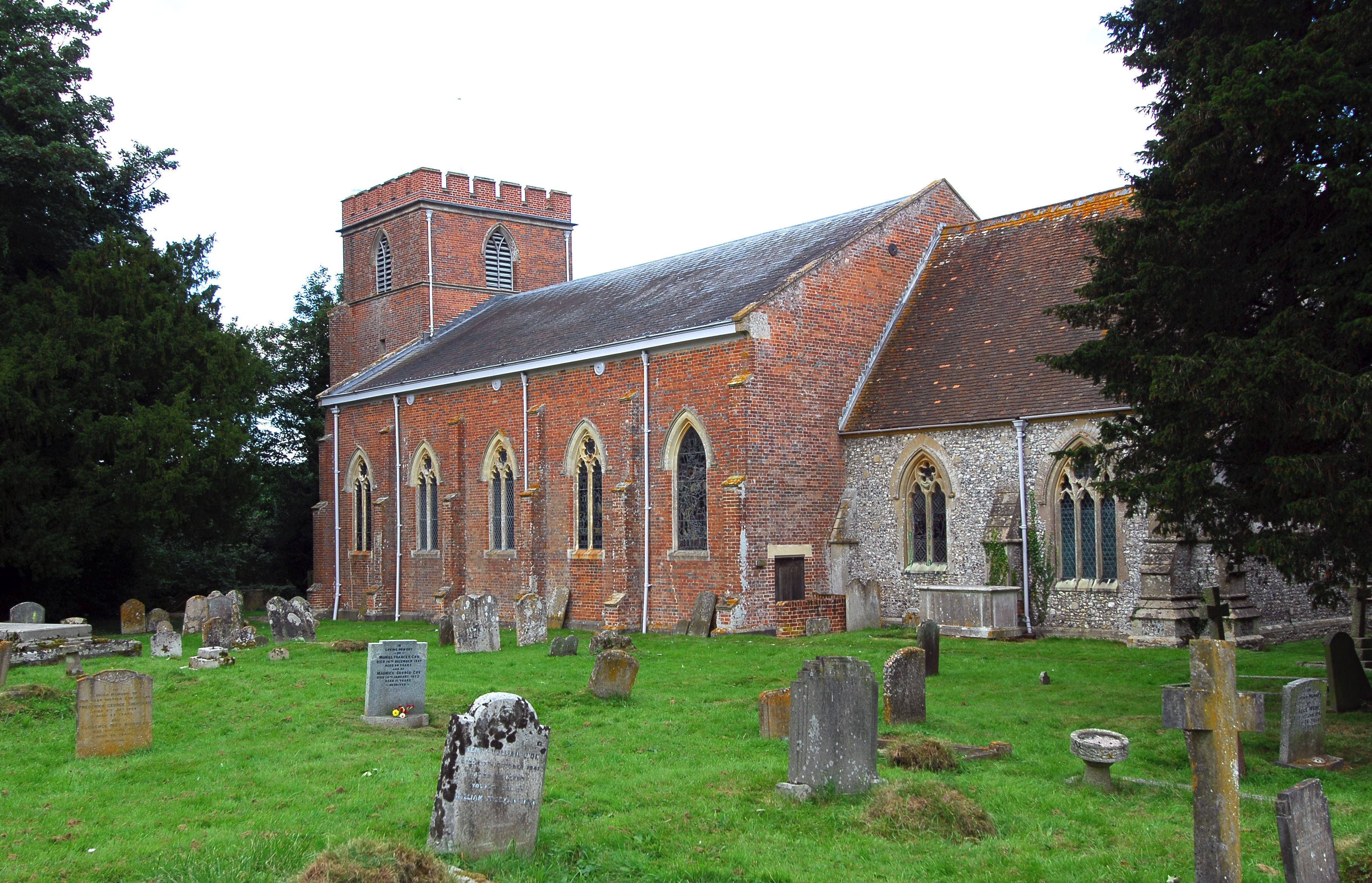
St. Martin's Churchyard is located at East Woodhay, Basingstoke and Deane Borough ,Hampshire , RG20 0ALEngland.
-
St. Martin's Churchyard cemetery's updated grave count on graveviews.com?
1 memorials
-
Where are the coordinates of the St. Martin's Churchyard?
Latitude: 51.3511800
Longitude: -1.4188700
Nearby Cemetories:
1. West Woodhay Churchyard
West Woodhay, West Berkshire Unitary Authority, England
Coordinate: 51.3637960, -1.4385220
2. St. Thomas Churchyard
Woolton Hill, Basingstoke and Deane Borough, England
Coordinate: 51.3517900, -1.3841060
3. St Barnabas Churchyard
Faccombe, Test Valley Borough, England
Coordinate: 51.3204100, -1.4415400
4. Saint Swithun Churchyard
Combe, West Berkshire Unitary Authority, England
Coordinate: 51.3445800, -1.4728000
5. Highclere Cemetery
Highclere, Basingstoke and Deane Borough, England
Coordinate: 51.3319240, -1.3625700
6. St Michael Cemetery
Netherton, Test Valley Borough, England
Coordinate: 51.3175780, -1.4622810
7. St James Churchyard
Ashmansworth, Basingstoke and Deane Borough, England
Coordinate: 51.3071600, -1.4122600
8. St. Michael and All Angels Churchyard
Enborne, West Berkshire Unitary Authority, England
Coordinate: 51.3893860, -1.3751660
9. St. Michael's Churchyard
Inkpen, West Berkshire Unitary Authority, England
Coordinate: 51.3722999, -1.4877492
10. St Mary Churchyard
Hamstead Marshall, West Berkshire Unitary Authority, England
Coordinate: 51.3981940, -1.3977010
11. St Peter Churchyard
Linkenholt, Test Valley Borough, England
Coordinate: 51.3205900, -1.4798200
12. St Michael and All Angels Churchyard
Crux Easton, Basingstoke and Deane Borough, England
Coordinate: 51.3037600, -1.3918900
13. St. Mary the Virgin Churchyard
Kintbury, West Berkshire Unitary Authority, England
Coordinate: 51.4007840, -1.4505240
14. Highclere Stud Equine Cemetery
Burghclere, Basingstoke and Deane Borough, England
Coordinate: 51.3125000, -1.3588400
15. St. James the Great
Buttermere, Wiltshire Unitary Authority, England
Coordinate: 51.3475000, -1.5090000
16. Church of the Ascension Churchyard
Burghclere, Basingstoke and Deane Borough, England
Coordinate: 51.3466000, -1.3269200
17. Beacon Hill
Highclere, Basingstoke and Deane Borough, England
Coordinate: 51.3126090, -1.3467130
18. St James Churchyard
Lower Woodcott, Basingstoke and Deane Borough, England
Coordinate: 51.2915300, -1.3813600
19. St Mary the Virgin Churchyard
Vernham Dean, Test Valley Borough, England
Coordinate: 51.3105630, -1.4994880
20. All Saints Churchyard
Old Burghclere, Basingstoke and Deane Borough, England
Coordinate: 51.3181600, -1.3290300
21. St Mary and St John the Baptist Churchyard
Newtown, Basingstoke and Deane Borough, England
Coordinate: 51.3702000, -1.3169200
22. Newtown Road Cemetery
Newbury, West Berkshire Unitary Authority, England
Coordinate: 51.3924300, -1.3252900
23. St. Mary the Virgin Churchyard
Speen, West Berkshire Unitary Authority, England
Coordinate: 51.4076540, -1.3469800
24. Newbury Friends Burial Ground (Defunct)
Reading Borough, England
Coordinate: 51.3987240, -1.3228830