
| Memorials | : | 0 |
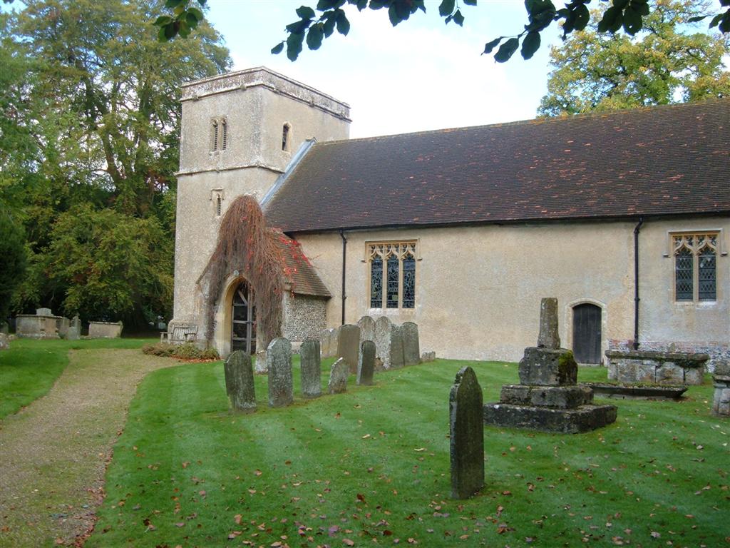
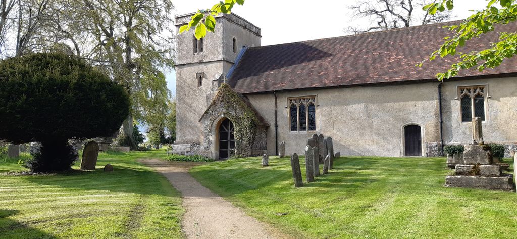
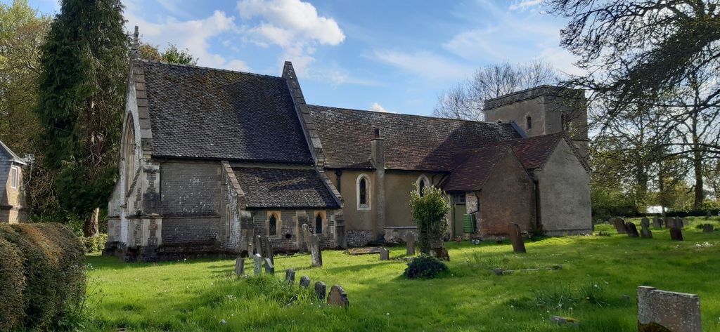
| Location | : | Chaddleworth, West Berkshire Unitary Authority, England |
| Coordinate | : | 51.4969190, -1.4070694 |
| Description | : | The church was built on the site of an earlier Saxon church. The present day church has an 11th Century nave with 13th Century additions. The village of Chaddleworth lies beneath the Berkshire Downs between Hungerford and Wantage. |
frequently asked questions (FAQ):
-
Where is St Andrew's Churchyard?
St Andrew's Churchyard is located at Chaddleworth, West Berkshire Unitary Authority ,Berkshire ,England.
-
St Andrew's Churchyard cemetery's updated grave count on graveviews.com?
0 memorials
-
Where are the coordinates of the St Andrew's Churchyard?
Latitude: 51.4969190
Longitude: -1.4070694

Nearby Cemetories:
1. All Saints
Brightwalton, West Berkshire Unitary Authority, England
Coordinate: 51.5109870, -1.3860750
2. Poughley Priory
Chaddleworth, West Berkshire Unitary Authority, England
Coordinate: 51.4770570, -1.4012960
3. Saint Thomas Churchyard
Little Shefford, West Berkshire Unitary Authority, England
Coordinate: 51.4697450, -1.4390310
4. St. Mary's Churchyard
Great Shefford, West Berkshire Unitary Authority, England
Coordinate: 51.4761000, -1.4541700
5. St. Mary's Churchyard
Fawley, West Berkshire Unitary Authority, England
Coordinate: 51.5298010, -1.4375380
6. All Saints Churchyard
Farnborough, West Berkshire Unitary Authority, England
Coordinate: 51.5346370, -1.3741600
7. All Saints Churchyard
West Ilsley, West Berkshire Unitary Authority, England
Coordinate: 51.5393520, -1.3187210
8. St Michael & All Angels Churchyard
Letcombe Bassett, Vale of White Horse District, England
Coordinate: 51.5620598, -1.4620905
9. St. Mary's Churchyard
Lambourn, West Berkshire Unitary Authority, England
Coordinate: 51.4731746, -1.5204365
10. St Marys Churchyard
East Ilsley, West Berkshire Unitary Authority, England
Coordinate: 51.5249930, -1.2903250
11. St Michael and All Angels Churchyard
Lambourn, West Berkshire Unitary Authority, England
Coordinate: 51.5086000, -1.5316000
12. Isley Baptist Churchyard
East Ilsley, West Berkshire Unitary Authority, England
Coordinate: 51.5270990, -1.2896650
13. St. Andrew Churchyard
Letcombe Regis, Vale of White Horse District, England
Coordinate: 51.5758900, -1.4527800
14. All Saints Churchyard
Wantage, Vale of White Horse District, England
Coordinate: 51.5827496, -1.3822236
15. Chain Hill Cemetery
Wantage, Vale of White Horse District, England
Coordinate: 51.5843868, -1.4217107
16. East Lockinge War Memorial
Wantage, Vale of White Horse District, England
Coordinate: 51.5844426, -1.3883416
17. East Lockinge All Souls Church Cemetery
Lockinge, Vale of White Horse District, England
Coordinate: 51.5846900, -1.3899900
18. St. Luke's Churchyard
West Berkshire Unitary Authority, England
Coordinate: 51.5209870, -1.5492870
19. Upper Lambourn Cemetery
Upper Lambourn, West Berkshire Unitary Authority, England
Coordinate: 51.5206400, -1.5499370
20. St. Peter and Paul Churchyard
Wantage, Vale of White Horse District, England
Coordinate: 51.5886860, -1.4284970
21. Wantage Baptist Church
Wantage, Vale of White Horse District, England
Coordinate: 51.5892190, -1.4270540
22. Vicarage Hill Cemetery
East Challow, Vale of White Horse District, England
Coordinate: 51.5877810, -1.4512553
23. Holy Trinity Churchyard
Ardington, Vale of White Horse District, England
Coordinate: 51.5920530, -1.3784550
24. St. Mary the Virgin Churchyard
Speen, West Berkshire Unitary Authority, England
Coordinate: 51.4076540, -1.3469800