
| Memorials | : | 0 |
| Location | : | Willenhall, Metropolitan Borough of Walsall, England |
| Coordinate | : | 52.5868880, -2.0299620 |
| Description | : | Willenhall is a town in the Black Country area of the West Midlands of England, situated between Wolverhampton and Walsall, historically in the county of Staffordshire. It lies upon the River Tame. The urban district of Willenhall (established by the Local Government Act 1894) was partitioned in 1966 between the county boroughs of Walsall and Wolverhampton (since 1974 the metropolitan boroughs of Walsall and Wolverhampton). |
frequently asked questions (FAQ):
-
Where is Bentley Cemetery?
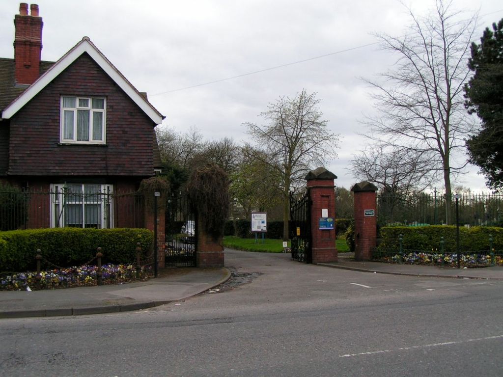
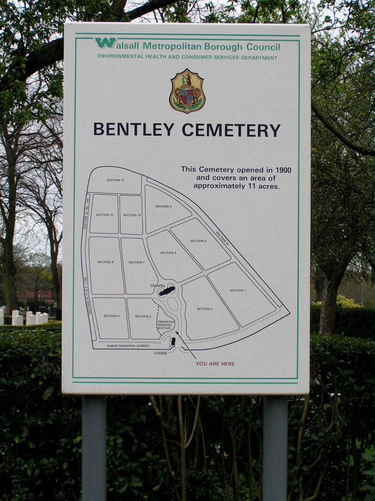
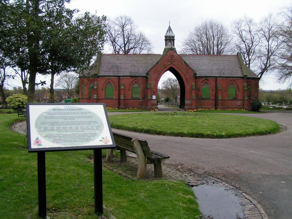
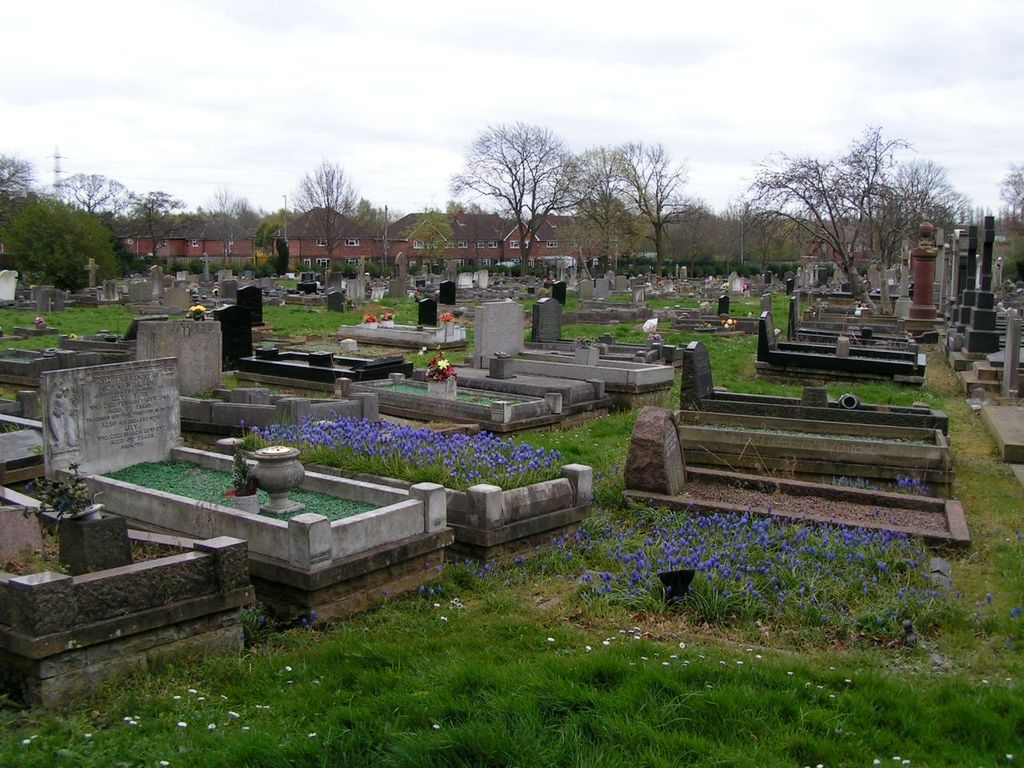
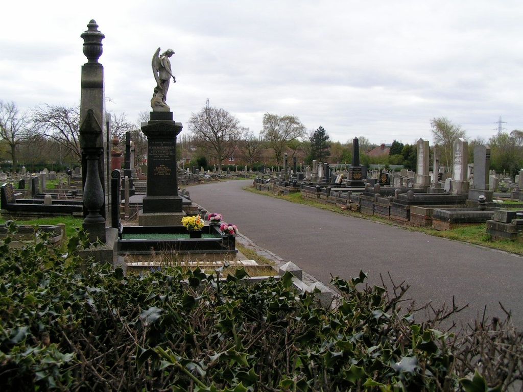
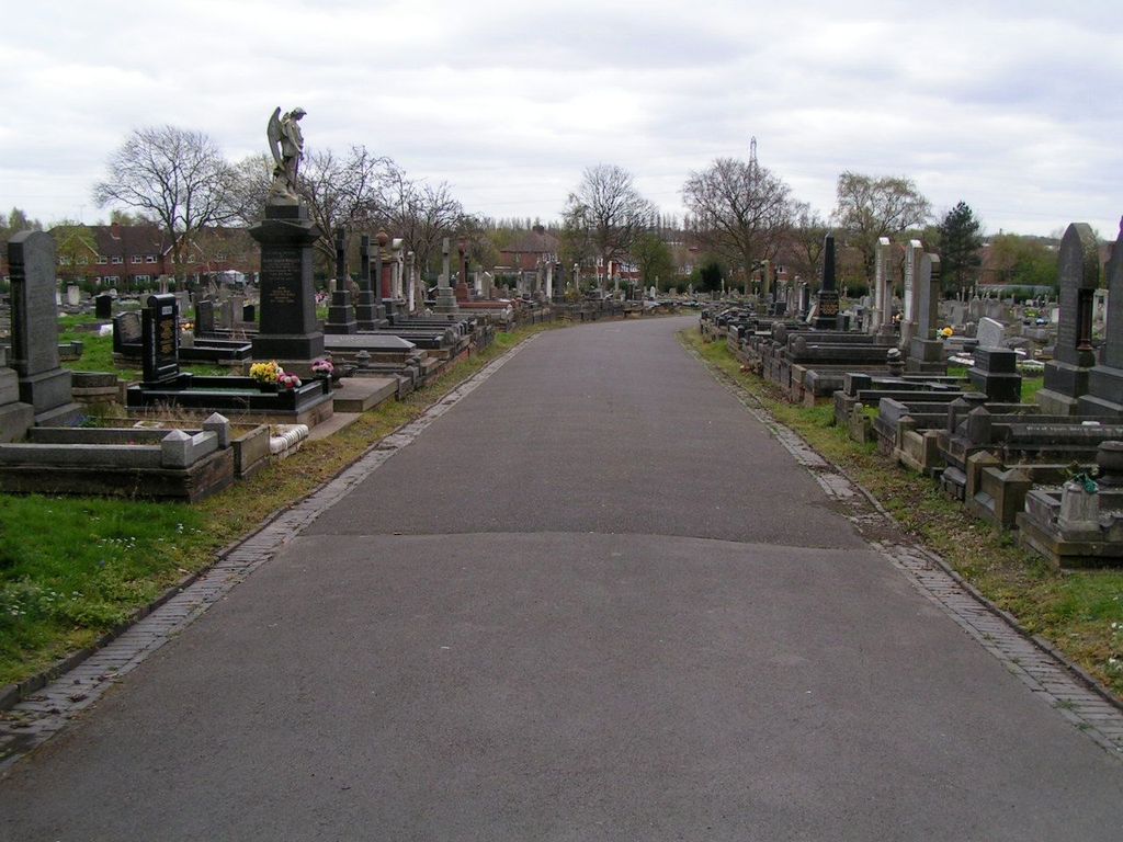
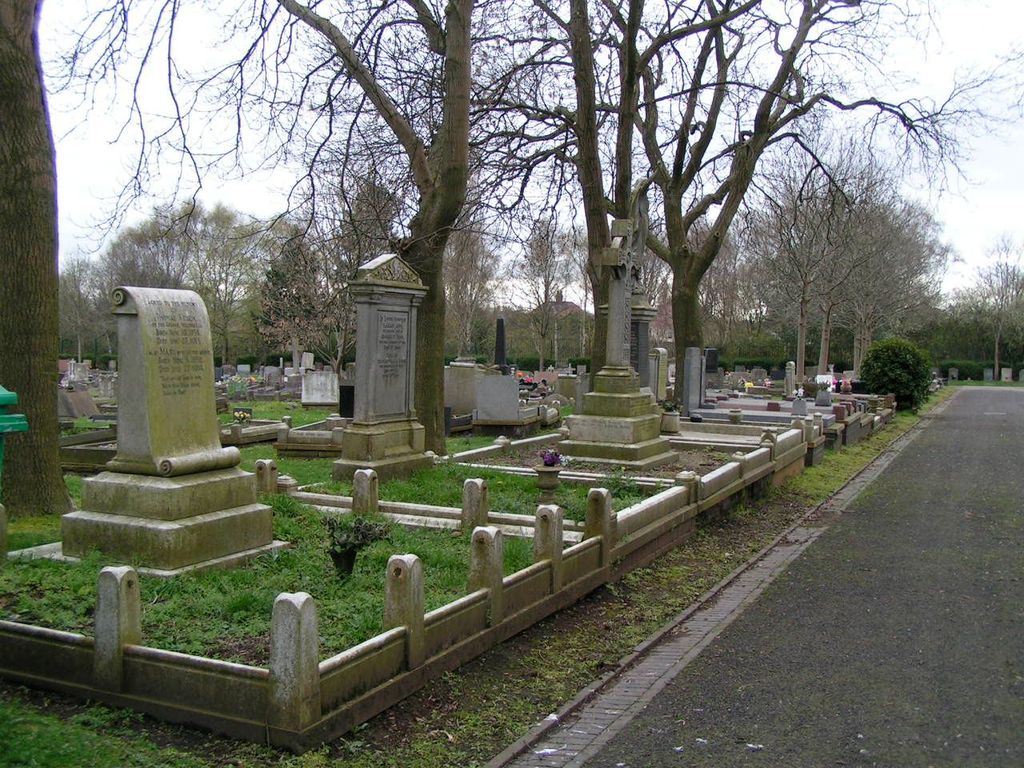
Bentley Cemetery is located at Wolverhampton Road West Willenhall, Metropolitan Borough of Walsall ,West Midlands ,England.
-
Bentley Cemetery cemetery's updated grave count on graveviews.com?
0 memorials
-
Where are the coordinates of the Bentley Cemetery?
Latitude: 52.5868880
Longitude: -2.0299620
Nearby Cemetories:
1. St. Giles Church Cholera Burial Ground
Willenhall, Metropolitan Borough of Coventry, England
Coordinate: 52.5851060, -2.0498580
2. James Bridge Cemetery
Darlaston, Metropolitan Borough of Walsall, England
Coordinate: 52.5765076, -2.0185659
3. St Giles Church Cemetery
Willenhall, Metropolitan Borough of Walsall, England
Coordinate: 52.5841600, -2.0504000
4. Willenhall Lawn Cemetery
Willenhall, Metropolitan Borough of Walsall, England
Coordinate: 52.6001870, -2.0327110
5. Wood Street Cemetery
Willenhall, Metropolitan Borough of Walsall, England
Coordinate: 52.5867500, -2.0528900
6. Holy Trinity Churchyard Shortheath
Willenhall, Metropolitan Borough of Walsall, England
Coordinate: 52.6047160, -2.0364190
7. Fallings Heath Cemetery
Wednesbury, Metropolitan Borough of Sandwell, England
Coordinate: 52.5689100, -2.0182820
8. All Saints Churchyard
Moxley, Metropolitan Borough of Walsall, England
Coordinate: 52.5666000, -2.0350200
9. Queen Street Cemetery
Walsall, Metropolitan Borough of Walsall, England
Coordinate: 52.5797190, -1.9929050
10. St Mary Roman Catholic Churchyard
Walsall, Metropolitan Borough of Walsall, England
Coordinate: 52.5797300, -1.9835900
11. Bath Street Burial Grounds
Walsall, Metropolitan Borough of Walsall, England
Coordinate: 52.5801310, -1.9799960
12. Wood Green Cemetery
Wednesbury, Metropolitan Borough of Sandwell, England
Coordinate: 52.5585990, -2.0081480
13. All Saints Church Cemetery
Bloxwich, Metropolitan Borough of Walsall, England
Coordinate: 52.6147940, -2.0050330
14. St. Mary's
Bilston, Metropolitan Borough of Wolverhampton, England
Coordinate: 52.5639000, -2.0681000
15. St. Leonard's Churchyard
Bilston, Metropolitan Borough of Wolverhampton, England
Coordinate: 52.5665580, -2.0752470
16. St. Thomas Churchyard
Wednesfield, Metropolitan Borough of Wolverhampton, England
Coordinate: 52.5997080, -2.0835350
17. Ryecroft Cemetery
Walsall, Metropolitan Borough of Walsall, England
Coordinate: 52.6012820, -1.9752140
18. St. John's Church
Wednesbury, Metropolitan Borough of Sandwell, England
Coordinate: 52.5506170, -2.0184700
19. Bilston Cemetery
Bilston, Metropolitan Borough of Wolverhampton, England
Coordinate: 52.5709000, -2.0862800
20. Bloxwich Cemetery
Bloxwich, Metropolitan Borough of Walsall, England
Coordinate: 52.6188070, -1.9963110
21. Wednesfield New Burial Ground
Wednesfield, Metropolitan Borough of Wolverhampton, England
Coordinate: 52.6003500, -2.0918900
22. Hall Green Cemetery
Bradley, Stafford Borough, England
Coordinate: 52.5525360, -2.0728930
23. Holy Trinity Churchyard
Heath Town, Metropolitan Borough of Wolverhampton, England
Coordinate: 52.5962450, -2.1029310
24. North Walsall Cemetery
Bloxwich, Metropolitan Borough of Walsall, England
Coordinate: 52.6321680, -2.0151070