
| Memorials | : | 0 |
| Location | : | Kirkby-in-Ashfield, Ashfield District, England |
| Coordinate | : | 53.0975000, -1.2693400 |
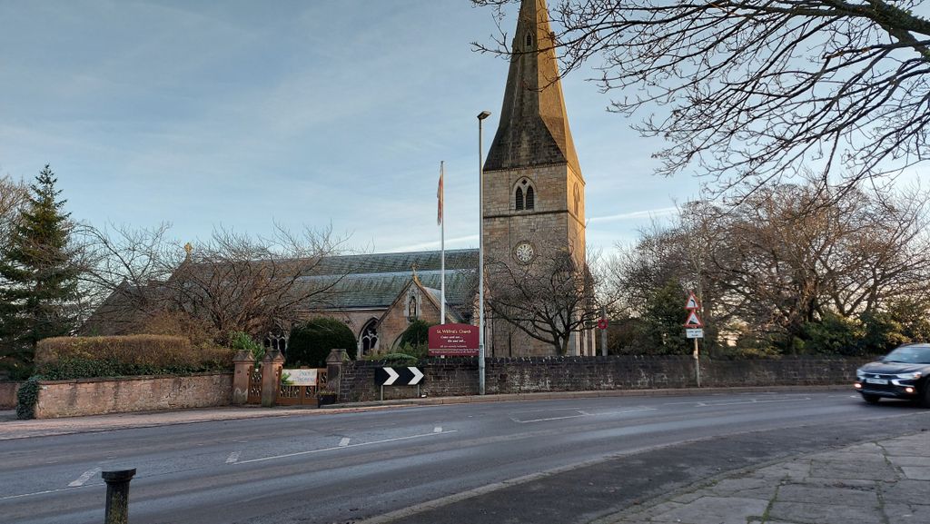
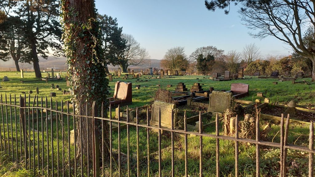
| Description | : | Kirkby-in-Ashfield(St Wilfrid) Churchyard Extension Kirkby-in-Ashfield is a market town in Nottinghamshire, England. It is a part of the Mansfield Urban Area. |
frequently asked questions (FAQ):
-
Where is St. Wilfrid's Churchyard Extension?
St. Wilfrid's Churchyard Extension is located at Church Street Kirkby-in-Ashfield, Ashfield District ,Nottinghamshire , NG17 8LAEngland.
-
St. Wilfrid's Churchyard Extension cemetery's updated grave count on graveviews.com?
0 memorials
-
Where are the coordinates of the St. Wilfrid's Churchyard Extension?
Latitude: 53.0975000
Longitude: -1.2693400
Nearby Cemetories:
1. Kingsway Old Cemetery
Kirkby-in-Ashfield, Ashfield District, England
Coordinate: 53.0936690, -1.2427970
2. Kingsway New Cemetery
Kirkby-in-Ashfield, Ashfield District, England
Coordinate: 53.0917070, -1.2422500
3. Sutton Cemetery
Sutton-in-Ashfield, Ashfield District, England
Coordinate: 53.1238890, -1.2714690
4. Annesley and Felley
Annesley, Ashfield District, England
Coordinate: 53.0771910, -1.2407140
5. St. Mary Magdalene Churchyard
Sutton-in-Ashfield, Ashfield District, England
Coordinate: 53.1255500, -1.2700820
6. All Saints Churchyard
Annesley, Ashfield District, England
Coordinate: 53.0662300, -1.2501190
7. St. Helen's Churchyard
Pinxton, Bolsover District, England
Coordinate: 53.0904510, -1.3243570
8. St. Mary the Virgin Churchyard
Newstead, Gedling Borough, England
Coordinate: 53.0688200, -1.2273000
9. Newstead Hucknall Road Cemetery
Newstead, Gedling Borough, England
Coordinate: 53.0651470, -1.2298350
10. St. Michael and All Angels Churchyard
South Normanton, Bolsover District, England
Coordinate: 53.1091020, -1.3411800
11. Saint Andrew's Parish Churchyard
Skegby, Ashfield District, England
Coordinate: 53.1429900, -1.2661100
12. St. Werburgh's Churchyard
Blackwell, Bolsover District, England
Coordinate: 53.1209850, -1.3380680
13. Newstead Abbey
Newstead, Gedling Borough, England
Coordinate: 53.0783450, -1.1931120
14. Mansfield Crematorium
Mansfield, Mansfield District, England
Coordinate: 53.1214230, -1.1946980
15. Mansfield Cemetery
Mansfield, Mansfield District, England
Coordinate: 53.1250960, -1.1934520
16. St. Mary's Churchyard
Jacksdale, Ashfield District, England
Coordinate: 53.0577660, -1.3326300
17. Nottingham Road Cemetery
Mansfield, Mansfield District, England
Coordinate: 53.1270400, -1.1920500
18. Christ Church Churchyard
Ironville, Amber Valley Borough, England
Coordinate: 53.0628250, -1.3508600
19. St. James's Churchyard
Riddings, Amber Valley Borough, England
Coordinate: 53.0702500, -1.3618710
20. St. Thomas' Churchyard
Somercotes, Amber Valley Borough, England
Coordinate: 53.0798171, -1.3687464
21. St. James Churchyard
Papplewick, Gedling Borough, England
Coordinate: 53.0582060, -1.1872990
22. St. John the Baptist Churchyard
Tibshelf, Bolsover District, England
Coordinate: 53.1431860, -1.3427080
23. St. Peter's Churchyard
Mansfield, Mansfield District, England
Coordinate: 53.1434700, -1.1928900
24. Leabrooks Cemetery
Leabrooks, Amber Valley Borough, England
Coordinate: 53.0770590, -1.3757380