
| Memorials | : | 2 |
| Location | : | Council Bluffs, Pottawattamie County, USA |
| Coordinate | : | 41.2532620, -95.7751770 |
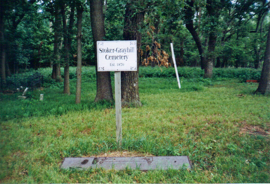
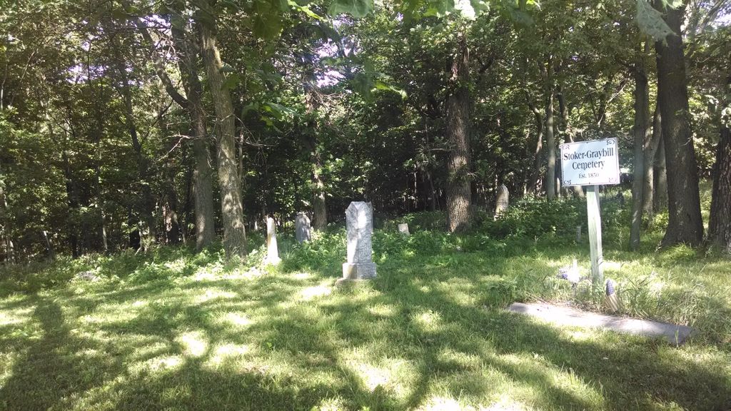
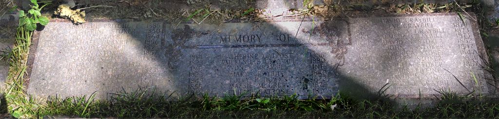
| Description | : | The burials in the Stoker - Graybill Cemetery are of family members who came to Council Bluffs with the Mormon migration from Nauvoo, Illinois in 1846-1847. Due to the fact that this cemetery was not on land owned by the Stokers and Graybills, speculation holds that some members of the family were camped here in their oxen drawn wagons when a family member died and was buried at the campsite. Afterwards, the family continued to use this site as their burial ground for fifty years. The last burial appears to have been that of Margaret Judd Stoker in 1893. The farm... Read More |
frequently asked questions (FAQ):
-
Where is Stoker-Graybill Cemetery?
Stoker-Graybill Cemetery is located at Cedar Lane Council Bluffs, Pottawattamie County ,Iowa , 51503USA.
-
Stoker-Graybill Cemetery cemetery's updated grave count on graveviews.com?
2 memorials
-
Where are the coordinates of the Stoker-Graybill Cemetery?
Latitude: 41.2532620
Longitude: -95.7751770
Nearby Cemetories:
1. Clark Cemetery
Pottawattamie County, USA
Coordinate: 41.2551610, -95.8223390
2. Cedar Lawn Cemetery
Council Bluffs, Pottawattamie County, USA
Coordinate: 41.2694016, -95.8182983
3. Saint Joseph Cemetery
Council Bluffs, Pottawattamie County, USA
Coordinate: 41.2722015, -95.8208008
4. Oak Hill Cemetery
Council Bluffs, Pottawattamie County, USA
Coordinate: 41.2700900, -95.8226400
5. Bikhor Cholim Cemetery
Council Bluffs, Pottawattamie County, USA
Coordinate: 41.2703670, -95.8229350
6. Memorial Park Cemetery
Council Bluffs, Pottawattamie County, USA
Coordinate: 41.2644005, -95.8261032
7. Green Valley Cemetery
Council Bluffs, Pottawattamie County, USA
Coordinate: 41.2743988, -95.8225021
8. Walnut Hill Cemetery
Council Bluffs, Pottawattamie County, USA
Coordinate: 41.2719002, -95.8255997
9. Maple Grove Cemetery
Council Bluffs, Pottawattamie County, USA
Coordinate: 41.2265560, -95.8187100
10. Ridgewood Cemetery
Council Bluffs, Pottawattamie County, USA
Coordinate: 41.2694016, -95.8272018
11. Lewis Township Cemetery
Council Bluffs, Pottawattamie County, USA
Coordinate: 41.2117004, -95.7938995
12. Garner Cemetery
Council Bluffs, Pottawattamie County, USA
Coordinate: 41.2956161, -95.8001709
13. Fairview Cemetery
Council Bluffs, Pottawattamie County, USA
Coordinate: 41.2703018, -95.8480988
14. Saint Pauls Evangelical Country Church Cemetery
Dumfries, Pottawattamie County, USA
Coordinate: 41.1748352, -95.7492371
15. Gregg Cemetery
Weston, Pottawattamie County, USA
Coordinate: 41.3330000, -95.7931000
16. Zion Cemetery
Pottawattamie County, USA
Coordinate: 41.1778000, -95.7272000
17. Evans Cemetery
Crescent, Pottawattamie County, USA
Coordinate: 41.3255997, -95.8368988
18. Council Point Cemetery
Council Bluffs, Pottawattamie County, USA
Coordinate: 41.2110830, -95.8788610
19. Keg Creek Township Cemetery
Treynor, Pottawattamie County, USA
Coordinate: 41.1913986, -95.6893997
20. Saint Columbanus Cemetery
Weston, Pottawattamie County, USA
Coordinate: 41.3429440, -95.7435260
21. Hazel Dell Cemetery
Council Bluffs, Pottawattamie County, USA
Coordinate: 41.3489723, -95.7939911
22. Salem Lutheran Church Cemetery
Glenwood, Mills County, USA
Coordinate: 41.1556015, -95.7617035
23. Hardin Township Cemetery
McClelland, Pottawattamie County, USA
Coordinate: 41.2949982, -95.6513977
24. Saint Paul Lutheran Cemetery
Treynor, Pottawattamie County, USA
Coordinate: 41.2322000, -95.6380000