
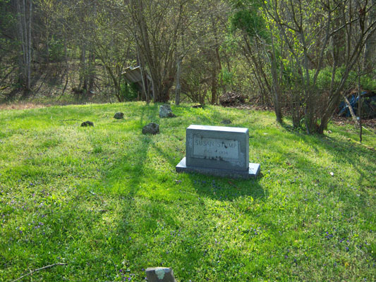
| Memorials | : | 0 |
| Location | : | Shock, Gilmer County, USA |
| Coordinate | : | 38.8012660, -80.9749330 |
| Description | : | Traveling CR 23 from Stumptown for about 6 miles and look for an iron bridge. After crossing bridge go about 50 yards and turn right up a small road. The cemetery is located to the left beside the road on private property and is well maintained. |
frequently asked questions (FAQ):
-
Where is Susan Stump Cemetery?
Susan Stump Cemetery is located at Shock, Gilmer County ,West Virginia ,USA.
-
Susan Stump Cemetery cemetery's updated grave count on graveviews.com?
0 memorials
-
Where are the coordinates of the Susan Stump Cemetery?
Latitude: 38.8012660
Longitude: -80.9749330
Nearby Cemetories:
1. Michael Stump Cemetery-Steer Creek
Stumptown, Gilmer County, USA
Coordinate: 38.8273200, -80.9736800
2. Chestnut Lick Community Church Cemetery
Gilmer County, USA
Coordinate: 38.8223950, -80.9426220
3. Oak Grove Cemetery
Normantown, Gilmer County, USA
Coordinate: 38.8061420, -80.9267360
4. Elihu-Stump Cemetery
Gilmer County, USA
Coordinate: 38.8403015, -80.9878006
5. Collins Community Cemetery
Stumptown, Gilmer County, USA
Coordinate: 38.8459700, -80.9903630
6. Kyer Cemetery
Perkins, Gilmer County, USA
Coordinate: 38.7861111, -80.9169444
7. Mount Pisgah Church Cemetery
Stumptown, Gilmer County, USA
Coordinate: 38.8469900, -80.9932700
8. Rosedale Cemetery
Gilmer County, USA
Coordinate: 38.7544770, -80.9442990
9. Stump Cemetery
Stumptown, Gilmer County, USA
Coordinate: 38.8495000, -81.0030000
10. Meadows Cemetery
Gilmer County, USA
Coordinate: 38.8506012, -80.9492035
11. Boggs Cemetery
Normantown, Gilmer County, USA
Coordinate: 38.8238160, -80.9127130
12. Mollohan Cemetery
Normantown, Gilmer County, USA
Coordinate: 38.8429600, -80.9262500
13. Normantown Cemetery
Normantown, Gilmer County, USA
Coordinate: 38.8511040, -80.9403910
14. Upper Steer Run Baptist Church Cemetery
Gilmer County, USA
Coordinate: 38.8429370, -80.9227830
15. Snakeroot Cemetery
Gilmer County, USA
Coordinate: 38.8586006, -80.9910965
16. Moore Cemetery
Normantown, Gilmer County, USA
Coordinate: 38.7986160, -80.8970590
17. Earl V. Miller Cemetery
Shock, Gilmer County, USA
Coordinate: 38.7403610, -80.9855210
18. Cottrell-Frozen Run Chapel Cemetery
Altizer, Calhoun County, USA
Coordinate: 38.7444350, -81.0057520
19. Albert VanHorn Cemetery
Orton, Gilmer County, USA
Coordinate: 38.8178020, -80.8983150
20. Crooked Fork Baptist Church Cemetery
Perkins, Gilmer County, USA
Coordinate: 38.7714360, -80.8988930
21. Mount Camel Baptist Church Cemetery
Gassaway, Braxton County, USA
Coordinate: 38.8174450, -80.8914080
22. Mount Carmel Cemetery
Normantown, Gilmer County, USA
Coordinate: 38.8174280, -80.8913720
23. Miller
Gilmer County, USA
Coordinate: 38.7313232, -80.9807434
24. Conley Cemetery
Orma, Calhoun County, USA
Coordinate: 38.7513600, -81.0414650