
| Memorials | : | 1 |
| Location | : | New Franklin, Howard County, USA |
| Coordinate | : | 39.0053368, -92.6174850 |
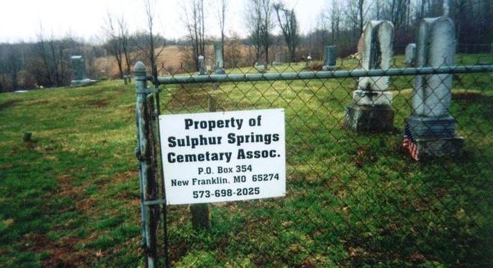
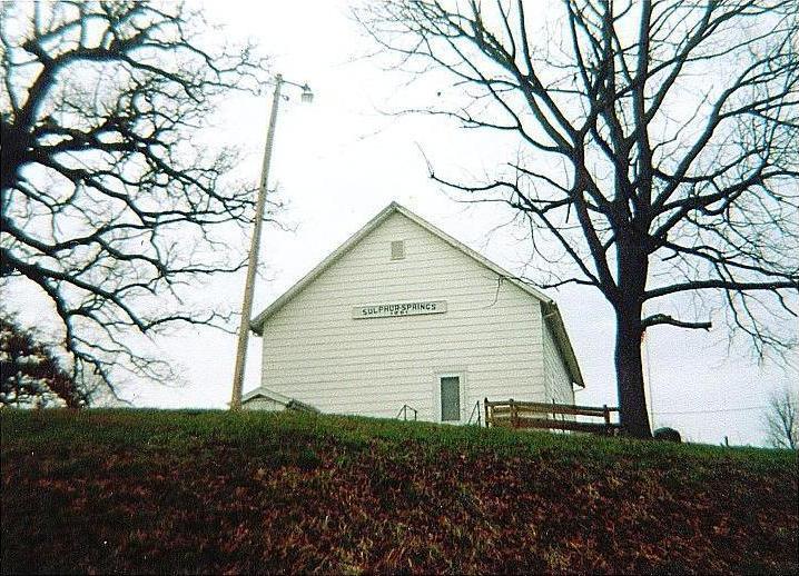
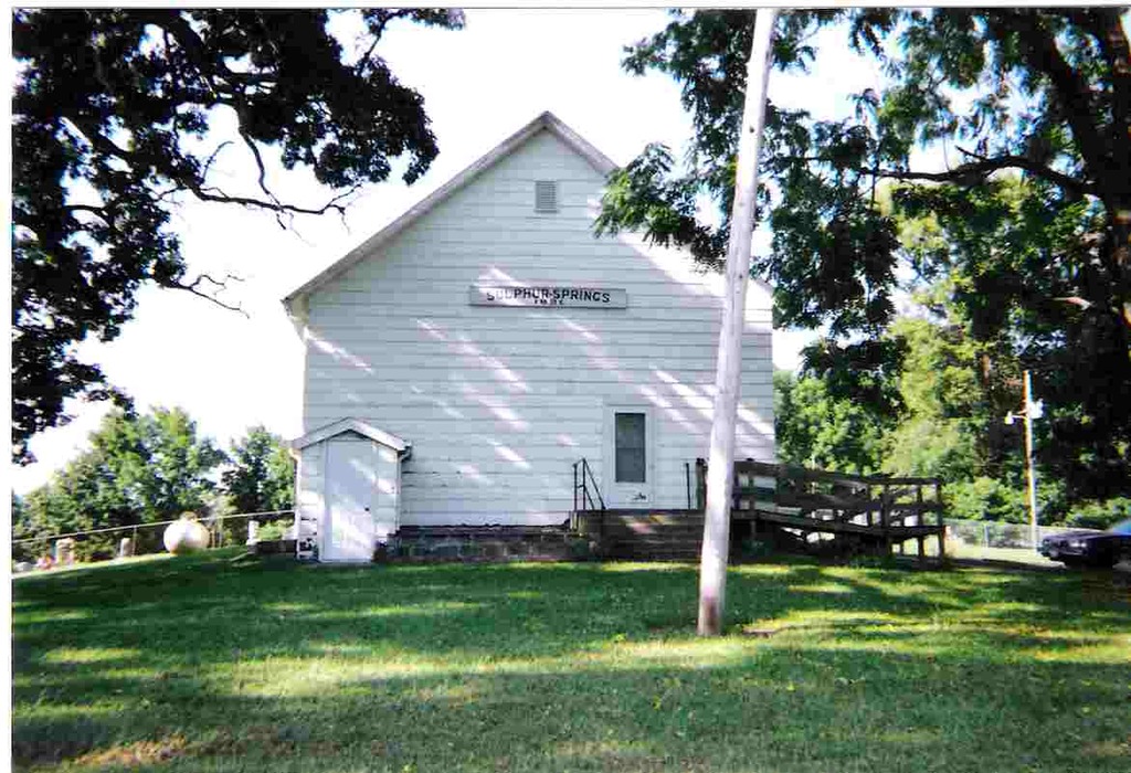
| Description | : | 8 miles southeast of New Franklin, Howard County, Missouri Coming from Columbia, Boone Co., Missouri -- Head west on I70 until reaching the Exit #121 (Midway), turn right onto Hwy 240, continue driving until you reach Alternate 240, turn left, drive a short distance until you reach County Rd #442 (gravel), turn right, continue down road until you reach a Y in the road, turn or veer to the left, follow the road until you reach Sulphur Springs Baptist Church on the right side of the road. The cemetery sits directly in back of the church in a chain-link fenced area. Directions... Read More |
frequently asked questions (FAQ):
-
Where is Sulphur Springs Cemetery?
Sulphur Springs Cemetery is located at New Franklin, Howard County ,Missouri ,USA.
-
Sulphur Springs Cemetery cemetery's updated grave count on graveviews.com?
1 memorials
-
Where are the coordinates of the Sulphur Springs Cemetery?
Latitude: 39.0053368
Longitude: -92.6174850
Nearby Cemetories:
1. Adams Cemetery
New Franklin, Howard County, USA
Coordinate: 39.0033210, -92.6126350
2. Jennings Cemetery
Howard County, USA
Coordinate: 39.0157160, -92.6355600
3. Shaw Cemetery
Howard County, USA
Coordinate: 39.0321530, -92.6183940
4. Drake-Campbell Cemetery
Howard County, USA
Coordinate: 39.0307999, -92.6502991
5. Robinson Cemetery
Howard County, USA
Coordinate: 39.0264015, -92.6596985
6. Ashland Cemetery
Fayette, Howard County, USA
Coordinate: 39.0495200, -92.6222900
7. Rocheport City Cemetery
Rocheport, Boone County, USA
Coordinate: 38.9809050, -92.5590420
8. Salt Creek Cemetery
Howard County, USA
Coordinate: 39.0474280, -92.6628770
9. Schmidt Cemetery
Wooldridge, Cooper County, USA
Coordinate: 38.9500008, -92.6046982
10. Big Springs Christian Church Cemetery
Hilldale, Howard County, USA
Coordinate: 39.0328598, -92.5495834
11. Hourigan Cemetery
Howard County, USA
Coordinate: 39.0558014, -92.5622025
12. Mount Woodland African Methodist Episcopal Church
Hilldale, Howard County, USA
Coordinate: 39.0601980, -92.5632510
13. Clayton Cemetery
Overton, Cooper County, USA
Coordinate: 38.9427986, -92.5744019
14. Walnut Grove Cemetery
Rocheport, Boone County, USA
Coordinate: 39.0125008, -92.5233002
15. Yahweh's Assembly In Messiah Cemetery
Rocheport, Boone County, USA
Coordinate: 38.9611995, -92.5397969
16. Old Bethel Cemetery
Midway, Boone County, USA
Coordinate: 39.0414200, -92.5198800
17. Lientz Cemetery
Midway, Boone County, USA
Coordinate: 39.0080400, -92.5050200
18. Hail Ridge Cemetery
Boonville, Cooper County, USA
Coordinate: 38.9394444, -92.6941667
19. Missouri Boys Training School Cemetery
Boonville, Cooper County, USA
Coordinate: 38.9732120, -92.7297190
20. Boonville Memorial Gardens Cemetery
Boonville, Cooper County, USA
Coordinate: 38.9670460, -92.7271950
21. Saint Peter and Paul Catholic Cemetery
Boonville, Cooper County, USA
Coordinate: 38.9730060, -92.7306800
22. Walnut Grove Cemetery
Boonville, Cooper County, USA
Coordinate: 38.9713783, -92.7324524
23. Mount Zion Cemetery
Howard County, USA
Coordinate: 39.0916300, -92.6754700
24. Mount Pleasant Cemetery
New Franklin, Howard County, USA
Coordinate: 39.0348600, -92.7399700