
| Memorials | : | 5 |
| Location | : | Boonville, Cooper County, USA |
| Coordinate | : | 38.9636130, -92.7458480 |
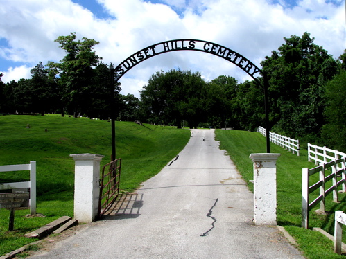
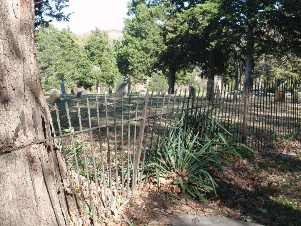
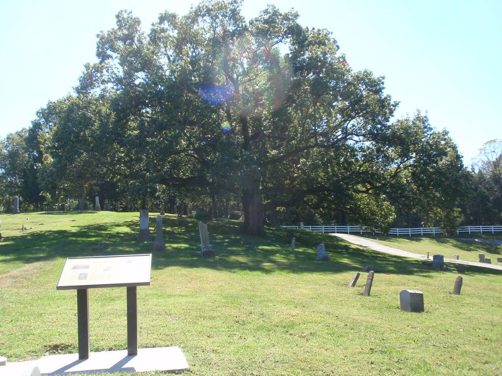
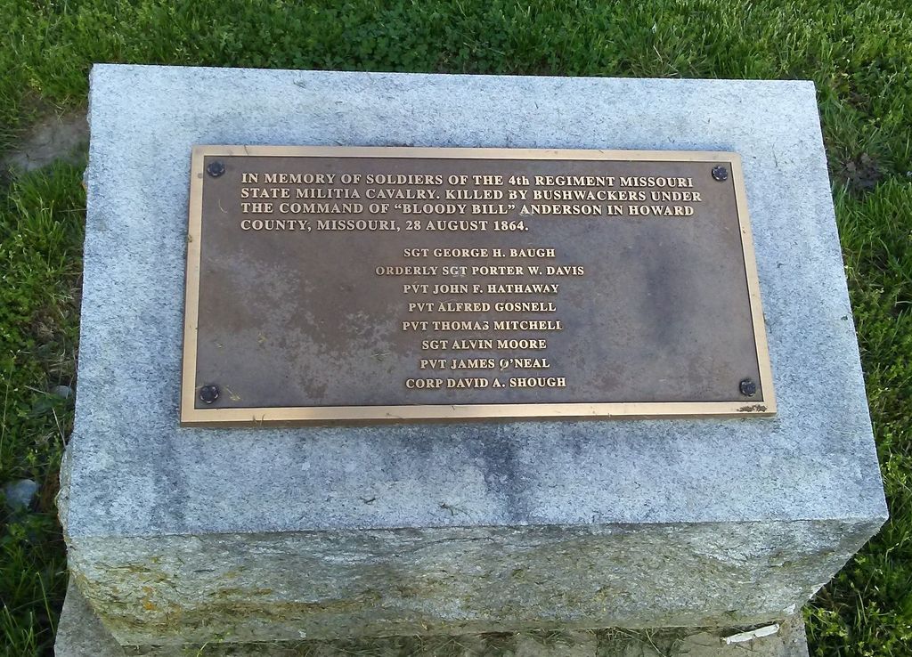
| Description | : | Sunset Hills is the oldest cemetery in Boonville, and is one of two cemeteries owned and operated by the City. By city ordinance, the cemeteries are under the supervision of a Sexton who is the Director of Parks for the City. A five member Cemetery Advisory Board appointed by the City Council meets in January, March, May, July, September and November, on the fourth Thurday at 3:30 p.m. in the City Council Chambers, Cit Hall. The meetings are open to the public. POC: Gary Nauman, Director of Parks & Recreation, 1221 11th Street, Boonville, 660-882-7447; gary.nauman(a t)boonville-mo.org. The... Read More |
frequently asked questions (FAQ):
-
Where is Sunset Hills Cemetery?
Sunset Hills Cemetery is located at West end of South Street Boonville, Cooper County ,Missouri , 65233USA.
-
Sunset Hills Cemetery cemetery's updated grave count on graveviews.com?
5 memorials
-
Where are the coordinates of the Sunset Hills Cemetery?
Latitude: 38.9636130
Longitude: -92.7458480
Nearby Cemetories:
1. Walnut Grove Cemetery
Boonville, Cooper County, USA
Coordinate: 38.9713783, -92.7324524
2. Boonville Memorial Gardens Cemetery
Boonville, Cooper County, USA
Coordinate: 38.9670460, -92.7271950
3. Saint Peter and Paul Catholic Cemetery
Boonville, Cooper County, USA
Coordinate: 38.9730060, -92.7306800
4. Missouri Boys Training School Cemetery
Boonville, Cooper County, USA
Coordinate: 38.9732120, -92.7297190
5. Hail Ridge Cemetery
Boonville, Cooper County, USA
Coordinate: 38.9394444, -92.6941667
6. Clarks Chapel Cemetery
New Franklin, Howard County, USA
Coordinate: 39.0102910, -92.7851010
7. Cooper County Poor Farm Cemetery
Boonville, Cooper County, USA
Coordinate: 38.9108430, -92.7820330
8. Williams Burials Grounds
Cooper County, USA
Coordinate: 38.9696750, -92.8270000
9. West Boonville Evangelical Church Cemetery
Boonville, Cooper County, USA
Coordinate: 38.9593981, -92.8282225
10. Saint Johns UCC Cemetery
Billingsville, Cooper County, USA
Coordinate: 38.9042410, -92.7951050
11. Mount Pleasant Cemetery
New Franklin, Howard County, USA
Coordinate: 39.0348600, -92.7399700
12. Jones Chapel Cemetery
Cooper County, USA
Coordinate: 38.9433060, -92.8348710
13. Prairie Lick Cemetery
Billingsville, Cooper County, USA
Coordinate: 38.9170410, -92.8257630
14. Mount Hermon Baptist Cemetery
Clarks Fork, Cooper County, USA
Coordinate: 38.8824560, -92.7340030
15. Brown-Cartner Family Cemetery
Billingsville, Cooper County, USA
Coordinate: 38.8812900, -92.7609200
16. Robinson Cemetery
Howard County, USA
Coordinate: 39.0264015, -92.6596985
17. Pleasant Hill Cemetery
Cooper County, USA
Coordinate: 38.8955994, -92.8383026
18. Drake-Campbell Cemetery
Howard County, USA
Coordinate: 39.0307999, -92.6502991
19. Jennings Cemetery
Howard County, USA
Coordinate: 39.0157160, -92.6355600
20. Herndon Cemetery
Cooper County, USA
Coordinate: 38.9592018, -92.8767014
21. Salt Creek Cemetery
Howard County, USA
Coordinate: 39.0474280, -92.6628770
22. Burrus Family Cemetery
Franklin, Howard County, USA
Coordinate: 39.0573158, -92.8109512
23. Sulphur Springs Cemetery
New Franklin, Howard County, USA
Coordinate: 39.0053368, -92.6174850
24. Schuster Family Cemetery
Lamine, Cooper County, USA
Coordinate: 38.9526600, -92.8862720