
| Memorials | : | 0 |
| Location | : | Burlington, Boone County, USA |
| Coordinate | : | 39.0225000, -84.7222220 |
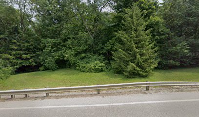
| Description | : | The cemetery is located on the east side of East Bend Road (Kentucky State Highway 338) near its intersection with Allens Fork Drive. The Boone County GIS unique ID assigned to this cemetery is 163 (Tandy Cemetery). The cemetery has an index number of 165 (Tandy) on the Boone County Kentucky Cemetery Map published in 2005 by the Boone County Planning Commission in conjunction with Johnson-Wilson Cemetery Stewards Association. The cemetery is identified as Tandy in the index and listed as Tandy Graveyard on page 279 of the book “Boone County, Kentucky Cemeteries” by Stephen W. Worrel, M.A. & Anne W. Fitzgerald, B.S.,... Read More |
frequently asked questions (FAQ):
-
Where is Tandy Cemetery?
Tandy Cemetery is located at 6168 East Bend Road (Kentucky State Highway 338) Burlington, Boone County ,Kentucky , 41005USA.
-
Tandy Cemetery cemetery's updated grave count on graveviews.com?
0 memorials
-
Where are the coordinates of the Tandy Cemetery?
Latitude: 39.0225000
Longitude: -84.7222220
Nearby Cemetories:
1. Caldwell Cemetery
Burlington, Boone County, USA
Coordinate: 39.0205560, -84.7241670
2. Chambers Cemetery
Burlington, Boone County, USA
Coordinate: 39.0196991, -84.7241974
3. Burlington IOOF Cemetery
Burlington, Boone County, USA
Coordinate: 39.0253983, -84.7154999
4. Old Burlington Cemetery
Burlington, Boone County, USA
Coordinate: 39.0319444, -84.7233333
5. Potters Field Cemetery
Burlington, Boone County, USA
Coordinate: 39.0341670, -84.7319440
6. Rouse-Utz Cemetery
Burlington, Boone County, USA
Coordinate: 39.0372220, -84.7127780
7. Boone County Infirmary Cemetery
Burlington, Boone County, USA
Coordinate: 39.0350560, -84.7384820
8. Johnson-Wilson Cemetery
Burlington, Boone County, USA
Coordinate: 39.0299150, -84.7434200
9. Utz Cemetery
Burlington, Boone County, USA
Coordinate: 39.0414170, -84.7177350
10. Utz Slave Cemetery
Burlington, Boone County, USA
Coordinate: 39.0416670, -84.7172220
11. Underhill Cemetery
Burlington, Boone County, USA
Coordinate: 39.0027780, -84.7188890
12. Churchill Clore Family Cemetery
Burlington, Boone County, USA
Coordinate: 39.0106710, -84.7466150
13. Zinn Cemetery
Burlington, Boone County, USA
Coordinate: 39.0447220, -84.7183330
14. White Family Cemetery
Burlington, Boone County, USA
Coordinate: 39.0158330, -84.7522220
15. Clore-Weaver Cemetery
Burlington, Boone County, USA
Coordinate: 39.0009340, -84.7048250
16. E Rouse Cemetery (Defunct)
Hebron, Boone County, USA
Coordinate: 39.0316670, -84.6869440
17. Duncan Cemetery
Burlington, Boone County, USA
Coordinate: 39.0478230, -84.7459560
18. Aylor Cemetery (Defunct)
Florence, Boone County, USA
Coordinate: 39.0169973, -84.6793854
19. William Aylor Cemetery (Defunct)
Florence, Boone County, USA
Coordinate: 39.0203480, -84.6778680
20. A.S. Crisler Cemetery
Florence, Boone County, USA
Coordinate: 38.9916590, -84.7020550
21. Snyder-Crisler Cemetery
Burlington, Boone County, USA
Coordinate: 38.9867750, -84.7183080
22. Crigler-Clore-Smith Cemetery
Hebron, Boone County, USA
Coordinate: 39.0580560, -84.7141670
23. Crisler Family Cemetery
Burlington, Boone County, USA
Coordinate: 38.9858330, -84.7230560
24. Weaver Cemetery
Florence, Boone County, USA
Coordinate: 39.0283012, -84.6755981