
| Memorials | : | 1 |
| Location | : | Burlington, Boone County, USA |
| Coordinate | : | 39.0478230, -84.7459560 |
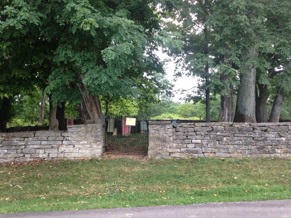
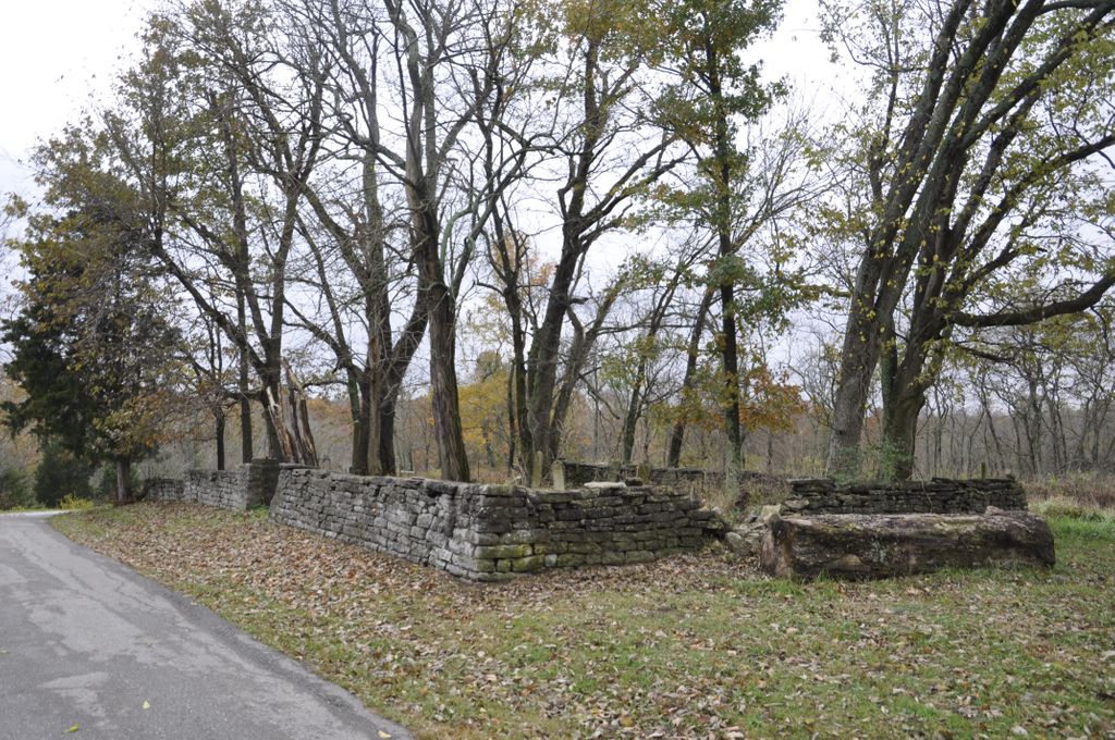
| Description | : | The cemetery is located on the north side of Idlewild Road (Kentucky State Highway 338) about 0.4 miles west of its intersection with Easton Lane. The Boone County GIS unique ID assigned to this cemetery is 64 (Duncan Cemetery). The cemetery has an index number of 65 (Duncan) on the Boone County Kentucky Cemetery Map published in 2005 by the Boone County Planning Commission in conjunction with Johnson-Wilson Cemetery Stewards Association. The cemetery is identified as Duncan in the index and listed as Duncan Cemetery on pages 337-338 of the book “Boone County, Kentucky Cemeteries” by Stephen W. Worrel, M.A. & Anne W.... Read More |
frequently asked questions (FAQ):
-
Where is Duncan Cemetery?
Duncan Cemetery is located at 5000 Idlewild Road (Kentucky State Highway 338) Burlington, Boone County ,Kentucky , 41005USA.
-
Duncan Cemetery cemetery's updated grave count on graveviews.com?
1 memorials
-
Where are the coordinates of the Duncan Cemetery?
Latitude: 39.0478230
Longitude: -84.7459560
Nearby Cemetories:
1. Boone County Infirmary Cemetery
Burlington, Boone County, USA
Coordinate: 39.0350560, -84.7384820
2. Potters Field Cemetery
Burlington, Boone County, USA
Coordinate: 39.0341670, -84.7319440
3. Johnson-Wilson Cemetery
Burlington, Boone County, USA
Coordinate: 39.0299150, -84.7434200
4. Crisler-Millakin Place Cemetery
Burlington, Boone County, USA
Coordinate: 39.0676970, -84.7441380
5. Zinn Cemetery
Burlington, Boone County, USA
Coordinate: 39.0447220, -84.7183330
6. Utz Cemetery
Burlington, Boone County, USA
Coordinate: 39.0414170, -84.7177350
7. Utz Slave Cemetery
Burlington, Boone County, USA
Coordinate: 39.0416670, -84.7172220
8. Old Burlington Cemetery
Burlington, Boone County, USA
Coordinate: 39.0319444, -84.7233333
9. Crigler-Clore-Smith Cemetery
Hebron, Boone County, USA
Coordinate: 39.0580560, -84.7141670
10. Rouse-Utz Cemetery
Burlington, Boone County, USA
Coordinate: 39.0372220, -84.7127780
11. Watts Cemetery
Hebron, Boone County, USA
Coordinate: 39.0788994, -84.7427979
12. Tandy Cemetery
Burlington, Boone County, USA
Coordinate: 39.0225000, -84.7222220
13. Caldwell Cemetery
Burlington, Boone County, USA
Coordinate: 39.0205560, -84.7241670
14. White Family Cemetery
Burlington, Boone County, USA
Coordinate: 39.0158330, -84.7522220
15. Burlington IOOF Cemetery
Burlington, Boone County, USA
Coordinate: 39.0253983, -84.7154999
16. Chambers Cemetery
Burlington, Boone County, USA
Coordinate: 39.0196991, -84.7241974
17. Churchill Clore Family Cemetery
Burlington, Boone County, USA
Coordinate: 39.0106710, -84.7466150
18. Johnson Cemetery
Commissary Corner, Boone County, USA
Coordinate: 39.0370037, -84.7949484
19. Johnson Cemetery
Union, Boone County, USA
Coordinate: 39.0368996, -84.7949982
20. Hebron Lutheran Church Cemetery
Hebron, Boone County, USA
Coordinate: 39.0641677, -84.6988889
21. Hicks Cemetery
Hebron, Boone County, USA
Coordinate: 39.0711110, -84.7013890
22. Gaines-Graves Cemetery
Idlewild, Boone County, USA
Coordinate: 39.0863800, -84.7716110
23. Hensley Cemetery
Petersburg, Boone County, USA
Coordinate: 39.0494490, -84.8068290
24. E Rouse Cemetery (Defunct)
Hebron, Boone County, USA
Coordinate: 39.0316670, -84.6869440