
| Memorials | : | 86 |
| Location | : | Tedrow, Fulton County, USA |
| Coordinate | : | 41.6019300, -84.1975100 |
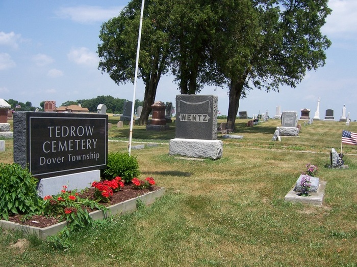
| Description | : | Tedrow Cemetery land deeded to T.V Burtch in 1844 was used for burials at an early time, possibly as early as the 1840's. The burial ground, first known as Spring Hill Cemetery, for the nearby village of that name, was organized during the 1860's. In 1872 the cemetery was turned over to the trustees, Dover Township. When the village name was changed to Tedrow the cemetery also became known by that name. Added by Pamela Stephens on Jun 25, 2010: |
frequently asked questions (FAQ):
-
Where is Tedrow Cemetery?
Tedrow Cemetery is located at Tedrow, Fulton County ,Ohio ,USA.
-
Tedrow Cemetery cemetery's updated grave count on graveviews.com?
86 memorials
-
Where are the coordinates of the Tedrow Cemetery?
Latitude: 41.6019300
Longitude: -84.1975100
Nearby Cemetories:
1. Ayers Cemetery
Fulton County, USA
Coordinate: 41.5960999, -84.2296982
2. Smith Cemetery
Franklin Township, Fulton County, USA
Coordinate: 41.5957985, -84.2316971
3. North Pettisville Cemetery
Wauseon, Fulton County, USA
Coordinate: 41.5728190, -84.2200180
4. Ottokee Cemetery
Fulton County, USA
Coordinate: 41.6005610, -84.1386770
5. Bayes Cemetery
Wauseon, Fulton County, USA
Coordinate: 41.5581017, -84.1706009
6. Fulton County Home Cemetery
Ottokee, Fulton County, USA
Coordinate: 41.6025540, -84.1307420
7. Eckley Cemetery
Eckley, Fulton County, USA
Coordinate: 41.5641600, -84.2491200
8. Mikesell Cemetery
Wauseon, Fulton County, USA
Coordinate: 41.5511017, -84.1631012
9. Lauber Hill Cemetery
Fulton County, USA
Coordinate: 41.5742410, -84.2681490
10. Wauseon Union Cemetery
Wauseon, Fulton County, USA
Coordinate: 41.5480995, -84.1564026
11. Saint Caspar Catholic Cemetery
Wauseon, Fulton County, USA
Coordinate: 41.5479500, -84.1557600
12. Beck Cemetery
Fulton County, USA
Coordinate: 41.5648620, -84.2682880
13. Wyse Cemetery
Fulton County, USA
Coordinate: 41.5647820, -84.2686700
14. Butler Cemetery
Fulton County, USA
Coordinate: 41.6650009, -84.1716995
15. Fluhart Cemetery
Fulton County, USA
Coordinate: 41.5769005, -84.1130981
16. Pettisville Lutheran Cemetery
Pettisville, Fulton County, USA
Coordinate: 41.5321900, -84.2237400
17. Pettisville Cemetery
Pettisville, Fulton County, USA
Coordinate: 41.5302620, -84.2258690
18. Pettisville Union Cemetery
Pettisville, Fulton County, USA
Coordinate: 41.5294190, -84.2258910
19. Saint James Lutheran Cemetery
Burlington, Fulton County, USA
Coordinate: 41.5428009, -84.2630997
20. Lena Cemetery
Fulton County, USA
Coordinate: 41.5175018, -84.1731033
21. Aeschliman Cemetery
Pettisville, Fulton County, USA
Coordinate: 41.5147018, -84.2192001
22. Saint Peters Cemetery
Archbold, Fulton County, USA
Coordinate: 41.5428009, -84.2882996
23. Hawley Cemetery
Fulton County, USA
Coordinate: 41.6983000, -84.1725000
24. Howard House Cemetery
Winameg, Fulton County, USA
Coordinate: 41.6214020, -84.0674230