| Memorials | : | 0 |
| Location | : | Franklin Township, Fulton County, USA |
| Coordinate | : | 41.5957985, -84.2316971 |
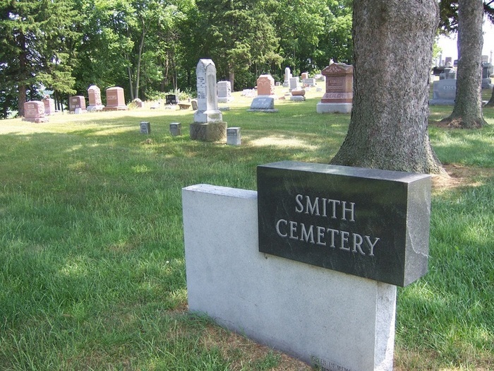
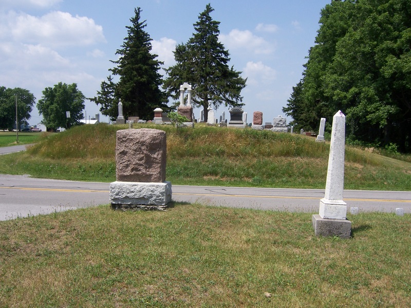
| Description | : | The Smith Cemetery is located southwest of Tedrow at the northwest corner of the intersection of County Road 19 and Township Road HJ. The Smith Cemetery lies on land granted to Demas Adams in 1835. During the 1860's the corner northwest of the Andre-Hagerman and Pettisville-Morence roads was set aside as a burial site. In 1933 the 1.75 acres was transferred to the Smith Cemetery Association. The cemetery has since been placed under the control of the township trustees. The oldest grave marker at the site dates from October, 1861. Across the road, to the east, lies the older Ayers... Read More |
frequently asked questions (FAQ):
-
Where is Smith Cemetery?
Smith Cemetery is located at Franklin Township, Fulton County ,Ohio ,USA.
-
Smith Cemetery cemetery's updated grave count on graveviews.com?
0 memorials
-
Where are the coordinates of the Smith Cemetery?
Latitude: 41.5957985
Longitude: -84.2316971
Nearby Cemetories:
1. Ayers Cemetery
Fulton County, USA
Coordinate: 41.5960999, -84.2296982
2. North Pettisville Cemetery
Wauseon, Fulton County, USA
Coordinate: 41.5728190, -84.2200180
3. Tedrow Cemetery
Tedrow, Fulton County, USA
Coordinate: 41.6019300, -84.1975100
4. Eckley Cemetery
Eckley, Fulton County, USA
Coordinate: 41.5641600, -84.2491200
5. Lauber Hill Cemetery
Fulton County, USA
Coordinate: 41.5742410, -84.2681490
6. Beck Cemetery
Fulton County, USA
Coordinate: 41.5648620, -84.2682880
7. Wyse Cemetery
Fulton County, USA
Coordinate: 41.5647820, -84.2686700
8. Saint James Lutheran Cemetery
Burlington, Fulton County, USA
Coordinate: 41.5428009, -84.2630997
9. Bayes Cemetery
Wauseon, Fulton County, USA
Coordinate: 41.5581017, -84.1706009
10. Pettisville Lutheran Cemetery
Pettisville, Fulton County, USA
Coordinate: 41.5321900, -84.2237400
11. Pettisville Cemetery
Pettisville, Fulton County, USA
Coordinate: 41.5302620, -84.2258690
12. Pettisville Union Cemetery
Pettisville, Fulton County, USA
Coordinate: 41.5294190, -84.2258910
13. Saint Peters Cemetery
Archbold, Fulton County, USA
Coordinate: 41.5428009, -84.2882996
14. Mikesell Cemetery
Wauseon, Fulton County, USA
Coordinate: 41.5511017, -84.1631012
15. Ottokee Cemetery
Fulton County, USA
Coordinate: 41.6005610, -84.1386770
16. Wauseon Union Cemetery
Wauseon, Fulton County, USA
Coordinate: 41.5480995, -84.1564026
17. Saint Caspar Catholic Cemetery
Wauseon, Fulton County, USA
Coordinate: 41.5479500, -84.1557600
18. Fulton County Home Cemetery
Ottokee, Fulton County, USA
Coordinate: 41.6025540, -84.1307420
19. Johnson Cemetery
Burlington, Fulton County, USA
Coordinate: 41.5791230, -84.3308020
20. Aeschliman Cemetery
Pettisville, Fulton County, USA
Coordinate: 41.5147018, -84.2192001
21. Butler Cemetery
Fulton County, USA
Coordinate: 41.6650009, -84.1716995
22. Rupp Cemetery
Archbold, Fulton County, USA
Coordinate: 41.5140110, -84.2771370
23. Lena Cemetery
Fulton County, USA
Coordinate: 41.5175018, -84.1731033
24. Coffin Cemetery (Defunct)
Fayette, Fulton County, USA
Coordinate: 41.6719610, -84.2956440


