
| Memorials | : | 1 |
| Location | : | Fulton County, USA |
| Coordinate | : | 41.5648620, -84.2682880 |
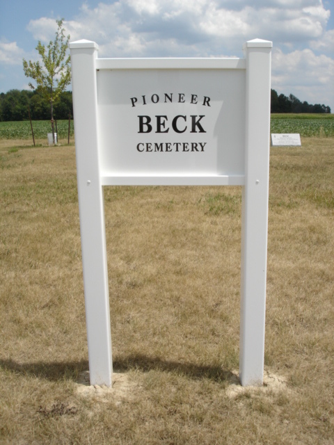
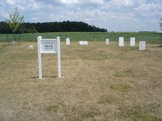
| Description | : | The Beck Cemetery is located two miles east and one-half mile south of Burlington on the east side of County Road 21. The cemetery occupied land deeded to Christian Beck in 1834. The first burials were made before 1850 and it is possible some unmarked graves exist in the cemetery. West, across the road, is found the Wyse Cemetery. The cemetery is located in German Township, Fulton County, Ohio, and is # 3762 (Beck Cemetery / Leichty Cemetery) in “Ohio Cemeteries 1803-2003”, compiled by the Ohio Genealogical Society. The U.S. Geological Survey (USGS) Geographic Names Information System (GNIS) feature... Read More |
frequently asked questions (FAQ):
-
Where is Beck Cemetery?
Beck Cemetery is located at County Road 21 Fulton County ,Ohio , 43502USA.
-
Beck Cemetery cemetery's updated grave count on graveviews.com?
1 memorials
-
Where are the coordinates of the Beck Cemetery?
Latitude: 41.5648620
Longitude: -84.2682880
Nearby Cemetories:
1. Wyse Cemetery
Fulton County, USA
Coordinate: 41.5647820, -84.2686700
2. Lauber Hill Cemetery
Fulton County, USA
Coordinate: 41.5742410, -84.2681490
3. Eckley Cemetery
Eckley, Fulton County, USA
Coordinate: 41.5641600, -84.2491200
4. Saint James Lutheran Cemetery
Burlington, Fulton County, USA
Coordinate: 41.5428009, -84.2630997
5. Saint Peters Cemetery
Archbold, Fulton County, USA
Coordinate: 41.5428009, -84.2882996
6. North Pettisville Cemetery
Wauseon, Fulton County, USA
Coordinate: 41.5728190, -84.2200180
7. Smith Cemetery
Franklin Township, Fulton County, USA
Coordinate: 41.5957985, -84.2316971
8. Ayers Cemetery
Fulton County, USA
Coordinate: 41.5960999, -84.2296982
9. Pettisville Lutheran Cemetery
Pettisville, Fulton County, USA
Coordinate: 41.5321900, -84.2237400
10. Pettisville Cemetery
Pettisville, Fulton County, USA
Coordinate: 41.5302620, -84.2258690
11. Pettisville Union Cemetery
Pettisville, Fulton County, USA
Coordinate: 41.5294190, -84.2258910
12. Johnson Cemetery
Burlington, Fulton County, USA
Coordinate: 41.5791230, -84.3308020
13. Rupp Cemetery
Archbold, Fulton County, USA
Coordinate: 41.5140110, -84.2771370
14. Aeschliman Cemetery
Pettisville, Fulton County, USA
Coordinate: 41.5147018, -84.2192001
15. Tedrow Cemetery
Tedrow, Fulton County, USA
Coordinate: 41.6019300, -84.1975100
16. Reform Cemetery
Archbold, Fulton County, USA
Coordinate: 41.5039790, -84.3061070
17. Archbold Cemetery
Archbold, Fulton County, USA
Coordinate: 41.5028000, -84.3058014
18. Bayes Cemetery
Wauseon, Fulton County, USA
Coordinate: 41.5581017, -84.1706009
19. Goll Cemetery
Archbold, Fulton County, USA
Coordinate: 41.5558014, -84.3677979
20. Mikesell Cemetery
Wauseon, Fulton County, USA
Coordinate: 41.5511017, -84.1631012
21. Wauseon Union Cemetery
Wauseon, Fulton County, USA
Coordinate: 41.5480995, -84.1564026
22. Lena Cemetery
Fulton County, USA
Coordinate: 41.5175018, -84.1731033
23. Saint Caspar Catholic Cemetery
Wauseon, Fulton County, USA
Coordinate: 41.5479500, -84.1557600
24. Lockport Cemetery
Stryker, Williams County, USA
Coordinate: 41.5466690, -84.3927765