
| Memorials | : | 0 |
| Location | : | Rayleigh, Rochford District, England |
| Coordinate | : | 51.5936500, 0.6135600 |
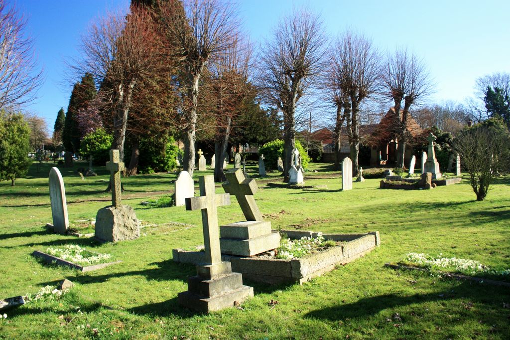
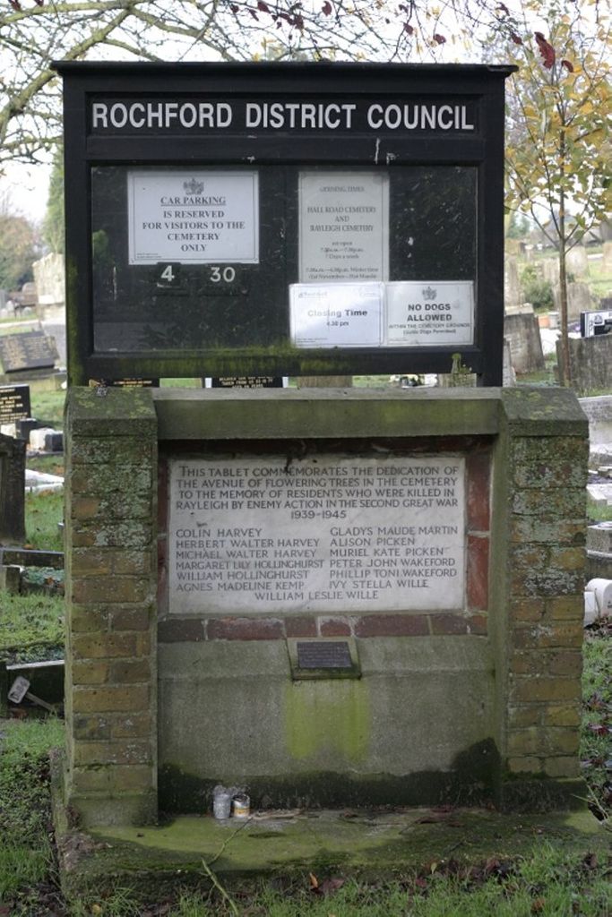
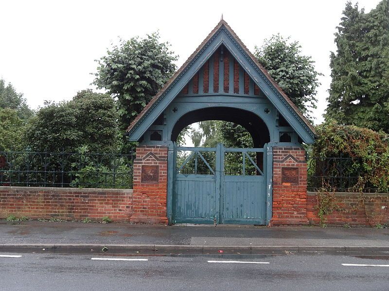
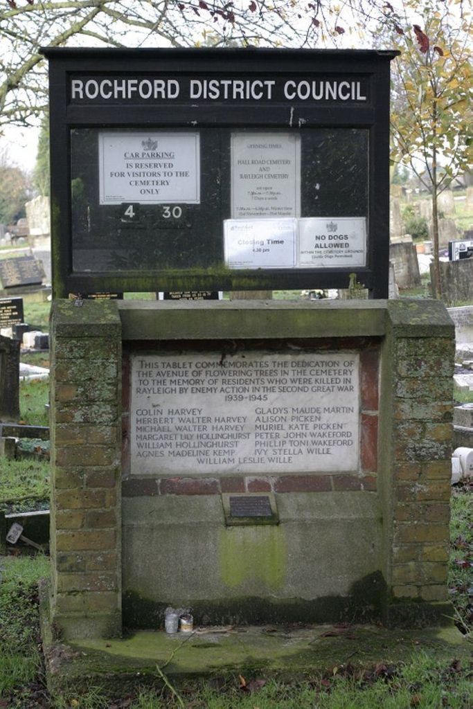
| Description | : | Rochford District Council maintain two cemeteries for Rayleigh, this one on Hockley Road dates back to the 1880's and is now at capacity (with the exception of reserved plots and cremations). The other is on Hall Road, between Rayleigh and Rochford. |
frequently asked questions (FAQ):
-
Where is Rochford District Council Cemetery?
Rochford District Council Cemetery is located at Hockley Road Rayleigh, Rochford District ,Essex , SS6 8EPEngland.
-
Rochford District Council Cemetery cemetery's updated grave count on graveviews.com?
0 memorials
-
Where are the coordinates of the Rochford District Council Cemetery?
Latitude: 51.5936500
Longitude: 0.6135600
Nearby Cemetories:
1. Holy Trinity Churchyard
Rayleigh, Rochford District, England
Coordinate: 51.5879958, 0.6085753
2. St Peter and St Paul Churchyard
Hockley, Rochford District, England
Coordinate: 51.6098370, 0.6356820
3. Daws Heath Evangelical Churchyard
Daws Heath, Castle Point Borough, England
Coordinate: 51.5673560, 0.6136020
4. St Nicholas Churchyard
Rawreth, Rochford District, England
Coordinate: 51.6115180, 0.5702160
5. St Peter Churchyard
Thundersley, Castle Point Borough, England
Coordinate: 51.5687940, 0.5710100
6. Hall Road Cemetery
Rochford, Rochford District, England
Coordinate: 51.5842870, 0.6749670
7. Rochford Lawn Cemetery
Rochford, Rochford District, England
Coordinate: 51.5829870, 0.6759490
8. St James the Less Churchyard
Hadleigh, Castle Point Borough, England
Coordinate: 51.5530400, 0.6095590
9. All Saints Churchyard
North Benfleet, Basildon District, England
Coordinate: 51.5813200, 0.5403260
10. St. Peter's Churchyard
Nevendon, Basildon District, England
Coordinate: 51.5885080, 0.5378120
11. Leigh Cemetery
Leigh-on-Sea, Southend-on-Sea Unitary Authority, England
Coordinate: 51.5481500, 0.6496740
12. St Laurence and All Saints Churchyard
Eastwood, Southend-on-Sea Unitary Authority, England
Coordinate: 51.5677030, 0.6847360
13. St Andrew Churchyard
Ashingdon, Rochford District, England
Coordinate: 51.6103050, 0.6933730
14. All Saints Churchyard
Rettendon, Chelmsford Borough, England
Coordinate: 51.6349940, 0.5566860
15. South Benfleet Cemetery
South Benfleet, Castle Point Borough, England
Coordinate: 51.5556220, 0.5501750
16. All Saints Churchyard
South Fambridge, Rochford District, England
Coordinate: 51.6232020, 0.6879920
17. St. Andrew's Churchyard
Rochford, Rochford District, England
Coordinate: 51.5803090, 0.7002030
18. Thornton Meadows Wildflower Cemetery
Ashingdon, Rochford District, England
Coordinate: 51.6131670, 0.6983290
19. St. Mary the Virgin Churchyard
South Benfleet, Castle Point Borough, England
Coordinate: 51.5461020, 0.5630390
20. St Mary Churchyard
Runwell, Chelmsford Borough, England
Coordinate: 51.6211190, 0.5318030
21. St. Clement's Churchyard
Leigh-on-Sea, Southend-on-Sea Unitary Authority, England
Coordinate: 51.5412990, 0.6542310
22. Holy Trinity Churchyard
North Fambridge, Maldon District, England
Coordinate: 51.6425440, 0.6721570
23. Pitsea Cemetery
Pitsea, Basildon District, England
Coordinate: 51.5641840, 0.5243510
24. St. Margaret of Antioch Churchyard
Pitsea, Basildon District, England
Coordinate: 51.5569160, 0.5309590