
| Memorials | : | 0 |
| Location | : | Launceston, Cornwall Unitary Authority, England |
| Coordinate | : | 50.6022996, -4.3390569 |
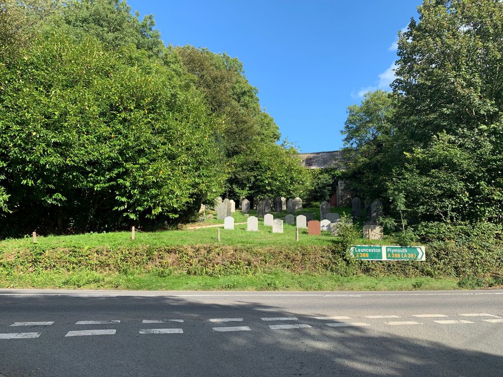
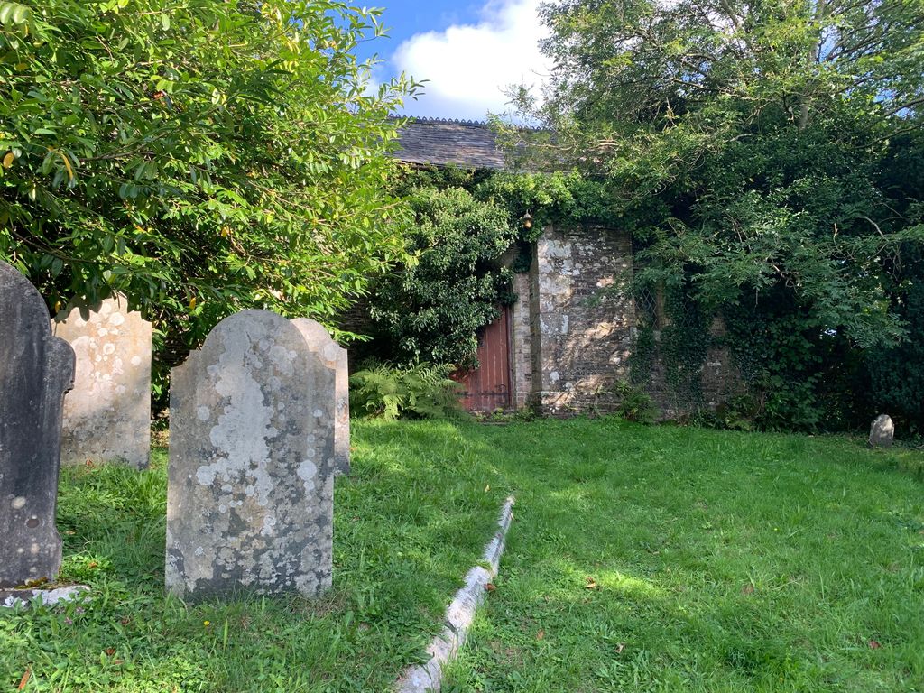
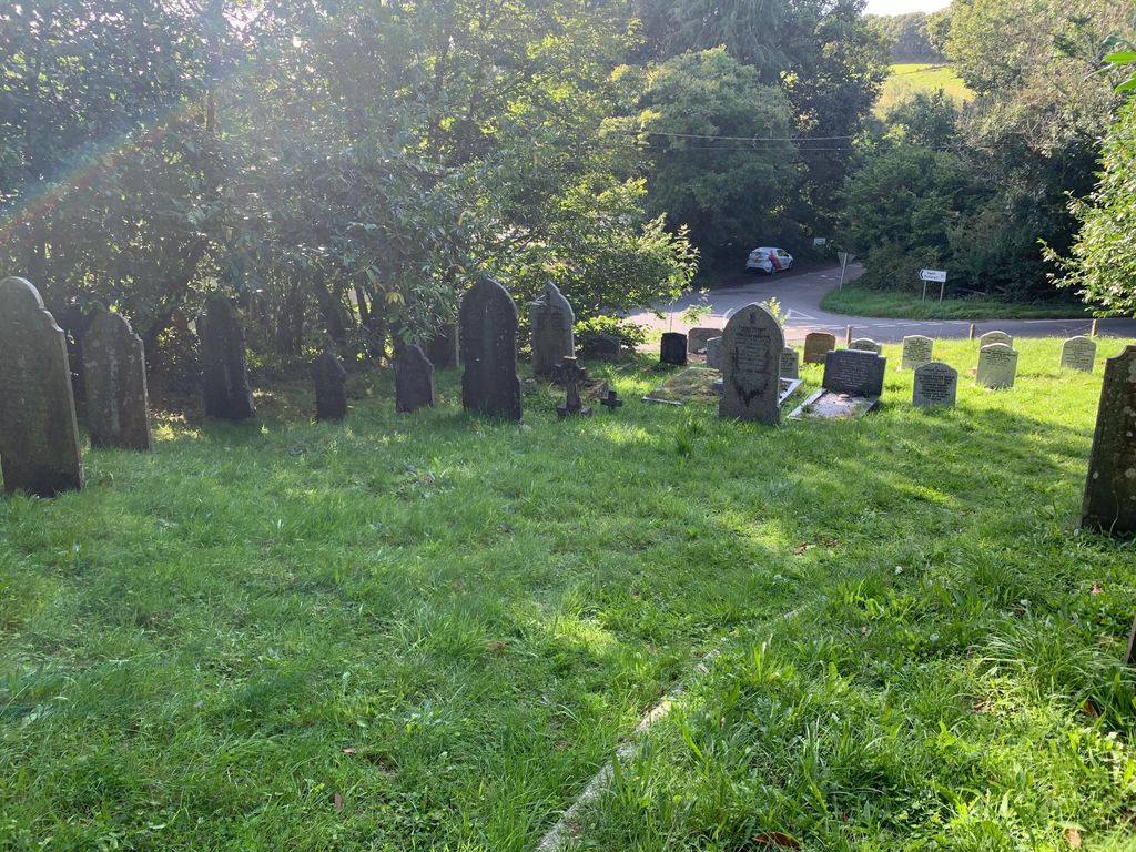
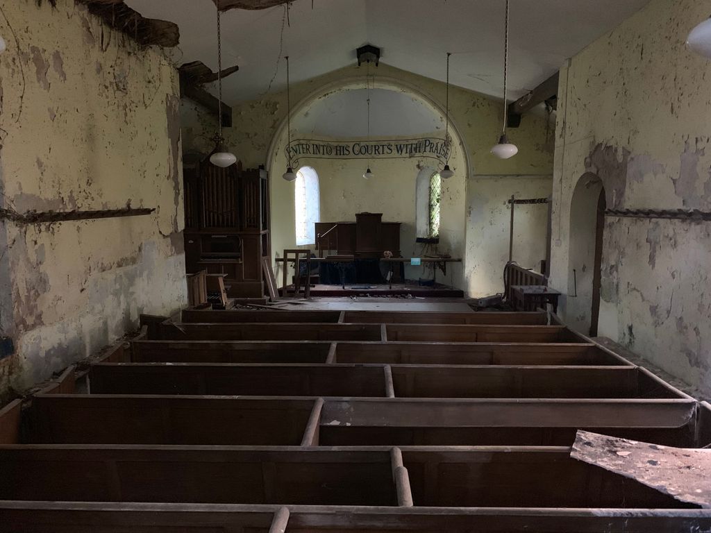
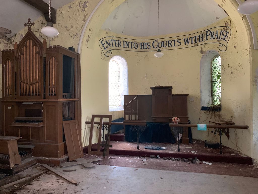
| Description | : | Tregada Chapel near Launceston on the A388 now abandoned and derelict. |
frequently asked questions (FAQ):
-
Where is Tregada Chapel Cemetery?
Tregada Chapel Cemetery is located at Launceston, Cornwall Unitary Authority ,Cornwall , PL15 9NAEngland.
-
Tregada Chapel Cemetery cemetery's updated grave count on graveviews.com?
0 memorials
-
Where are the coordinates of the Tregada Chapel Cemetery?
Latitude: 50.6022996
Longitude: -4.3390569
Nearby Cemetories:
1. St Briochus Churchyard
Lezant, Cornwall Unitary Authority, England
Coordinate: 50.5878210, -4.3484720
2. Treburley Cemetery
Callington, Cornwall Unitary Authority, England
Coordinate: 50.5755556, -4.3308333
3. All Saints Churchyard
Dunterton, West Devon Borough, England
Coordinate: 50.5909760, -4.2958300
4. Truscott Chapel Cemetery
Launceston, Cornwall Unitary Authority, England
Coordinate: 50.6369820, -4.3600720
5. St Thomas the Apostle Churchyard
Launceston, Cornwall Unitary Authority, England
Coordinate: 50.6411650, -4.3662600
6. St. Stephen the Martyr
Launceston, Cornwall Unitary Authority, England
Coordinate: 50.6465400, -4.3702200
7. Saint Mary's Church Cemetery
Lifton, West Devon Borough, England
Coordinate: 50.6427200, -4.2839200
8. Coads Green Methodist Church Cemetery
Coad's Green, Cornwall Unitary Authority, England
Coordinate: 50.5643053, -4.4126086
9. St Mary
Sydenham Damerel, West Devon Borough, England
Coordinate: 50.5617270, -4.2604490
10. St. Melor Churchyard
Linkinhorne, Cornwall Unitary Authority, England
Coordinate: 50.5376040, -4.3728820
11. Golberdon Methodist Burial Ground
Golberdon, Cornwall Unitary Authority, England
Coordinate: 50.5167500, -4.3605400
12. St. Giles' Parish Churchyard
St Giles on the Heath, Torridge District, England
Coordinate: 50.6914989, -4.3245055
13. Lamerton Cemetery
Lamerton, West Devon Borough, England
Coordinate: 50.5736420, -4.1907340
14. St Mary Churchyard
Callington, Cornwall Unitary Authority, England
Coordinate: 50.5035020, -4.3158890
15. Boyton Methodist Chapel
Boyton, Cornwall Unitary Authority, England
Coordinate: 50.7023020, -4.3816220
16. Callington Cemetery
Callington, Cornwall Unitary Authority, England
Coordinate: 50.4992660, -4.3194640
17. St George's Churchyard
Thrushelton, West Devon Borough, England
Coordinate: 50.6674000, -4.1984000
18. St. Michael de Rupe Churchyard
Brentor, West Devon Borough, England
Coordinate: 50.6029880, -4.1621880
19. Bennacott Chapel
Boyton, Cornwall Unitary Authority, England
Coordinate: 50.7048188, -4.4127882
20. Albaston Cemetery
Calstock, Cornwall Unitary Authority, England
Coordinate: 50.5133240, -4.2225080
21. St. Paul Churchyard
Gulworthy, West Devon Borough, England
Coordinate: 50.5335800, -4.1918400
22. Christ Church
Brentor, West Devon Borough, England
Coordinate: 50.6124252, -4.1464026
23. Calstock Cemetery
Calstock, Cornwall Unitary Authority, England
Coordinate: 50.5021300, -4.2082100
24. St Andrew Churchyard
Calstock, Cornwall Unitary Authority, England
Coordinate: 50.5021270, -4.2062400