
| Memorials | : | 0 |
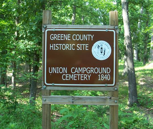
| Location | : | Springfield, Greene County, USA |
| Coordinate | : | 37.2609400, -93.2234000 |
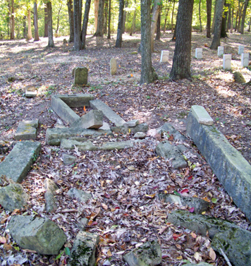
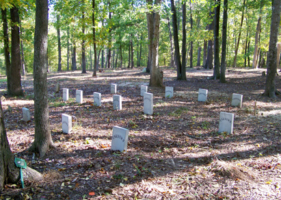
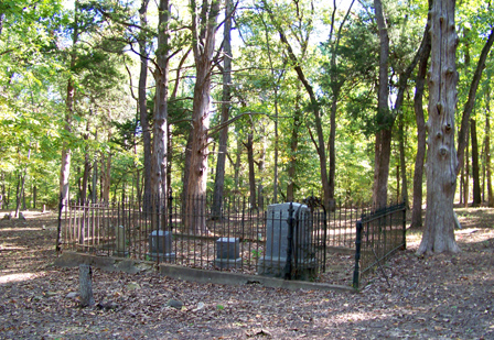
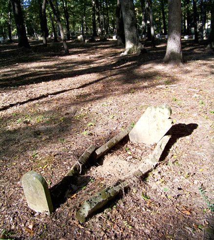
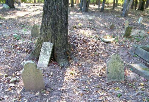
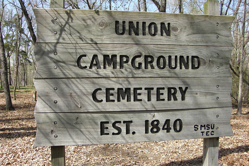
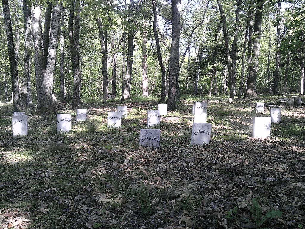
| Description | : | This cemetery is NOT aka UNION GROVE. Union Grove Cemetery is about 10 miles north of this cemetery in Polk County. Please keep in mind when requesting photos of headstones that in the 1990's vandals destroyed most all of the headstones in the cemetery, and some that were not destroyed were stolen and are still missing to this day. The Union Camp Ground Cemetery AKA: Gollnick Cemetery or Camp Ground Cemetery Section 3 Township 29N Range 21W 2nd North Campbell Township. If you know of someone who is buried there who is not on the list, or have further information on someone buried there... Read More |
frequently asked questions (FAQ):
-
Where is Union Campground Cemetery?
Union Campground Cemetery is located at Springfield, Greene County ,Missouri ,USA.
-
Union Campground Cemetery cemetery's updated grave count on graveviews.com?
0 memorials
-
Where are the coordinates of the Union Campground Cemetery?
Latitude: 37.2609400
Longitude: -93.2234000
Nearby Cemetories:
1. Hancock-Morton-Westmoreland Cemetery
Greene County, USA
Coordinate: 37.2489014, -93.2133026
2. Bellview Cemetery
Springfield, Greene County, USA
Coordinate: 37.2880287, -93.2539215
3. Greenlawn Memorial Gardens
Springfield, Greene County, USA
Coordinate: 37.2611008, -93.2750015
4. Eastlawn Cemetery
Springfield, Greene County, USA
Coordinate: 37.2155991, -93.2514038
5. Dysart Cemetery
Springfield, Greene County, USA
Coordinate: 37.2516020, -93.2913170
6. Lincoln Memorial Park Cemetery
Springfield, Greene County, USA
Coordinate: 37.2108002, -93.2518997
7. Doling Park
Springfield, Greene County, USA
Coordinate: 37.2461815, -93.2902374
8. Bodenhamer Cemetery
Greene County, USA
Coordinate: 37.2153015, -93.1841965
9. Danforth Cemetery
Strafford, Greene County, USA
Coordinate: 37.2368850, -93.1554670
10. Liberty Cemetery
Springfield, Greene County, USA
Coordinate: 37.3192000, -93.1993900
11. Danforth Family Cemetery
Strafford, Greene County, USA
Coordinate: 37.2403000, -93.1480000
12. Mount Comfort Cemetery
Springfield, Greene County, USA
Coordinate: 37.3250010, -93.2475450
13. Parsley Cemetery
Greene County, USA
Coordinate: 37.2078018, -93.1688995
14. Banfield Cemetery
Greene County, USA
Coordinate: 37.2779400, -93.3071900
15. Potter Family Cemetery
Strafford, Greene County, USA
Coordinate: 37.2656517, -93.1362610
16. Roberts Cemetery
Greene County, USA
Coordinate: 37.1932983, -93.1975021
17. Webb Cemetery
Springfield, Greene County, USA
Coordinate: 37.1972008, -93.1791992
18. Christ Episcopal Church Columbarium
Springfield, Greene County, USA
Coordinate: 37.2071800, -93.2862800
19. Nancy Haden Grave
Springfield, Greene County, USA
Coordinate: 37.1868520, -93.2127710
20. Keet Burial
Springfield, Greene County, USA
Coordinate: 37.2069190, -93.2883940
21. Fielder Langston Cemetery
Springfield, Greene County, USA
Coordinate: 37.1873700, -93.2479700
22. Bumgarner-Keiser Cemetery
Strafford, Greene County, USA
Coordinate: 37.2670580, -93.1217560
23. Potter Cemetery
Springfield, Greene County, USA
Coordinate: 37.2317009, -93.1271973
24. Maple Park Cemetery
Springfield, Greene County, USA
Coordinate: 37.1944008, -93.2921982