
| Memorials | : | 14 |
| Location | : | Hoosierville, Clay County, USA |
| Coordinate | : | 39.4746390, -87.0958110 |
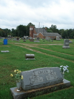
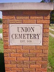
| Description | : | The cemetery is located in Jackson Township (S half of the SE quadrant of Section 17 Township 12N Range 6W) on the north side of E County Road 600 N at its intersection with N County Road 75 E. Indiana Cemetery Locations, Volume 4, published by the Indiana Genealogical Society (April 2009), gives the primary cemetery name as Union Cemetery with an alternate name of Hoosierville Cemetery. The cemetery is listed in the Cemetery and Burial Grounds Registry of the Indiana Department of Natural Resources (DNR) and in the State Historical Architectural and Archaeological Research Database (SHAARD) with... Read More |
frequently asked questions (FAQ):
-
Where is Union Cemetery?
Union Cemetery is located at E County Road 600 N Hoosierville, Clay County ,Indiana , 47834USA.
-
Union Cemetery cemetery's updated grave count on graveviews.com?
12 memorials
-
Where are the coordinates of the Union Cemetery?
Latitude: 39.4746390
Longitude: -87.0958110
Nearby Cemetories:
1. Arthur Helton Farm Cemetery
Jackson Township, Clay County, USA
Coordinate: 39.4712140, -87.0873260
2. Reffet Cemetery
Brazil, Clay County, USA
Coordinate: 39.4891960, -87.1260020
3. Poplar Cemetery
Knightsville, Clay County, USA
Coordinate: 39.5042000, -87.0980988
4. Zenor Cemetery North
Prairie City, Clay County, USA
Coordinate: 39.4454346, -87.1073227
5. Neidlinger Cemetery
Harmony, Clay County, USA
Coordinate: 39.4599991, -87.0543976
6. Kaelber Cemetery
Clay County, USA
Coordinate: 39.4455986, -87.0667038
7. Wools Cemetery
Staunton, Clay County, USA
Coordinate: 39.4895690, -87.1446970
8. Summit Lawn Cemetery
Brazil, Clay County, USA
Coordinate: 39.4998190, -87.1445310
9. Saint John's Evangelical Lutheran Cemetery
Center Point, Clay County, USA
Coordinate: 39.4683609, -87.1544952
10. German Cemetery
Clay County, USA
Coordinate: 39.4681015, -87.1547012
11. Saint John's Cemetery
Brazil, Clay County, USA
Coordinate: 39.4443130, -87.0429688
12. Pell Cemetery
Knightsville, Clay County, USA
Coordinate: 39.5247580, -87.0640750
13. Old Hill Cemetery
Brazil, Clay County, USA
Coordinate: 39.5198300, -87.1432100
14. Harmony Cemetery
Harmony, Clay County, USA
Coordinate: 39.5310740, -87.0762920
15. Wesley Chapel Cemetery
Harmony, Clay County, USA
Coordinate: 39.5068060, -87.0314170
16. Center Point Cemetery
Center Point, Clay County, USA
Coordinate: 39.4178848, -87.0738297
17. Vest Cemetery
Staunton, Clay County, USA
Coordinate: 39.4795685, -87.1728516
18. Cottage Hill Cemetery
Brazil, Clay County, USA
Coordinate: 39.5186005, -87.1517029
19. Restlawn Cemetery
Brazil, Clay County, USA
Coordinate: 39.5353000, -87.1142000
20. Brazil Cemetery
Brazil, Clay County, USA
Coordinate: 39.5352500, -87.1149000
21. Staunton German Lutheran Cemetery
Staunton, Clay County, USA
Coordinate: 39.4806510, -87.1839270
22. Roberts Cemetery
Clay County, USA
Coordinate: 39.5256004, -87.0355988
23. Barnett Cemetery
Reelsville, Putnam County, USA
Coordinate: 39.5075000, -87.0142000
24. Croys Creek Cemetery
Reelsville, Putnam County, USA
Coordinate: 39.5060768, -87.0130157