
| Memorials | : | 0 |
| Location | : | Staunton, Clay County, USA |
| Coordinate | : | 39.4806510, -87.1839270 |
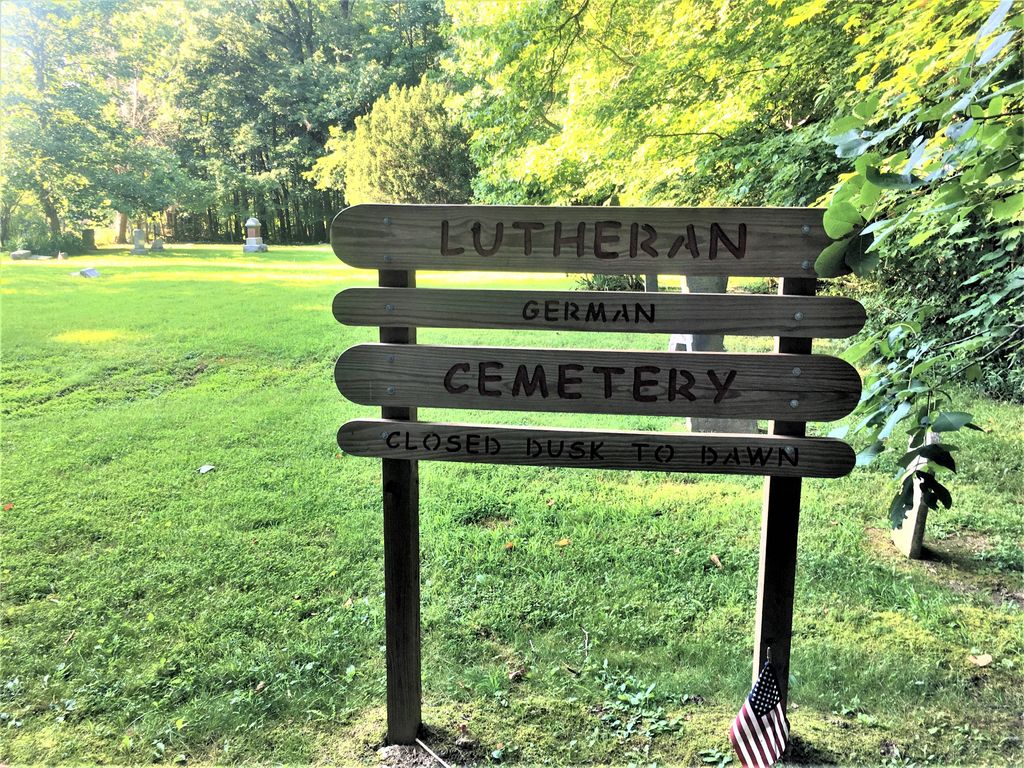
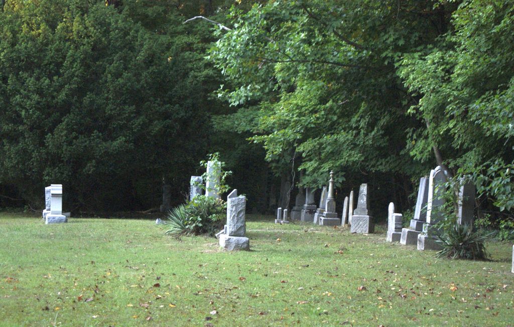
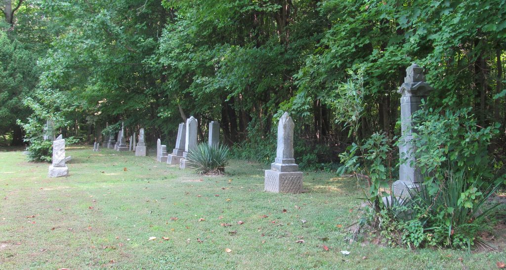
| Description | : | This cemetery is located just outside the limits of Staunton, Indiana on a dead end road. It is in excellent condition for the time period of the stones. Many stones are worn and difficult to read, many are in German. Google maps shows that the road goes all the way through, but according to road signs, it does not. To get to the cemetery (easiest route) is to take County Road 600 North to County Road 400 West (C R 400 W). Turn North on 400 West, then turn West on 625 North (it is marked as... Read More |
frequently asked questions (FAQ):
-
Where is Staunton German Lutheran Cemetery?
Staunton German Lutheran Cemetery is located at Staunton, Clay County ,Indiana ,USA.
-
Staunton German Lutheran Cemetery cemetery's updated grave count on graveviews.com?
0 memorials
-
Where are the coordinates of the Staunton German Lutheran Cemetery?
Latitude: 39.4806510
Longitude: -87.1839270
Nearby Cemetories:
1. Vest Cemetery
Staunton, Clay County, USA
Coordinate: 39.4795685, -87.1728516
2. German Cemetery
Clay County, USA
Coordinate: 39.4681015, -87.1547012
3. Saint John's Evangelical Lutheran Cemetery
Center Point, Clay County, USA
Coordinate: 39.4683609, -87.1544952
4. Billtown Cemetery
Billtown, Clay County, USA
Coordinate: 39.5083008, -87.1996994
5. Wools Cemetery
Staunton, Clay County, USA
Coordinate: 39.4895690, -87.1446970
6. Clearview Cemetery
Posey Township, Clay County, USA
Coordinate: 39.5141983, -87.1733017
7. Summit Lawn Cemetery
Brazil, Clay County, USA
Coordinate: 39.4998190, -87.1445310
8. Rhule Cemetery
Brazil, Clay County, USA
Coordinate: 39.4441986, -87.1971970
9. Carpenter Cemetery
Cloverland, Clay County, USA
Coordinate: 39.4939600, -87.2341100
10. Eppert Cemetery
Cloverland, Clay County, USA
Coordinate: 39.5020332, -87.2316666
11. Cottage Hill Cemetery
Brazil, Clay County, USA
Coordinate: 39.5186005, -87.1517029
12. Reffet Cemetery
Brazil, Clay County, USA
Coordinate: 39.4891960, -87.1260020
13. Harpold Cemetery
Ehrmandale, Vigo County, USA
Coordinate: 39.5205994, -87.2144012
14. Hoskins Cemetery
Seelyville, Vigo County, USA
Coordinate: 39.5060030, -87.2395880
15. Old Hill Cemetery
Brazil, Clay County, USA
Coordinate: 39.5198300, -87.1432100
16. Hyde Cemetery
Vigo County, USA
Coordinate: 39.4759180, -87.2566900
17. Bee Ridge Cemetery
Brazil, Clay County, USA
Coordinate: 39.5367584, -87.1687469
18. Wood Cemetery
Seelyville, Vigo County, USA
Coordinate: 39.4928818, -87.2622147
19. Patterson Cemetery
Seelyville, Vigo County, USA
Coordinate: 39.4952278, -87.2631226
20. Cheek Cemetery
Seelyville, Vigo County, USA
Coordinate: 39.4772415, -87.2659683
21. Turner Scofield Cemetery
Seelyville, Vigo County, USA
Coordinate: 39.4403954, -87.2492294
22. Rardin South Cemetery
Cory, Clay County, USA
Coordinate: 39.4168080, -87.2102430
23. Mount Calvary Cemetery
Brazil, Clay County, USA
Coordinate: 39.4163530, -87.1549810
24. Union Cemetery
Hoosierville, Clay County, USA
Coordinate: 39.4746390, -87.0958110