
| Memorials | : | 5 |
| Location | : | Riggs, Boone County, USA |
| Coordinate | : | 39.1716309, -92.3455200 |
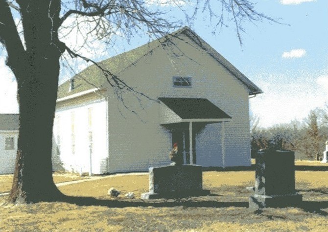
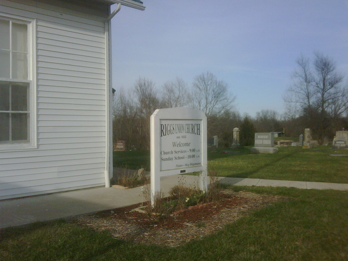
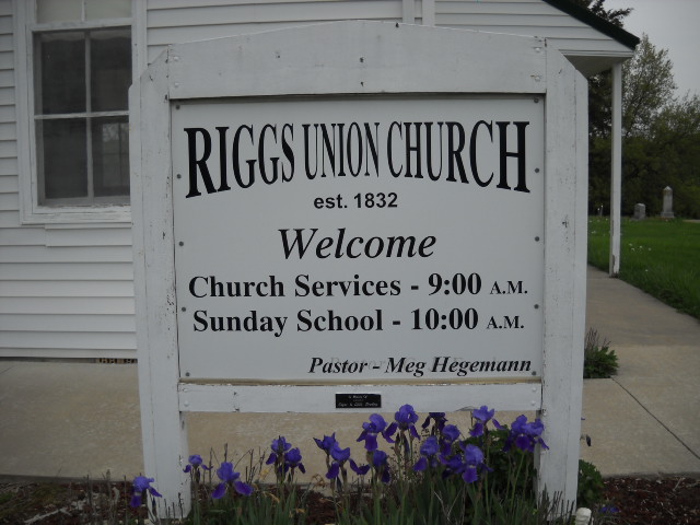
| Description | : | Riggs Union Church is located approximately 12 miles north of Columbia and one and one-half miles west on US Highway 63 on a parcel of land in the NE 1/4 of the NW 1/4 of Township 51N, Range 13W, Section 35 of the Boone County Plat Map. It's true name is Union Cumberland Presbyterian Church Cemetery. |
frequently asked questions (FAQ):
-
Where is Union Cumberland Presbyterian Church Cemetery?
Union Cumberland Presbyterian Church Cemetery is located at on Williams Road off of Old Highway 63 North Riggs, Boone County ,Missouri ,USA.
-
Union Cumberland Presbyterian Church Cemetery cemetery's updated grave count on graveviews.com?
5 memorials
-
Where are the coordinates of the Union Cumberland Presbyterian Church Cemetery?
Latitude: 39.1716309
Longitude: -92.3455200
Nearby Cemetories:
1. Naylor Cemetery
Riggs, Boone County, USA
Coordinate: 39.1589012, -92.3368988
2. Mount Carmel Cemetery
Boone County, USA
Coordinate: 39.1627998, -92.3653030
3. Locust Grove Church Cemetery
Boone County, USA
Coordinate: 39.1702461, -92.3188477
4. Locust Grove Baptist Church Cemetery
Sturgeon, Boone County, USA
Coordinate: 39.1698300, -92.3185900
5. Ruth Nowell Burial
Sturgeon, Boone County, USA
Coordinate: 39.1734026, -92.2921461
6. Lick Fork Cemetery
Sturgeon, Boone County, USA
Coordinate: 39.2139282, -92.3494873
7. Palmer Cemetery
Bourbon Township, Boone County, USA
Coordinate: 39.1880989, -92.2833023
8. Palmer Family Cemetery
Sturgeon, Boone County, USA
Coordinate: 39.1666718, -92.2712555
9. Brink-Gibson Cemetery
Sturgeon, Boone County, USA
Coordinate: 39.2195540, -92.2956280
10. Mount Horeb Cemetery
Sturgeon, Boone County, USA
Coordinate: 39.2158012, -92.2842026
11. Perche Church Cemetery
Rucker, Boone County, USA
Coordinate: 39.1990400, -92.4224400
12. Robinson Cemetery
Rucker, Boone County, USA
Coordinate: 39.2265500, -92.4009200
13. Sturgeon Cemetery
Sturgeon, Boone County, USA
Coordinate: 39.2331009, -92.2936020
14. Red Rock Cemetery
Harrisburg, Boone County, USA
Coordinate: 39.1059400, -92.4015400
15. Friendship Churchyard
Hallsville, Boone County, USA
Coordinate: 39.0978000, -92.2897900
16. Far West Cemetery
Sturgeon, Boone County, USA
Coordinate: 39.1986008, -92.2388992
17. Dripping Spring Christian Church Cemetery
Columbia, Boone County, USA
Coordinate: 39.0870200, -92.3747400
18. Harrisburg Cemetery
Harrisburg, Boone County, USA
Coordinate: 39.1413400, -92.4553200
19. Searcy Cemetery
Hinton, Boone County, USA
Coordinate: 39.0793915, -92.3542633
20. Chapel Grove Cemetery
Clark, Randolph County, USA
Coordinate: 39.2658005, -92.3424988
21. Red Top Cemetery
Hallsville, Boone County, USA
Coordinate: 39.1201400, -92.2419000
22. Church of Christ Cemetery
Boone County, USA
Coordinate: 39.1183160, -92.2430560
23. Botner Cemetery
Boone County, USA
Coordinate: 39.0800018, -92.3816986
24. Boone County Graveyard
Boone County, USA
Coordinate: 39.1383160, -92.4631690