
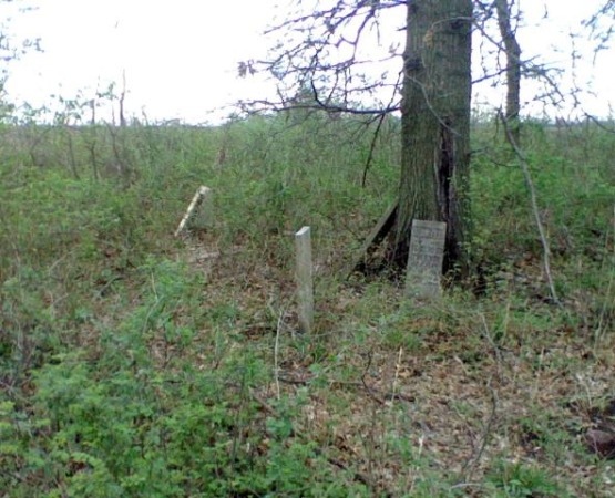
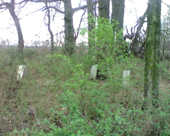
| Memorials | : | 0 |
| Location | : | Sturgeon, Boone County, USA |
| Coordinate | : | 39.2195540, -92.2956280 |
frequently asked questions (FAQ):
-
Where is Brink-Gibson Cemetery?
Brink-Gibson Cemetery is located at 22302 Lovers Lane Sturgeon, Boone County ,Missouri , 65284USA.
-
Brink-Gibson Cemetery cemetery's updated grave count on graveviews.com?
0 memorials
-
Where are the coordinates of the Brink-Gibson Cemetery?
Latitude: 39.2195540
Longitude: -92.2956280
Nearby Cemetories:
1. Mount Horeb Cemetery
Sturgeon, Boone County, USA
Coordinate: 39.2158012, -92.2842026
2. Sturgeon Cemetery
Sturgeon, Boone County, USA
Coordinate: 39.2331009, -92.2936020
3. Palmer Cemetery
Bourbon Township, Boone County, USA
Coordinate: 39.1880989, -92.2833023
4. Lick Fork Cemetery
Sturgeon, Boone County, USA
Coordinate: 39.2139282, -92.3494873
5. Ruth Nowell Burial
Sturgeon, Boone County, USA
Coordinate: 39.1734026, -92.2921461
6. Far West Cemetery
Sturgeon, Boone County, USA
Coordinate: 39.1986008, -92.2388992
7. Locust Grove Church Cemetery
Boone County, USA
Coordinate: 39.1702461, -92.3188477
8. Locust Grove Baptist Church Cemetery
Sturgeon, Boone County, USA
Coordinate: 39.1698300, -92.3185900
9. Mount Pisgah Cemetery
Audrain County, USA
Coordinate: 39.2731500, -92.2908000
10. Palmer Family Cemetery
Sturgeon, Boone County, USA
Coordinate: 39.1666718, -92.2712555
11. Chapel Grove Cemetery
Clark, Randolph County, USA
Coordinate: 39.2658005, -92.3424988
12. Union Cumberland Presbyterian Church Cemetery
Riggs, Boone County, USA
Coordinate: 39.1716309, -92.3455200
13. Naylor Cemetery
Riggs, Boone County, USA
Coordinate: 39.1589012, -92.3368988
14. Fountain Cemetery
Boone County, USA
Coordinate: 39.1963997, -92.2118988
15. Elington-Rice Cemetery
Randolph County, USA
Coordinate: 39.2744100, -92.3659200
16. Mount Carmel Cemetery
Boone County, USA
Coordinate: 39.1627998, -92.3653030
17. Robinson Cemetery
Rucker, Boone County, USA
Coordinate: 39.2265500, -92.4009200
18. Crews-Adams Cemetery
Randolph County, USA
Coordinate: 39.2990210, -92.3256260
19. Applemans Chapel Cemetery
Saling, Audrain County, USA
Coordinate: 39.2646600, -92.1972400
20. Pleasant Grove Cemetery
Audrain County, USA
Coordinate: 39.3022900, -92.2536200
21. Mount Vernon Cemetery
Clark, Randolph County, USA
Coordinate: 39.2980990, -92.3704250
22. Macedonia Cemetery
Audrain County, USA
Coordinate: 39.3177700, -92.2818780
23. Perche Church Cemetery
Rucker, Boone County, USA
Coordinate: 39.1990400, -92.4224400
24. Bruce Cemetery
Clark, Randolph County, USA
Coordinate: 39.2559260, -92.4175290