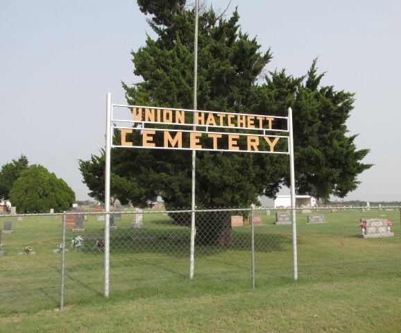
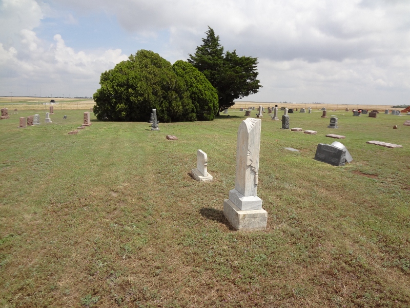
| Memorials | : | 3 |
| Location | : | Bessie, Washita County, USA |
| Coordinate | : | 35.4077988, -98.9756012 |
| Description | : | Located in Bessie Township; Legal description: SW ¼ Section 23, Township 11 N, Range 17 W. From Bessie, Ok, ½ mile east, then north on Hwy 183 for 1 ½ miles. On August 23, 1901, B. W. Stout and wife deeded 1 acre of farmland to the Trustees of the Mission School House. On June 17, 1904, they deeded another acre of the farmland to the Mission School House Cemetery. The Hatchett School was located nearby. Sexton: Leonard Allen |
frequently asked questions (FAQ):
-
Where is Union Hatchett Cemetery?
Union Hatchett Cemetery is located at Bessie, Washita County ,Oklahoma ,USA.
-
Union Hatchett Cemetery cemetery's updated grave count on graveviews.com?
3 memorials
-
Where are the coordinates of the Union Hatchett Cemetery?
Latitude: 35.4077988
Longitude: -98.9756012
Nearby Cemetories:
1. Peace Lutheran Cemetery
Bessie, Washita County, USA
Coordinate: 35.3918839, -98.9754410
2. Johnson Gravesite
Bessie, Washita County, USA
Coordinate: 35.3925500, -98.9582500
3. Bible Mennonite Brethren Cemetery
Bessie, Washita County, USA
Coordinate: 35.3624496, -98.9346313
4. Reinke Family Cemetery
Bessie, Washita County, USA
Coordinate: 35.4646530, -98.9960861
5. Howling Walks Indian Cemetery
Bessie, Washita County, USA
Coordinate: 35.4510231, -98.9205551
6. Guy Cemetery
Bessie, Washita County, USA
Coordinate: 35.4536781, -99.0276718
7. Herold Mennonite Church Cemetery
Bessie, Washita County, USA
Coordinate: 35.3596497, -98.9226608
8. Clinton City Cemetery
Clinton, Custer County, USA
Coordinate: 35.4771996, -98.9922028
9. Zion Lutheran Cemetery
Bessie Township, Washita County, USA
Coordinate: 35.4510231, -99.0547943
10. Parkersburg Cemetery
Custer County, USA
Coordinate: 35.4794006, -99.0291977
11. Tuberculosis Sanatorium Cemetery
Clinton, Custer County, USA
Coordinate: 35.4908485, -98.9587936
12. John Old Crow Cemetery
Clinton, Custer County, USA
Coordinate: 35.4953003, -98.9646988
13. Little Sioux Indian Cemetery
Clinton, Custer County, USA
Coordinate: 35.4867400, -98.9229400
14. Sod Cemetery
Cordell, Washita County, USA
Coordinate: 35.3205986, -99.0113983
15. Sichar Cemetery
Cordell, Washita County, USA
Coordinate: 35.3191986, -98.9233017
16. Shelley Cemetery
Corn, Washita County, USA
Coordinate: 35.3497009, -98.8703003
17. Lawnview Cemetery
Cordell, Washita County, USA
Coordinate: 35.3036995, -98.9645996
18. Redbird Wolf Chief Indian Gravesite
Corn, Washita County, USA
Coordinate: 35.4052811, -98.8435669
19. Chapel Hill Cemetery
Clinton, Custer County, USA
Coordinate: 35.4934400, -98.8852100
20. Clinton Indian Cemetery
Custer County, USA
Coordinate: 35.5223200, -98.9333800
21. Red Bluff Cemetery
Burns Flat, Washita County, USA
Coordinate: 35.3356438, -99.1006317
22. Bergthal Cemetery
Corn, Washita County, USA
Coordinate: 35.4198303, -98.8172073
23. Kerns Cemetery
Foss, Washita County, USA
Coordinate: 35.4432983, -99.1333008
24. Boggy Cemetery
Burns Flat, Washita County, USA
Coordinate: 35.3485985, -99.1339035


